
Holder Ridge Trail
View Photos
Holder Ridge Trail
Difficulty Rating:
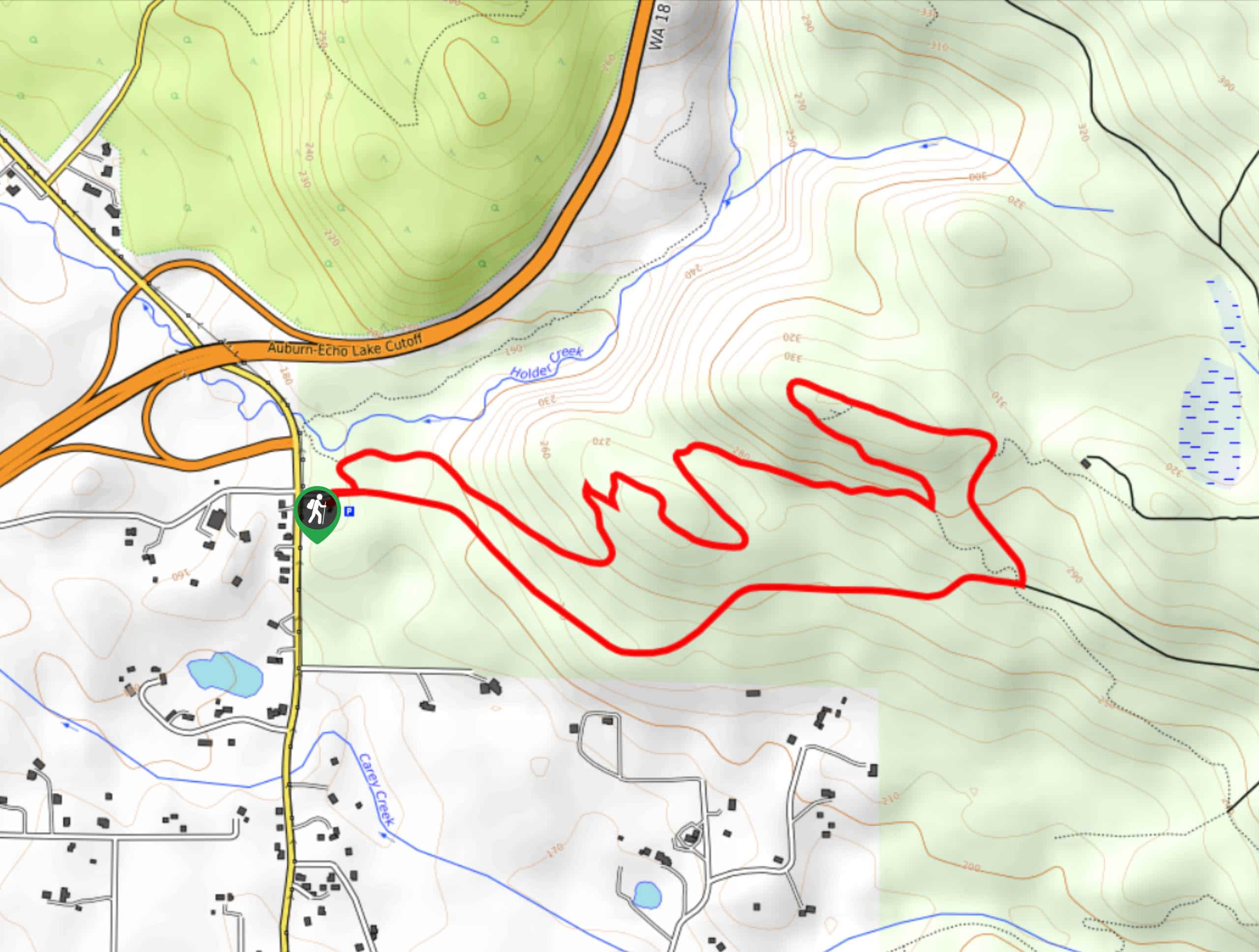
The Holder Ridge Trail is a 3.8-mile moderately trafficked loop trail in Taylor Mountain Forest. It’s rated as easy and shared by hikers, trail runners, and horseback riders. While the trail doesn’t boast impressive views, it’s a pleasant and pretty walk through the forest and it’s suitable for beginners.
Getting there
The trailhead for the Holder Ridge Trail is off 298th Ave SE, where there is parking.

About
| Backcountry Campground | No |
| When to do | Year-round |
| Pets allowed | Yes - On Leash |
| Family friendly | Yes |
| Route Signage | Average |
| Crowd Levels | Moderate |
| Route Type | Loop |
Holder Ridge Trail
Elevation Graph
Weather
Holder Ridge Trail Description
The Holder Ridge Trail is a hike in the forest shared by hikers, runners, and equestrians. The wooded trail is calming and serene. Runners and hikers, remember to announce yourselves to horseback riders as you approach them.
Begin from the trailhead. The trail begins across the street. Stay right immediately and follow the route as it switchbacks up a moderately steep section (if you prefer to descend steeper parts, go counterclockwise). There is a junction on the corner of one of the first switchbacks; stay left. As the trail begins to turn back downhill, stay right and then go straight through the 5-way junction. This trail (Road A) will take you back to your starting point.
Similar hikes to the Holder Ridge Trail hike

Explorer Falls Hike
The Explorer Falls hike is a 5.3mi moderate hike near Sultan, Washington. This trail takes you to a…

Sky Country to Harvey Manning Loop
The Sky Country to Harvey Manning Loop is a 4.2mi loop trail in the northern part of Cougar…

Iverson Spit Preserve Loop
The Iverson Spit Preserve Loop is a 1.2mi loop hike right on the beach, coursing through a beaver…
Comments