
West Point Lighthouse Hike
View Photos
West Point Lighthouse Hike
Difficulty Rating:
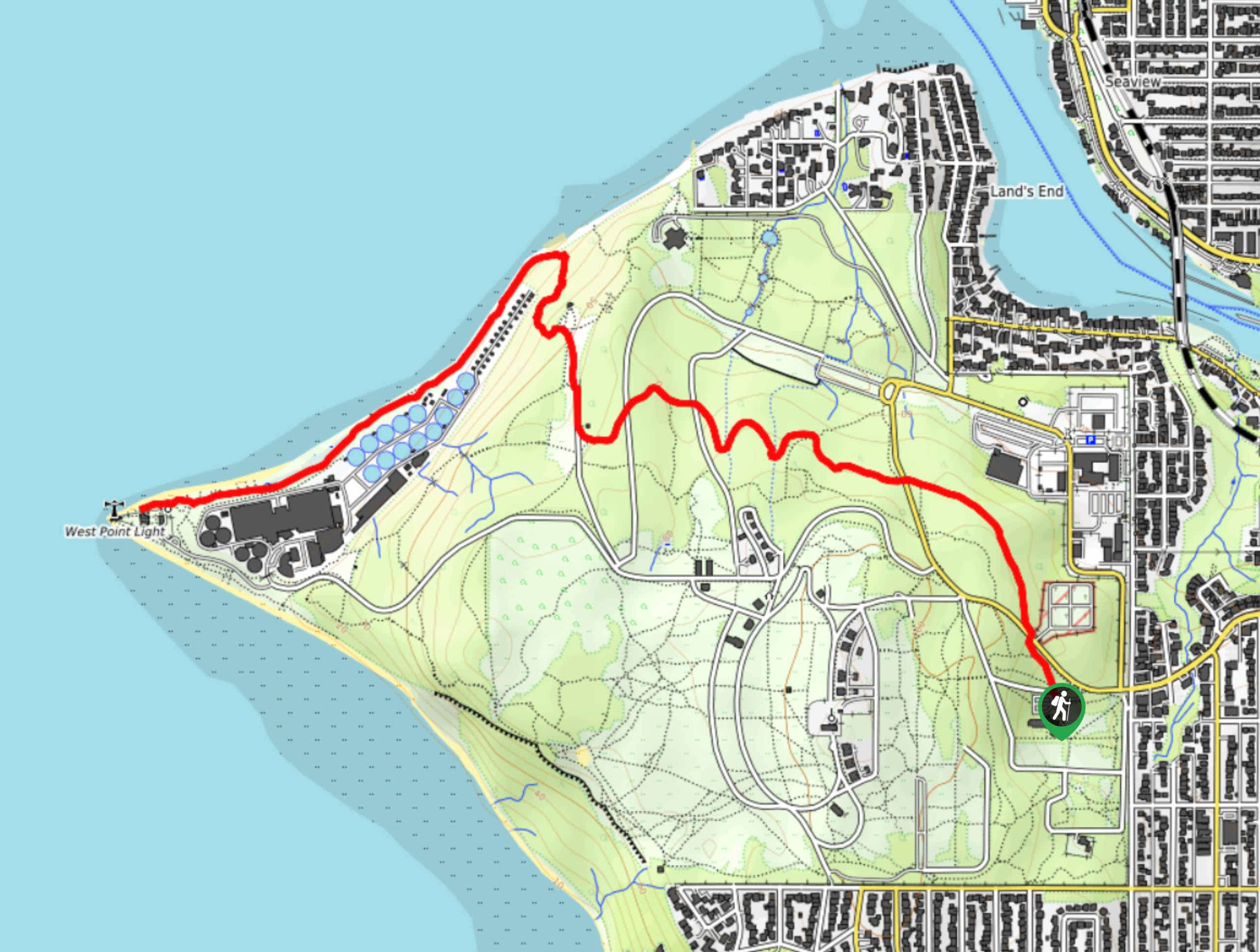
The West Point Lighthouse hike is in Discovery Park, Seattle’s most popular park. This hike is part of a designated National Recreation Trail that passes through beautiful forest and meadows. It’s popular with runners and walkers and can be enjoyed all year. This trail extends out to the beach where the West Point lighthouse stands watch. It’s a fantastic trip suitable for all skill levels.
Getting there
The trailhead for the West Point Lighthouse hike is near the Discovery Park Environmental Learning Center off Discovery Park Boulevard.

About
| Backcountry Campground | No |
| When to do | May-December |
| Pets allowed | Yes - On Leash |
| Family friendly | Yes |
| Route Signage | Good |
| Crowd Levels | Moderate |
| Route Type | Out and back |
West Point Lighthouse Hike
Elevation Graph
Weather
West Point Lighthouse Hike Description
Discovery Park is a wonderful recreation park north of Seattle that is well-loved by walkers, runners, bikers, and adventurers of all ages. This trail takes you through the park to the West Point Lighthouse and back. Discovery Park can get busy, so if you want to avoid the crowds, try visiting in the early morning, later in the afternoon, or in the middle of the week.
You can extend this hike easily by exploring any of the numerous interconnecting trails that cover the park. Download your GPS map if it’s your first time visiting and you’re concerned about losing your way.
Begin from the parking area near the environmental center. Head across the road on Loop Trail, sticking to this trail until it splits. Stay right towards the beach. Walk down the beach to your left, following it to the point on North Beach where the lighthouse is. Retrace your steps from here.
Similar hikes to the West Point Lighthouse Hike hike

Sky Country to Harvey Manning Loop
The Sky Country to Harvey Manning Loop is a 4.2mi loop trail in the northern part of Cougar…

Iverson Spit Preserve Loop
The Iverson Spit Preserve Loop is a 1.2mi loop hike right on the beach, coursing through a beaver…

Lowell Riverfront Trail
The Lowell Riverfront Trail is a 3.0mi route alongside the Snohomish River in Everett. This trail is heavily…
Comments