

Stevensonville Loop
View Photos
Stevensonville Loop
Difficulty Rating:
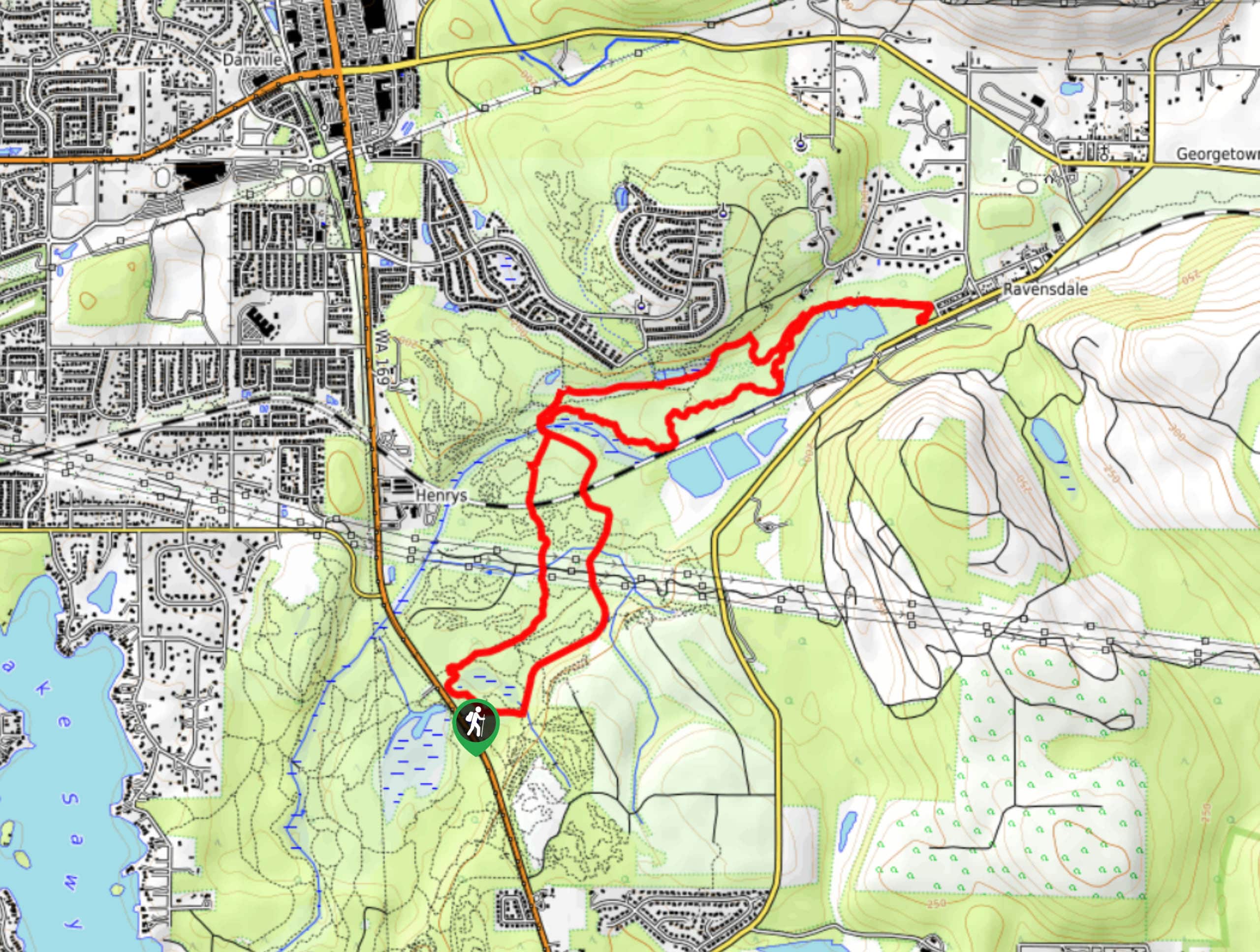
The Stevensonville Loop is a 6.6mi moderate hike in Green River Natural Area. It’s popular with hikers, bikers, and horseback riders, so make sure you share the trail well. The scenery is mostly forest and the trail requires some moderately steep inclines and declines.
Getting there
The trailhead for the Stevensonville Loop is off Access Road.

About
| Backcountry Campground | No |
| When to do | Year-round |
| Pets allowed | Yes - On Leash |
| Family friendly | Older Children only |
| Route Signage | Average |
| Crowd Levels | Moderate |
| Route Type | Loop |
Stevensonville Loop
Elevation Graph
Weather
Stevensonville Loop Description
The Stevensonville Loop is a calming forested trail used by hikers, bikers, and horseback riders. It’s easy to follow and the wooded scenery is great. Watch for horse poop and remember to share the trail.
Begin from the trailhead and hike alongside the road for a few steps. The trail splits, so stay left and make a wide turn onto Three Bridges Trail. Stay left at the next junction and make your way down zig-zagging turns.
Loop your way back by the river, turning away from the water on the trail and taking Potter’s Trail along the river. At the end of Potter’s, turn back and rejoin the main loop, keeping left and then left again to return to the trailhead.
Similar hikes to the Stevensonville Loop hike

Explorer Falls Hike
The Explorer Falls hike is a 5.3mi moderate hike near Sultan, Washington. This trail takes you to a…

Sky Country to Harvey Manning Loop
The Sky Country to Harvey Manning Loop is a 4.2mi loop trail in the northern part of Cougar…
Black Diamond Coal Mine Trail
The Black Diamond Coal Mine Trail is a 6.7mi moderate trail that is mostly used by mountain bikers.…
Comments