Flaming Geyser River Trail
View Photos
Flaming Geyser River Trail
Difficulty Rating:
Flaming Geyser River Trail is a 2.3mi easy hike in the park that is suitable for all skill levels. This quick walk shows off the vibrant forest on one side and the river and ponds on the other. It’s a good choice for families with small children and those wanting a quick outing. You could easily start with this loop and then spend the entire day exploring the park, including the geysers.
Getting there
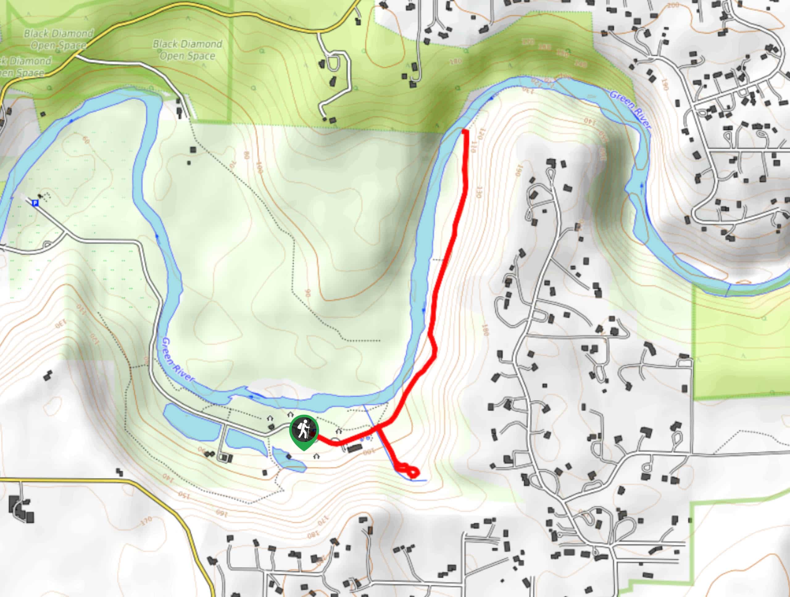
The trailhead for the Flaming Geyser River Trail is along SE Flaming Geyser Road. There are several parking options along this road.

About
| Backcountry Campground | No |
| When to do | Year-round |
| Pets allowed | Yes - On Leash |
| Family friendly | Yes |
| Route Signage | Average |
| Crowd Levels | Moderate |
| Route Type | Out and back |
Flaming Geyser River Trail
Elevation Graph
Weather
Flaming Geyser River Trail Description
Flaming Geyser State Park is a great place to spend the day adventuring with family, and this quick hike is a perfect start or end to your day. It’s a good choice for beginners and families with young children.
Begin from the trailhead off SE Flaming Geyser Road just past the restrooms. Walk east on the walkway past the salmon ponds and the geyser site. Head right to check out Bubbling Geyser before heading back onto the main trail and turning right onto the riverside path. The path takes you along the river before terminating, where you can turn around and retrace your steps.
Similar hikes to the Flaming Geyser River Trail hike

Explorer Falls Hike
The Explorer Falls hike is a 5.3mi moderate hike near Sultan, Washington. This trail takes you to a…

Sky Country to Harvey Manning Loop
The Sky Country to Harvey Manning Loop is a 4.2mi loop trail in the northern part of Cougar…

Iverson Spit Preserve Loop
The Iverson Spit Preserve Loop is a 1.2mi loop hike right on the beach, coursing through a beaver…
Comments