
Maple Valley Gnome Trail
View Photos
Maple Valley Gnome Trail
Difficulty Rating:
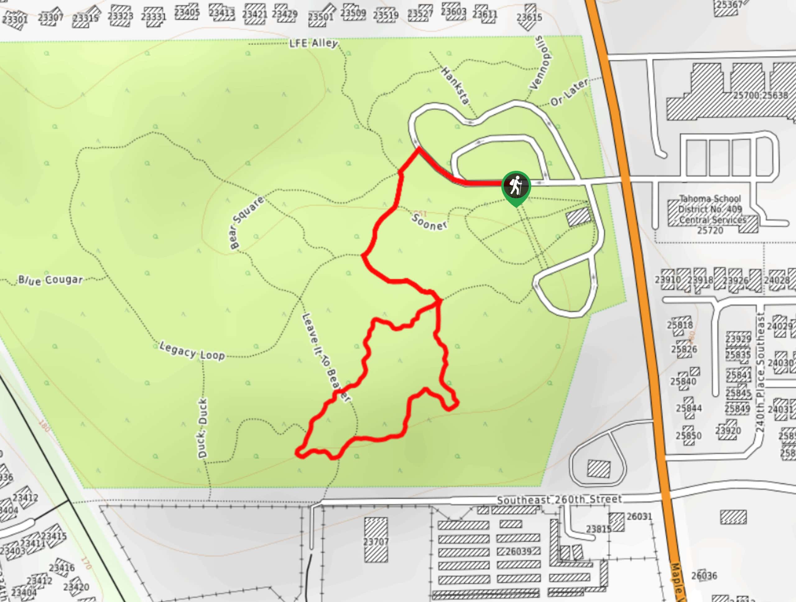
The Maple Valley Gnome Trail is true to its name, having countless gnomes of all shapes and sizes hiding along a 0.7mi trail. This route is very easy and mostly flat, and the gnomes in the trees and bushes are delightful for all ages. Despite being a quick stop, this is a trail you’ll look back on fondly. Expect heavy traffic, especially on weekends.
Getting there
The trailhead for the Maple Valley Gnome Trail is at the Maple Valley Farmers Market parking lot.

About
| Backcountry Campground | No |
| When to do | Year-round |
| Pets allowed | Yes - On Leash |
| Family friendly | Yes |
| Route Signage | Average |
| Crowd Levels | High |
| Route Type | Loop |
Maple Valley Gnome Trail
Elevation Graph
Weather
Maple Valley Gnome Trail Description
How many gnomes can you spot on the Maple Valley Gnome Trail? This cheerful easy hike is perfect for families with kids and can be tacked on to a weekend trip to the farmers market without much exertion required. Look for the gnomes hiding in the foliage and see how many you manage to spot.
Begin from the farmers market parking lot. You’ll want to get onto the Market Trail and you can do so from a couple of the junctions on the road, but this route follows the Legacy Loop to get there. Walk northwest on the road to the trail, keep left, and then keep right. On the Legacy Loop, stay left onto Market Trail and then find the entrance to the Gnome Trail. It’s a quick little loop that you can do either way, retracing your steps back to the parking lot once you’re sufficiently gnome-d.
Similar hikes to the Maple Valley Gnome Trail hike

Sky Country to Harvey Manning Loop
The Sky Country to Harvey Manning Loop is a 4.2mi loop trail in the northern part of Cougar…

Iverson Spit Preserve Loop
The Iverson Spit Preserve Loop is a 1.2mi loop hike right on the beach, coursing through a beaver…

Lowell Riverfront Trail
The Lowell Riverfront Trail is a 3.0mi route alongside the Snohomish River in Everett. This trail is heavily…
Comments