
Green River Trail
View Photos
Green River Trail
Difficulty Rating:
The Green River Trail is a 7.5mi multi-use trail used by walkers, runners, and bikers. This trail is flat and easy to follow. While the scenery is more suburban than natural, it’s a nice choice for those in the Kent area looking to stretch their legs without going far. The trail remains lightly used, even on weekends, and is paved the entire way.
Getting there
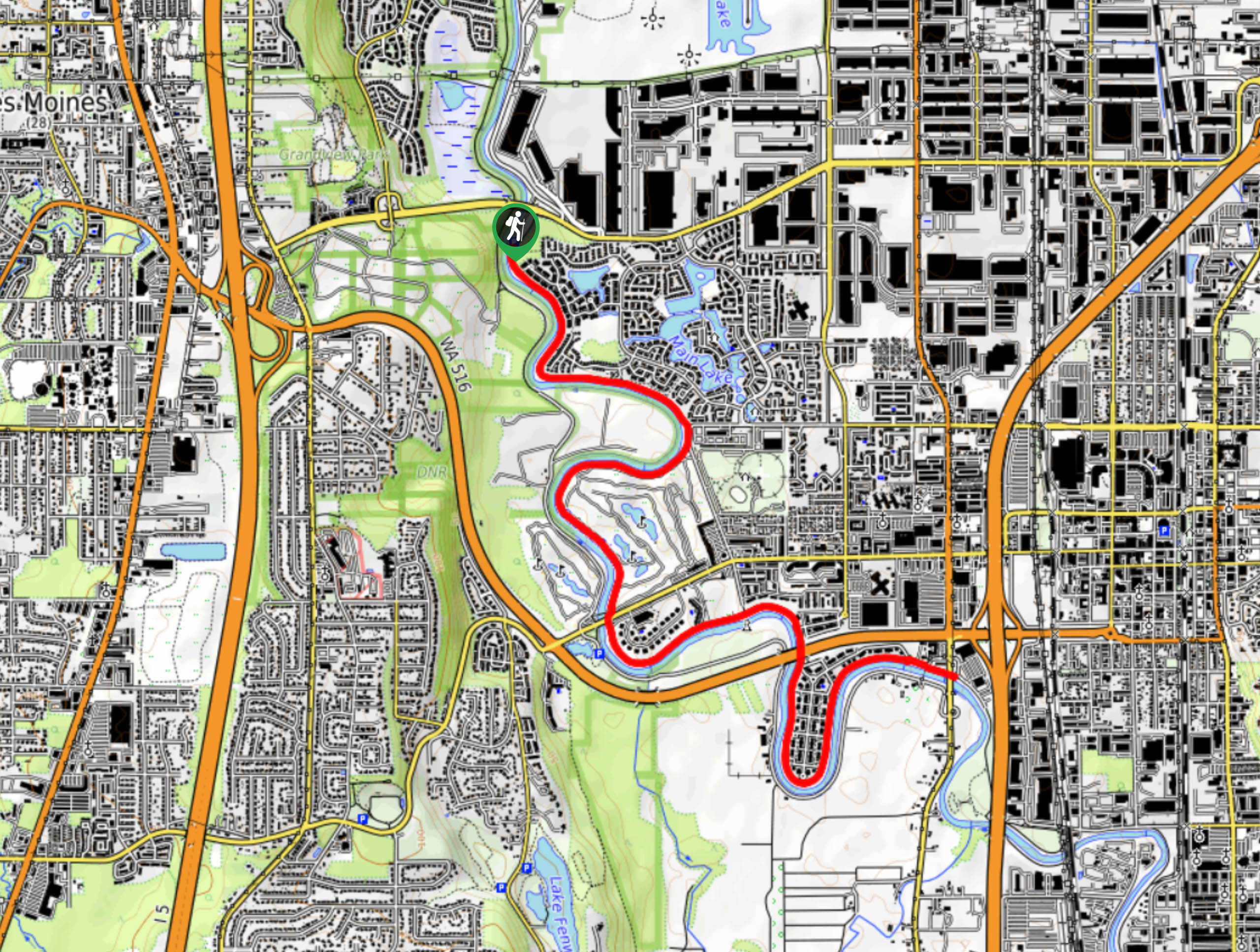
The trailhead for the Green River Trail is off Russell Road S.

About
| Backcountry Campground | No |
| When to do | Year-round |
| Pets allowed | Yes - On Leash |
| Family friendly | Yes |
| Route Signage | Average |
| Crowd Levels | Low |
| Route Type | Out and back |
Green River Trail
Elevation Graph
Weather
Green River Trail Description
The Green River Trail is an urban walk along the Green River in Washington. This trail is used by walkers, joggers, and bikers, but it doesn’t normally get too busy. It’s easy to follow and paved, making it stroller and kid-friendly. This portion of the trail is near Kent, but we also offer a guide for the Tukwila section.
The trail begins off Russell Road near the overpass of Veterans Drive S. You can head south along the river as far as W Valley Highway S, or begin from the other end and walk north. Of course, you can also hop on this trail at a point in between and do a section of it. The trail passes through the Riverbend golf course, offering a nice bit of green scenery and a brief respite from the road noise that can be present on the rest of the trail.
The Green River Trail does extend past the given points here, so you’re welcome to keep going for a longer trip.
Similar hikes to the Green River Trail hike

Explorer Falls Hike
The Explorer Falls hike is a 5.3mi moderate hike near Sultan, Washington. This trail takes you to a…

Sky Country to Harvey Manning Loop
The Sky Country to Harvey Manning Loop is a 4.2mi loop trail in the northern part of Cougar…

Iverson Spit Preserve Loop
The Iverson Spit Preserve Loop is a 1.2mi loop hike right on the beach, coursing through a beaver…
Comments