
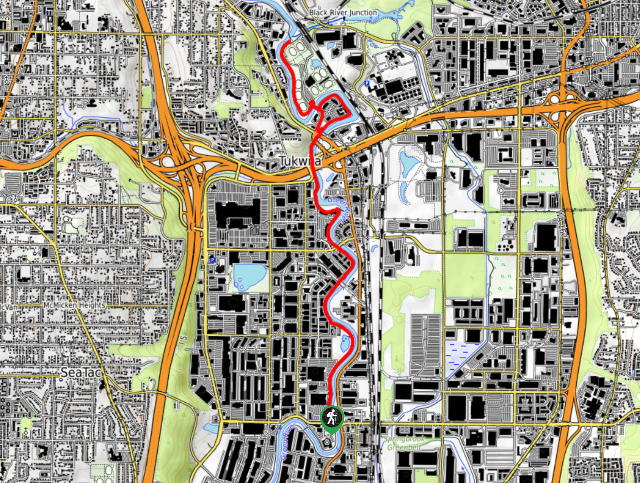
Green River Trail Tukwila Section
View Photos
Green River Trail Tukwila Section
Difficulty Rating:
The Tukwila section of the Green River Trail is a 6.2mi stretch of trail used by walkers, runners, and bikers. This trail is flat and easy to follow. While the scenery is more suburban than natural, it’s a great choice for those looking to stretch their legs without going far. The trail remains lightly used, even on weekends, and is paved the entire way.
Getting there
The trailhead for the Tukwila section of the Green River Trail is off Sperry Drive.

About
| Backcountry Campground | No |
| When to do | Year-round |
| Pets allowed | Yes - On Leash |
| Family friendly | Yes |
| Route Signage | Average |
| Crowd Levels | Low |
| Route Type | Out and back |
Green River Trail Tukwila Section
Elevation Graph
Weather
Green River Trail Tukwila Section Description
The Tukwila section of the longer Green River Trail is an urban walk along the Green River in Tukwila. This trail is used by walkers, bikers, and joggers, but it doesn’t normally get too crowded. The paved terrain and straightforward directions make this a great walk for those with strollers and kids.
The trail begins off Sperry Drive near S 180th St. You can head north along the river as far as the end of Fort Dent Park, or begin from the park and walk south. Of course, you can also hop on this trail at a point in between and do a section of it. The trail does extend past the given points here, so you’re welcome to keep going for a longer experience on the Green River Trail.
Similar hikes to the Green River Trail Tukwila Section hike

Sky Country to Harvey Manning Loop
The Sky Country to Harvey Manning Loop is a 4.2mi loop trail in the northern part of Cougar…

Iverson Spit Preserve Loop
The Iverson Spit Preserve Loop is a 1.2mi loop hike right on the beach, coursing through a beaver…

Lowell Riverfront Trail
The Lowell Riverfront Trail is a 3.0mi route alongside the Snohomish River in Everett. This trail is heavily…
Comments