
Evans Creek Trail
View Photos
Evans Creek Trail
Difficulty Rating:
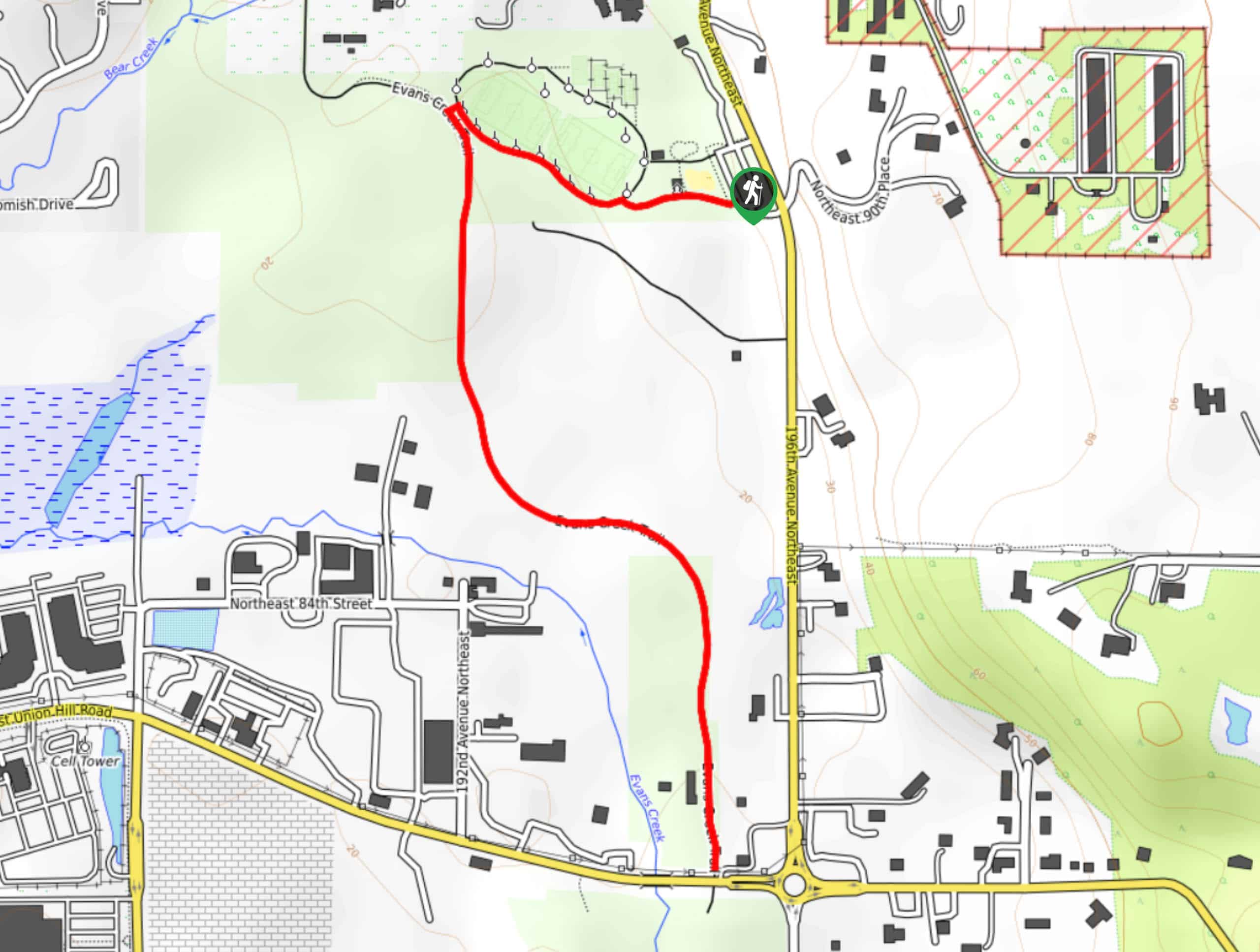
Evans Creek Trail is a 2.0mi trip through old farmland that offers access to Perrigo Park and Arthur Johnson Park. It’s a lightly trafficked walk popular with families, bikers, and birdwatchers. With more scenery than you might expect from a brief park walk, it’s a hidden gem on a sunny afternoon. Please note that this route is different from the Evans Creek Preserve Trail.
Getting there
The trailhead for the Evans Creek Trail is off 195th Ave NE at the eastern edge of Perrigo Park.

About
| Backcountry Campground | No |
| When to do | Year-round |
| Pets allowed | Yes - On Leash |
| Family friendly | Yes |
| Route Signage | Average |
| Crowd Levels | Low |
| Route Type | Out and back |
Evans Creek Trail
Elevation Graph
Weather
Evans Creek Trail Description
Evans Creek Trail is a splendid little walk suitable for all skill levels. This path is easy to follow and stroller-friendly, making it a favorite for families headed to Perrigo Park or Arthur Johnson Park. The walk is surprisingly scenic for its length and location. Pack a picnic for the park or just take advantage of this trail to stretch your legs.
Keep an eye out for kids on scooters and bikes while using this trail.
Begin from the trail’s start at the parking area. You can also access this trail from its southern end at Arthur Johnson Park. Walk past the picnic tables onto the Loop Path, going left. Take a left onto Evans Creek Trail and walk south though the park. The route ends in Arthur Johnson Park, where you can retrace your steps back to the parking area.
Similar hikes to the Evans Creek Trail hike

Sky Country to Harvey Manning Loop
The Sky Country to Harvey Manning Loop is a 4.2mi loop trail in the northern part of Cougar…

Iverson Spit Preserve Loop
The Iverson Spit Preserve Loop is a 1.2mi loop hike right on the beach, coursing through a beaver…

Lowell Riverfront Trail
The Lowell Riverfront Trail is a 3.0mi route alongside the Snohomish River in Everett. This trail is heavily…
Comments