Grass Lawn Park Walk
View Photos
Grass Lawn Park Walk
Difficulty Rating:
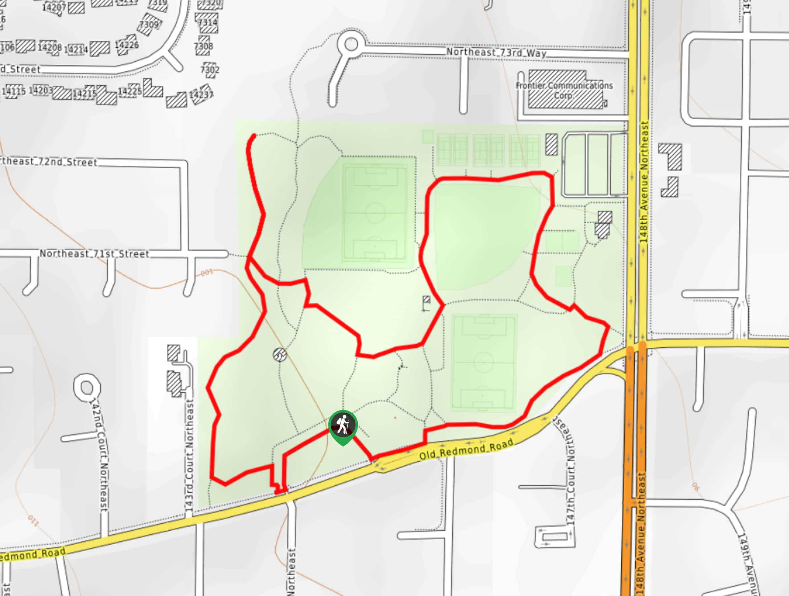
The Grass Lawn Park Walk is a simple, short stroll through the fields at Grass Lawn Park. While this loop isn’t full of expansive scenery, it’s a good way to get some steps in if your kids are playing sports at the park or you live nearby. The walk is 1.1mi and nearly flat. The paving on the majority of the trail makes it easy for strollers.
Getting there
The trailhead for the Grass Lawn Park Walk is near the parking area off Old Redmond Road.

About
| Backcountry Campground | No |
| When to do | Year-round |
| Pets allowed | Yes - On Leash |
| Family friendly | Yes |
| Route Signage | Average |
| Crowd Levels | Low |
| Route Type | Loop |
Grass Lawn Park Walk
Elevation Graph
Weather
Grass Lawn Park Walk Description
The Grass Lawn Park Walk is a quick loop through a well-maintained urban park. The path is mostly paved with some gravel sections. It’s a good walk to take advantage of the park if you’ve got kids playing sports or you live nearby. There are lots of picnic spots in the park.
Begin from the park entrance. The loop heads up the west side of the park, down through the picnic tables, and then above the sports fields. Loop down along the bottom edge of the park to arrive back where you started. There are a few interconnecting trails that you can use for a longer walk if you’d like.
Similar hikes to the Grass Lawn Park Walk hike

Sky Country to Harvey Manning Loop
The Sky Country to Harvey Manning Loop is a 4.2mi loop trail in the northern part of Cougar…

Iverson Spit Preserve Loop
The Iverson Spit Preserve Loop is a 1.2mi loop hike right on the beach, coursing through a beaver…

Lowell Riverfront Trail
The Lowell Riverfront Trail is a 3.0mi route alongside the Snohomish River in Everett. This trail is heavily…
Comments