
Sky Country and Military Road Trail
View Photos
Sky Country and Military Road Trail
Difficulty Rating:
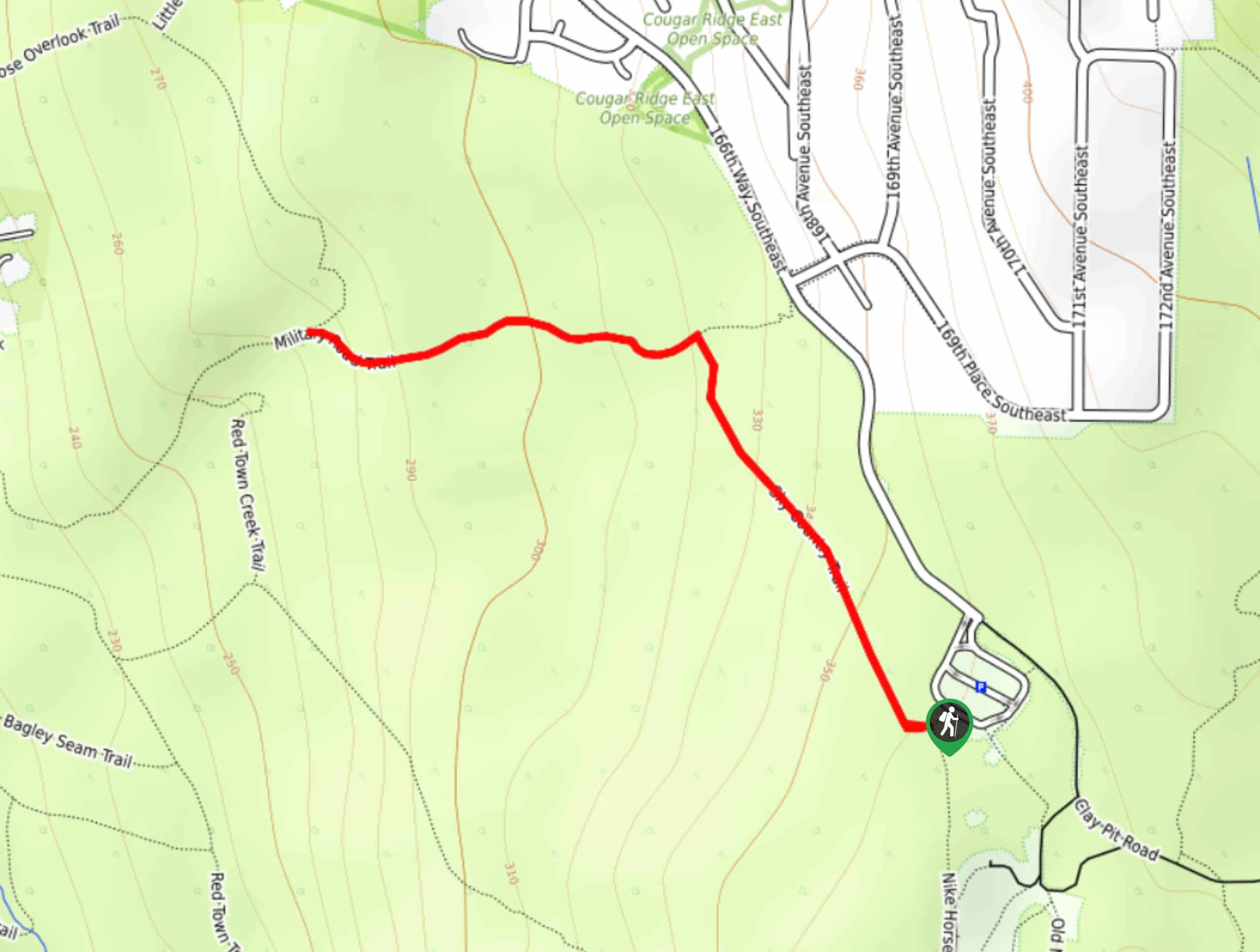
The Sky Country and Military Road Trail is a 1.2mi easy hike in Cougar Mountain Regional Wildland Park. This trail is great for families, dogs, and hikers of all skill levels. It might not boast the most impressive views, but it’s a charming break in nature. There’s a mild incline to parts of the trail, but none are very steep or long.
Getting there
The trailhead for the Sky Country and Military Road Trail is off the main parking area on 166th Way SE.

About
| Backcountry Campground | No |
| When to do | Year-round |
| Pets allowed | Yes - On Leash |
| Family friendly | Yes |
| Route Signage | Average |
| Crowd Levels | Low |
| Route Type | Out and back |
Sky Country and Military Road Trail
Elevation Graph
Weather
Sky Country and Military Road Trail Description
The Sky Country and Military Road Trail is an easy hike through a wooded area that can be enjoyed by hikers of all skill levels and ages. It’s a nice way to get outside and doesn’t tend to get that busy. The little creeks along the way are a highlight of the trail.
Begin from the parking area. There are two main trails that depart from the parking area, so make sure you’re taking the one on your far right. Take an immediate right onto the Sky Country Trail. Take a left at the next junction onto Military Road Trail. This route terminates as the next junction, so you can either turn around or keep going if you want to enjoy a longer hike. There are several trails in the area that you can explore without going too far.
Similar hikes to the Sky Country and Military Road Trail hike

Explorer Falls Hike
The Explorer Falls hike is a 5.3mi moderate hike near Sultan, Washington. This trail takes you to a…

Sky Country to Harvey Manning Loop
The Sky Country to Harvey Manning Loop is a 4.2mi loop trail in the northern part of Cougar…

Iverson Spit Preserve Loop
The Iverson Spit Preserve Loop is a 1.2mi loop hike right on the beach, coursing through a beaver…
Comments