
Indian, Shy Bear, and Quarry Loop
View Photos
Indian, Shy Bear, and Quarry Loop
Difficulty Rating:
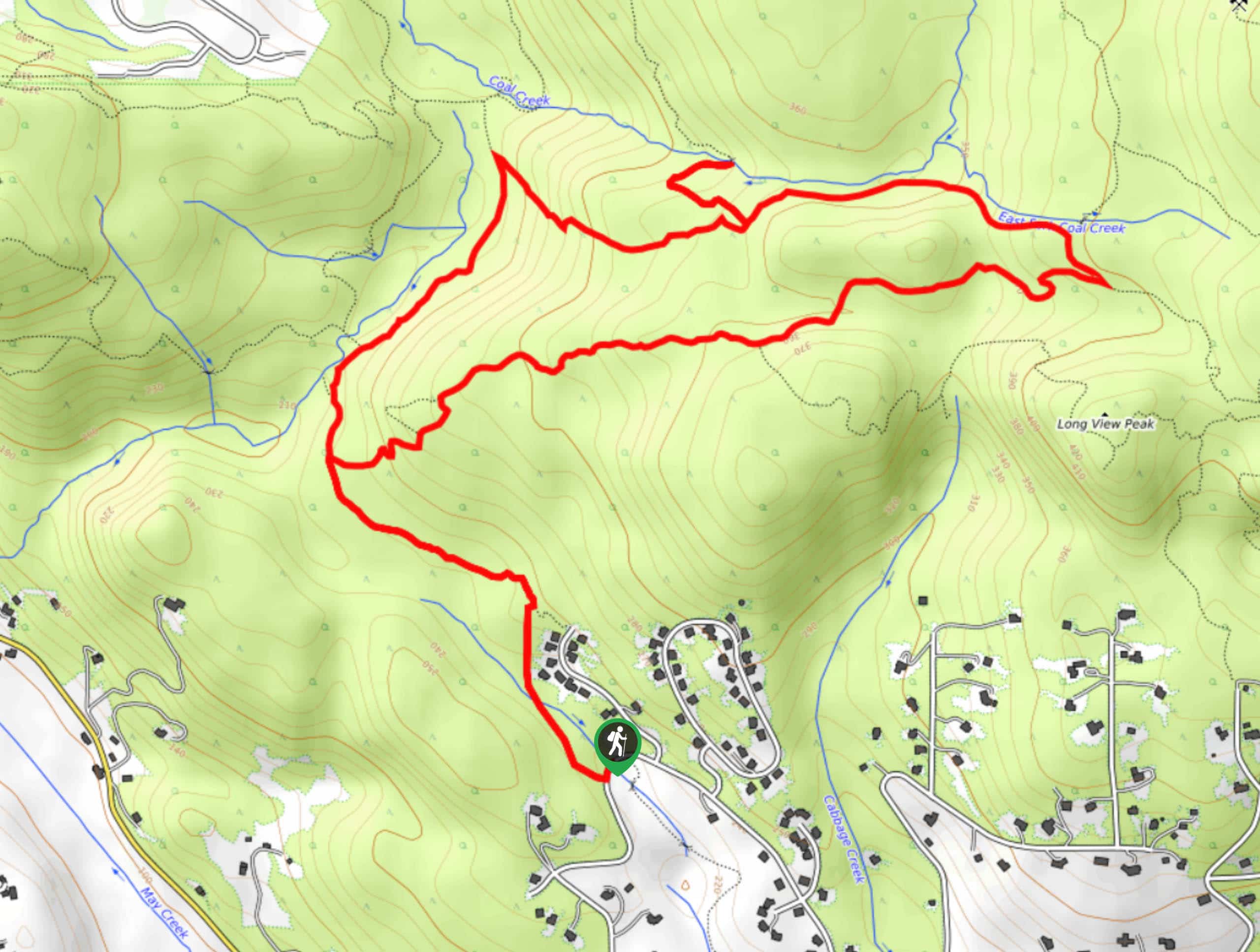
The Indian, Shy Bear, and Quarry Loop is a 5.6mi moderately difficult hike in Cougar Mountain Regional Wildland Park. This hike is an excellent option for those seeking a mid-distance adventure. It’s likely too much for younger children, but older kids may enjoy it. The trail is lined with a vibrant forest full of ferns. We recommend visiting in the springtime when the waterfalls and creeks are flowing.
Getting there
The trailhead for the Indian, Shy Bear, and Quarry Loop is off SE Licorice Way.

About
| Backcountry Campground | No |
| When to do | Year-round |
| Pets allowed | Yes - On Leash |
| Family friendly | Older Children only |
| Route Signage | Average |
| Crowd Levels | Moderate |
| Route Type | Loop |
Indian, Shy Bear, and Quarry Loop
Elevation Graph
Weather
Indian, Shy Bear, and Quarry Loop Trail Description
The Indian, Shy Bear, and Quarry Loop hike is a solid option among the various options that Cougar Mountain presents. It makes use of connecting trails to create a hike that features lush green forest. It’s moderately difficult with some inclines and descents, but it’s still suitable for string beginners and older children.
Note that the beginning of this trail has been rerouted to the Licorice Fern trailhead. You can find parking at the shoulder near the retention pond.
Beginning from the trailhead, take Licorice Fern Trail. At the first junction, go left onto Indian Trail. The loop starts at the next split. Go left to the Far Country Falls viewpoint and then right at the T intersection. On Quarry Trail, take two rights to begin your loop back. Continuing on this trail takes you back to where the loop splits, so retrace your steps on Indian Trail back to the trailhead.
Similar hikes to the Indian, Shy Bear, and Quarry Loop hike

Explorer Falls Hike
The Explorer Falls hike is a 5.3mi moderate hike near Sultan, Washington. This trail takes you to a…

Sky Country to Harvey Manning Loop
The Sky Country to Harvey Manning Loop is a 4.2mi loop trail in the northern part of Cougar…
Black Diamond Coal Mine Trail
The Black Diamond Coal Mine Trail is a 6.7mi moderate trail that is mostly used by mountain bikers.…
Comments