
Talus Bridge Trail
View Photos
Talus Bridge Trail
Difficulty Rating:
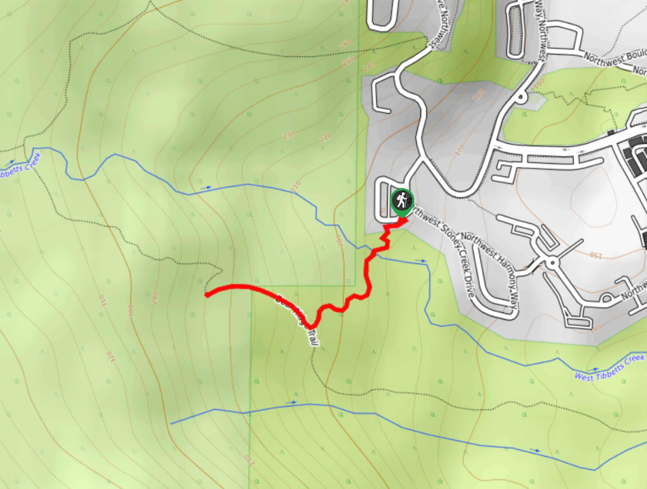
The Talus Bridge Trail is a quick little hike through Cougar Mountain Regional Wildland Park. This park has plenty of trails on offer, so pick this one if you want a quick hike that isn’t very challenging. The trail is 0.7mi long and takes you to the Fantastic Erratic viewpoint and back. It’s moderately trafficked and rated as easy.
Getting there
The trailhead for the Talus Bridge Trail is off NW Alpine Crest Way.

About
| Backcountry Campground | No |
| When to do | April-October |
| Pets allowed | Yes - On Leash |
| Family friendly | Yes |
| Route Signage | Average |
| Crowd Levels | Moderate |
| Route Type | Out and back |
Talus Bridge Trail
Elevation Graph
Weather
Talus Bridge Trail Description
The Talus Bridge Trail is one of many in the Cougar Mountain area. This quick little trip takes you to a viewpoint on a fern-lined trail. It’s very quick to complete, so consider checking out some of the other nearby trails if you want to keep exploring.
Begin from the parking street, taking the Talus Bridge Trail across West Tibbetts Creek. Enjoy the bright green surroundings as you stroll through the forest. There is one junction before the viewpoint where you’ll go right. The left-hand trail is the Bear Ridge route. The viewpoint is straight ahead, and then you’ll retrace your steps back to the trailhead once you’re ready.
Similar hikes to the Talus Bridge Trail hike

Sky Country to Harvey Manning Loop
The Sky Country to Harvey Manning Loop is a 4.2mi loop trail in the northern part of Cougar…

Iverson Spit Preserve Loop
The Iverson Spit Preserve Loop is a 1.2mi loop hike right on the beach, coursing through a beaver…

Lowell Riverfront Trail
The Lowell Riverfront Trail is a 3.0mi route alongside the Snohomish River in Everett. This trail is heavily…
Comments