Poo-Poo Point Trail
View Photos
Poo-Poo Point Trail
Difficulty Rating:
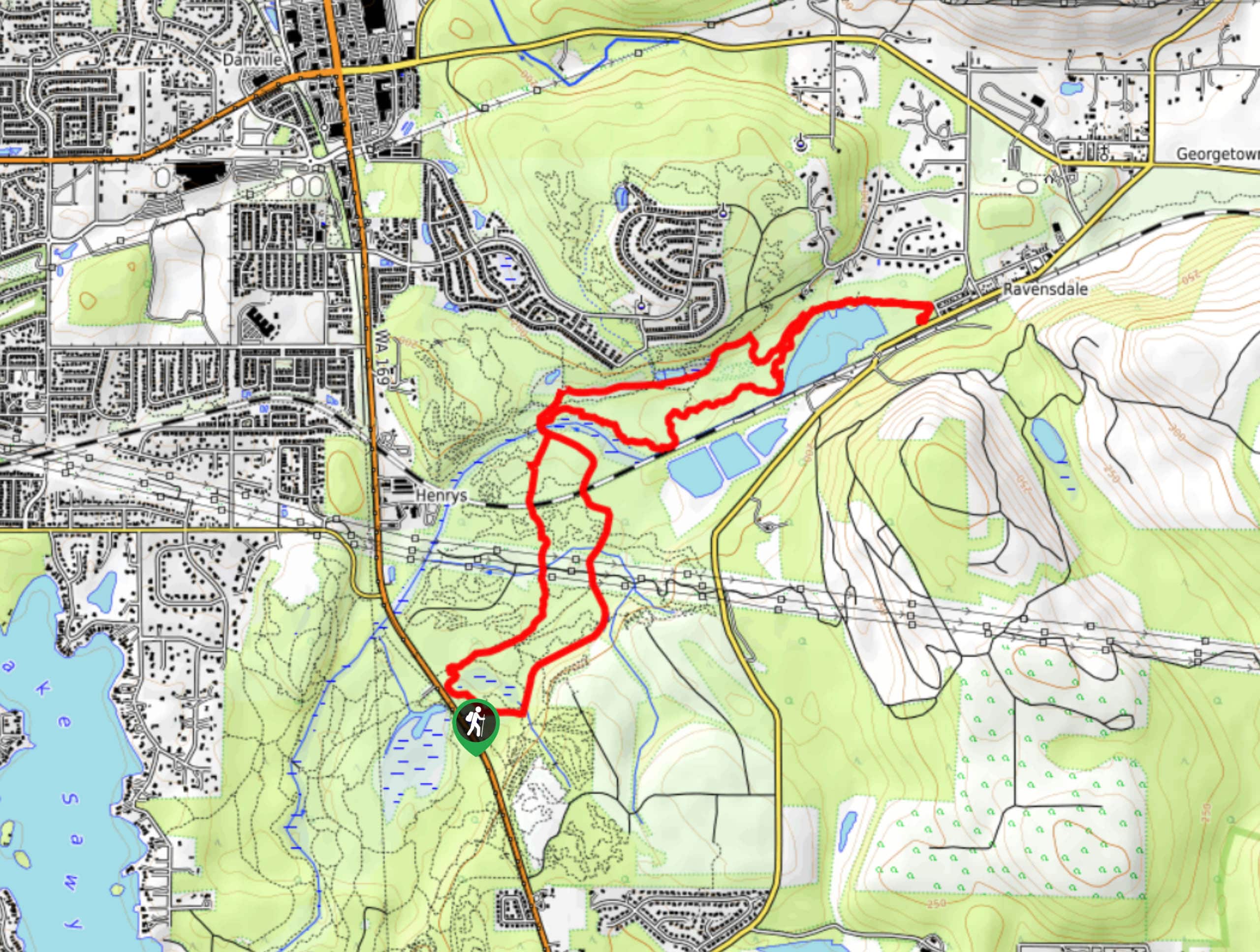
Poo-Poo Point is a heavily frequented destination on the shoulder of West Tiger Mountain. The point has clear views of Mount Rainier on sunny days and provides just enough of a challenge on the way up. On a good day, it’s the ideal overlook across the forest and to Tahoma. While there is more than one way to get to the point, this route follows the 6.9mi hard Poo-Poo Point Trail, which makes for a longer hike than the Chirico Trail approach. Expect heavy traffic on this hike.
While this hike isn’t exceptionally long or strenuous, it does have steep sections that where poles might be helpful to have.
Getting there
The trailhead for the hike to Poo-Poo Point Trail is off Front Street South and 2nd Ave SE.

About
| Backcountry Campground | No |
| When to do | May-October |
| Pets allowed | Yes - On Leash |
| Family friendly | No |
| Route Signage | Average |
| Crowd Levels | High |
| Route Type | Out and back |
Poo-Poo Point Trail
Elevation Graph
Weather
Poo-Poo Point Trail Description
Ready for a quick history lesson? Poo-Poo Point gets its name from the sounds of steam whistles that were heard through the mountains back in the earlier days of logging. When two logs were chained up and ready to go, the whistles would sound, and the workers eventually began calling the noises “poo-poo.”
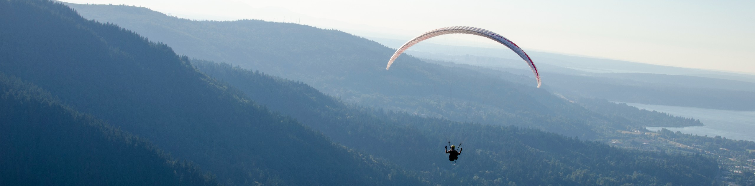
The point itself was also logged several years ago, leaving the clearing you’ll hike to on this route. This clearing is frequently used as a launchpad for paragliders, so you might get to see some brave folk take flight as you rest on the point.
Begin from the trailhead, walking east on an unsigned but obvious trail. You’ll hike through the community to where a sign reads “High School Trail.” Follow the signage indicating a turn, curving to the left. You’ll end up at an old road about a hundred feet further. Turn right here and begin to climb.
Pass a gate, which is normally open. You might notice an oddity of the trail a bit further on; an old metal bathtub filled with gravel sits by itself to the right of the trail. Don’t ask why!
Pass the signage about bears and the Green Trails Map. Stay straight at a junction with a spur trail. The trail soon begins to flatten, and around this point. Keep an eye out for a sign reading “Adventure Trail.” Go past this, eventually passing under a large power line. This is where the High School Trial ends and the Poo-Poo Point Trail picks ups.
You’ll begin climbing a disused railroad grade. Cross several creeks before traversing across Gap Creek on a bridge. From here the route becomes steeper. You’ll reach the point where the trail used to come to a 3-way junction. There is a new section of trail that offers a less challenging experience, and you’ll make a right onto it. This should lead you to a logging road that will take you the rest of the way to Poo-Poo Point.
Sit back, eat your lunch, and soak up the views. You can see Cougar Mountain, Squak Mountain, and Lake Sammamish. On clear days, Mount Rainier dominates the view. If you’re lucky, you might see some paragliders take flight.
When you’re ready, you’ll return via the same trail you ascended.
Trail Highlights
Mount Rainier
The tallest mountain in the state is a dominant part of your view on the hike to Poo-Poo Point if you manage to capture a clear day. This 14409ft stratovolcano is an iconic sight and the highlight of your view while hiking this route. If you can manage to score a cloudless day, you’ll have unobstructed views of the mountain.
Frequently Asked Questions
Can you see the sunset from Poo-Poo Point?
Yes. It’s a nice spot to watch the sunset if you’re hiking in the evening!
What mountain is Poo-Poo Point on?
The point is on West Tiger Mountain.
Who names Poo-Poo Point?
While there is no one credit to the name, the Issaquah Historical Society mentioned that there would be a whistle when two logs were ready to be towed, and the sound of the whistle inspired the name.
Insider Hints
There are picnic tables at the point.
No pass or permit is required to enjoy this hike.
Similar hikes to the Poo-Poo Point Trail hike

Explorer Falls Hike
The Explorer Falls hike is a 5.3mi moderate hike near Sultan, Washington. This trail takes you to a…
Black Diamond Coal Mine Trail
The Black Diamond Coal Mine Trail is a 6.7mi moderate trail that is mostly used by mountain bikers.…
Far Country Falls via Licorice Fern Trail
Far Country Falls via Licorice Fern Trail is a 4.8mi moderate hike in Cougar Mountain Regional Wildland Park…
Comments