Chirico Trail to Poo-Poo Point
View Photos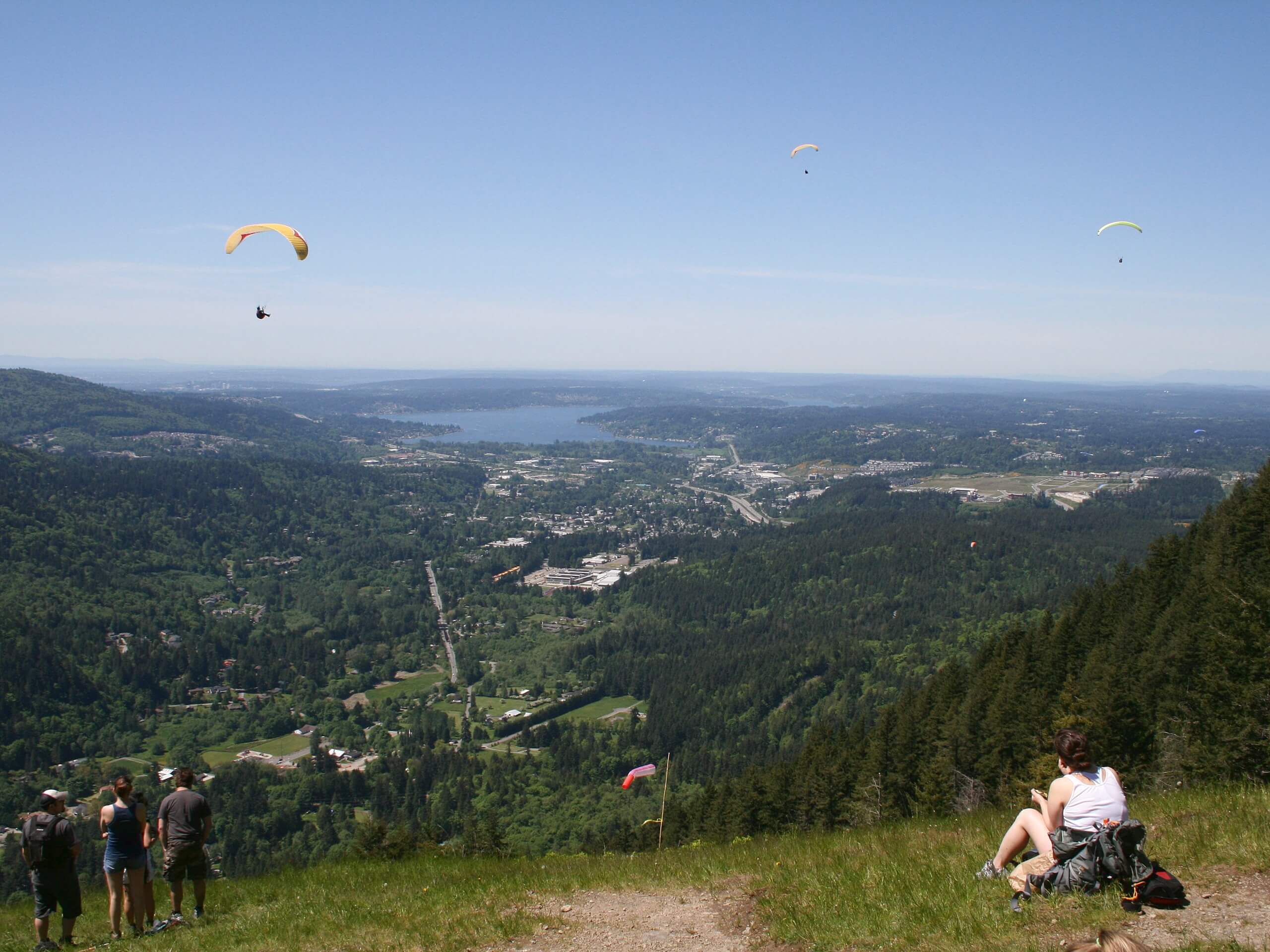
Chirico Trail to Poo-Poo Point
Difficulty Rating:
Poo-Poo Point is a popular destination on the shoulder of West Tiger Mountain. The point has fabulous views of Mount Rainier and isn’t too difficult to reach. On a clear day, it’s the ideal overlook across the forest and to the mighty Tahoma. While there is more than one way to get to the point, this route follows the 4.5mi moderate Chirico Trail, which makes for a shorter hike. Expect heavy traffic on this hike.
While this hike isn’t too long or strenuous, it does have some steeper sections that where poles might be helpful to have.
Getting there
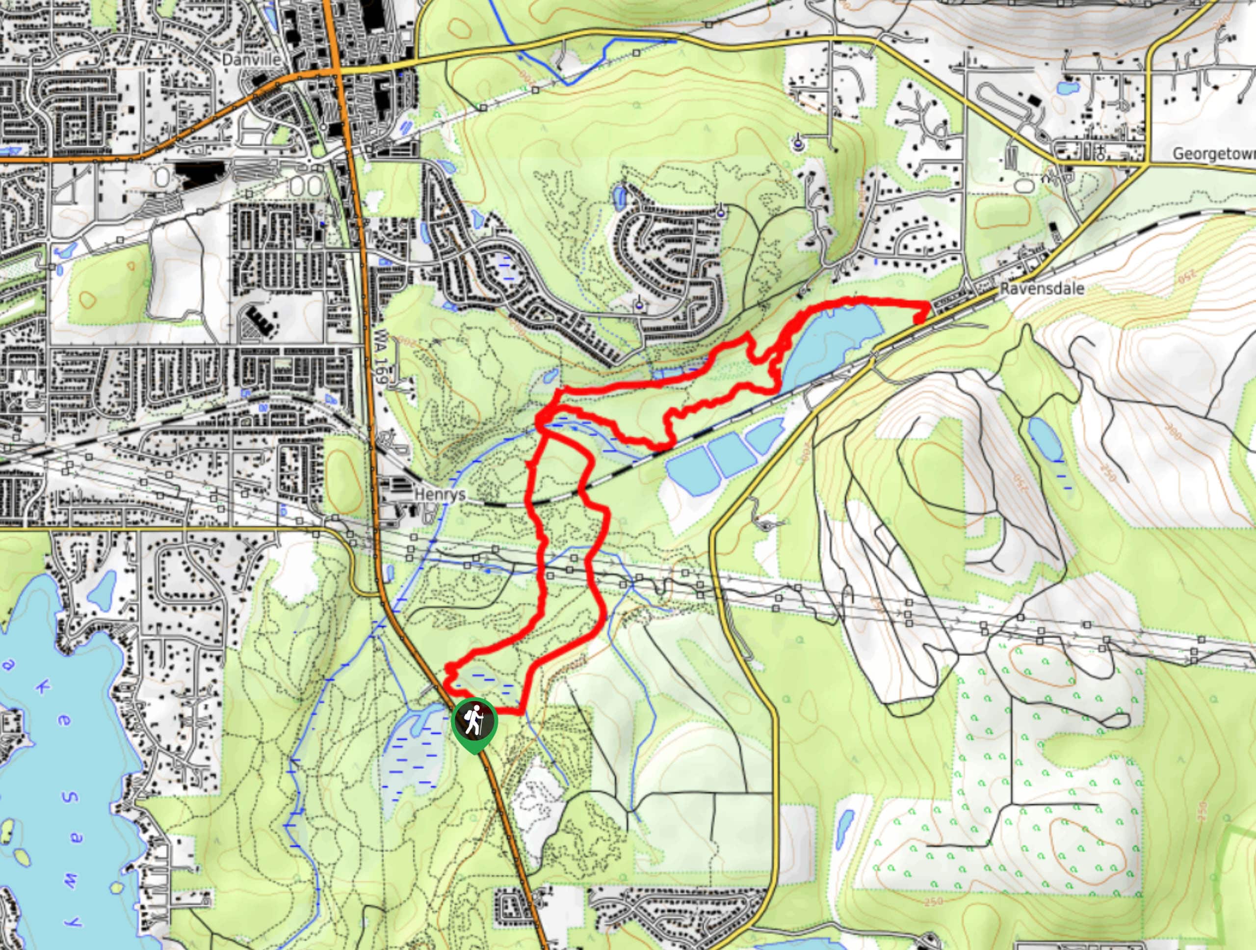
The trailhead for the hike to Poo-Poo Point on Chirico Trail is off Issaquah Hobart Road SE. Look for a big gravel parking area.

About
| Backcountry Campground | No |
| When to do | May-October |
| Pets allowed | Yes - On Leash |
| Family friendly | Older Children only |
| Route Signage | Average |
| Crowd Levels | High |
| Route Type | Out and back |
Chirico Trail to Poo-Poo Point
Elevation Graph
Weather
Chirico Trail to Poo-Poo Point Hike Description
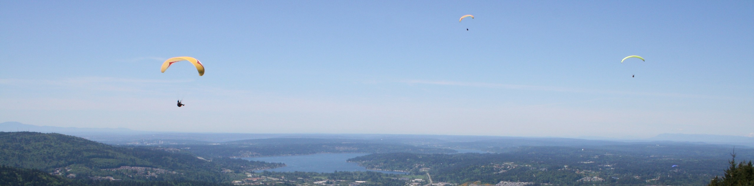
A quick history lesson: Poo-Poo Point gets its name from the sounds of steam whistles that were heard through the mountains back in the earlier days of logging. The point itself was also logged, leaving the clearing you’ll hike to on this route. This clearing is frequently used as a launchpad for paragliders, so you might get to see some brave souls take flight as you admire the view.
Beginning from the parking area, you’ll easily pick up the trail where it crosses the landing field. Take a look to the skies before you go so you don’t get any surprises from the paragliders above! You’ll enter the woods and begin hiking along a steep trail with stone steps built in. This part of the trail is called the Yah-er Wall.
Traverse across the hillside, taking care not to cut corners where others have, as this contributes to trail erosion. After about a mile and a half or so, you’ll come to the South Launch Viewpoint. Take a break here to appreciate the wide-open view of Mount Rainier.
The North Launch Viewpoint is only a 0.3mi further, and this is where you’ll find Poo-Poo Point. Sit back, enjoy your lunch, and soak up the views. You can see Cougar Mountain, Squak Mountain, and Lake Sammamish. If you’re lucky, you might see some paragliders take flight.
When you’re ready, you’ll return via the same trail you came up on. Poles will be a help for the steep sections of the descent if you have them. Remember to watch out as you walk through the landing zone!
Trail Highlights
Mount Rainier
The tallest mountain in the state is a dominant part of your view on the hike to Poo-Poo Point if you manage to capture a clear day. This 14409ft stratovolcano is an iconic sight and the highlight of your view while hiking this route. If you can manage to score a cloudless day, you’ll have unobstructed views of the mountain.
Frequently Asked Questions
Can you see the sunset from Poo-Poo Point?
It’s a nice spot to watch the sunset if you’re hiking in the evening!
What mountain is Poo-Poo Point on?
The point is on West Tiger Mountain.
Who names Poo-Poo Point?
While there is no one credit to the name, the Issaquah Historical Society mentioned that there would be a whistle when two logs were ready to be towed, and the sound of the whistle inspired the name.
Insider Hints
There are picnic tables at the point.
No pass or permit is required to enjoy this hike.
Similar hikes to the Chirico Trail to Poo-Poo Point hike

Explorer Falls Hike
The Explorer Falls hike is a 5.3mi moderate hike near Sultan, Washington. This trail takes you to a…

Sky Country to Harvey Manning Loop
The Sky Country to Harvey Manning Loop is a 4.2mi loop trail in the northern part of Cougar…
Black Diamond Coal Mine Trail
The Black Diamond Coal Mine Trail is a 6.7mi moderate trail that is mostly used by mountain bikers.…
Comments