
Marymoor Park Trail
View Photos
Marymoor Park Trail
Difficulty Rating:
The Marymoor Park Trail is a 6.4mi route that is considered easy. We highly recommend this trail for hikers who like to take their dogs off-leash and do not recommend it for those who are afraid of dogs as it passes directly through the off-leash dog park. It’s a great way to get outdoors with your furry friends or to meet some friendly dogs if you don’t have your own.
Getting there
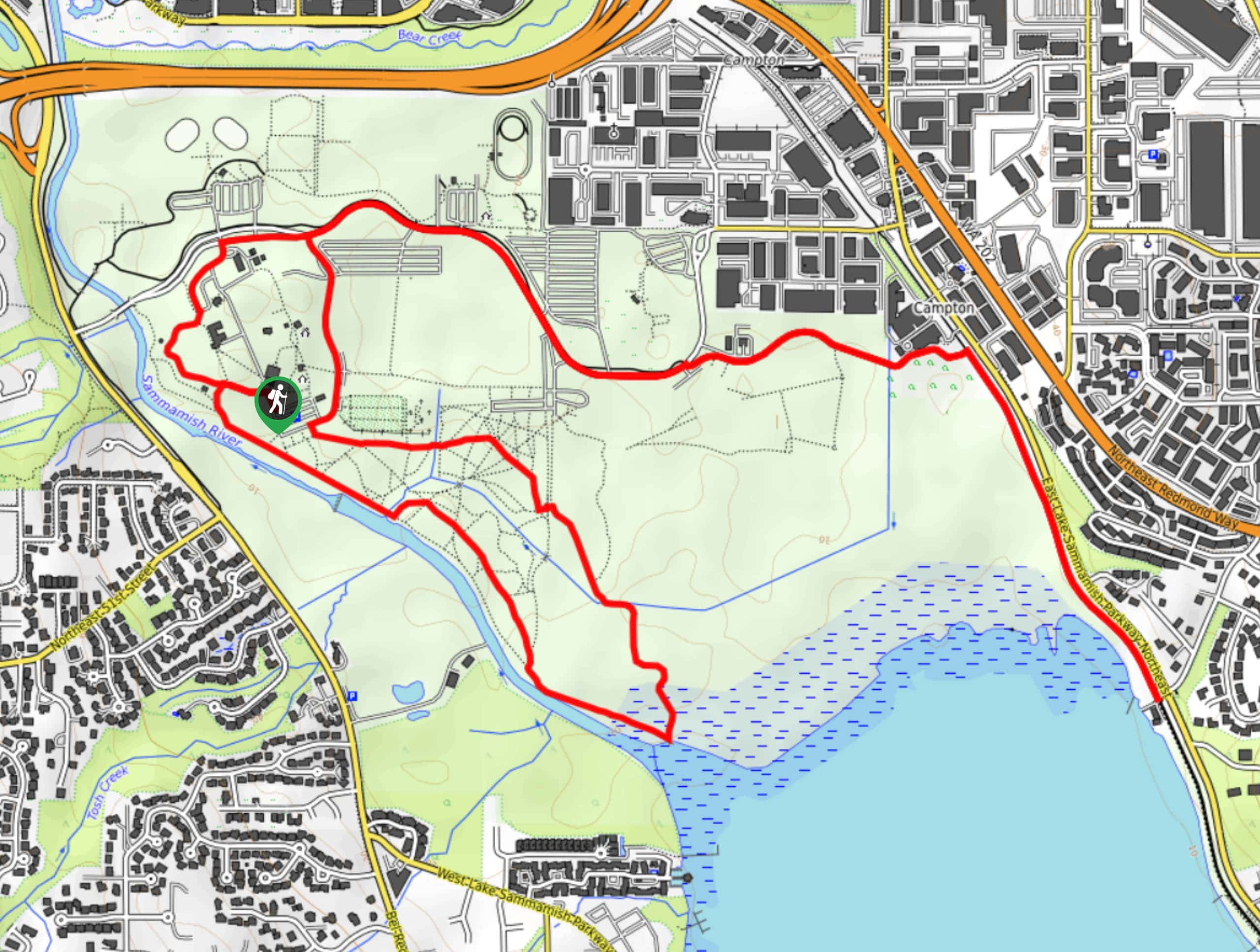
The trailhead for the Marymoor Park Trail is in the western side of the park.

About
| Backcountry Campground | No |
| When to do | Year-round |
| Pets allowed | Yes |
| Family friendly | Yes |
| Route Signage | Poor |
| Crowd Levels | Moderate |
| Route Type | Loop |
Marymoor Park Trail
Elevation Graph
Weather
Marymoor Park Trail Description
This trail runs through the Marymoor off-leash dog park, making it an ideal choice for hikers who want to let their pups have a run while they enjoy the trail. If you don’t like dogs, skip this one. The route described adds mileage by heading down the East Lake Sammamish Trail, but know that dogs need to be on leash outside of the designated area.
Begin from the trailhead in the park. There are lots of interconnecting trails, so a downloaded GPS route is recommended if it’s your first time in the park. You’ll loop around the park facilities, which include a wetland, soccer fields, and gardens (dogs are not permitted in the gardens).
Stroll through the off-leash area, perhaps making a new friend or two. The trail extends onto the pathway by the road to add some distance, but if you’re just here to enjoy the park with your pal, you can linger awhile in the off-leash area instead. When you’re ready, loop back to the parking area.
Insider Hints
There is a $1 parking fee for this trail.
Similar hikes to the Marymoor Park Trail hike

Sky Country to Harvey Manning Loop
The Sky Country to Harvey Manning Loop is a 4.2mi loop trail in the northern part of Cougar…

Iverson Spit Preserve Loop
The Iverson Spit Preserve Loop is a 1.2mi loop hike right on the beach, coursing through a beaver…

Lowell Riverfront Trail
The Lowell Riverfront Trail is a 3.0mi route alongside the Snohomish River in Everett. This trail is heavily…
Comments