
Perrigo Park Loop Trail
View Photos
Perrigo Park Loop Trail
Difficulty Rating:
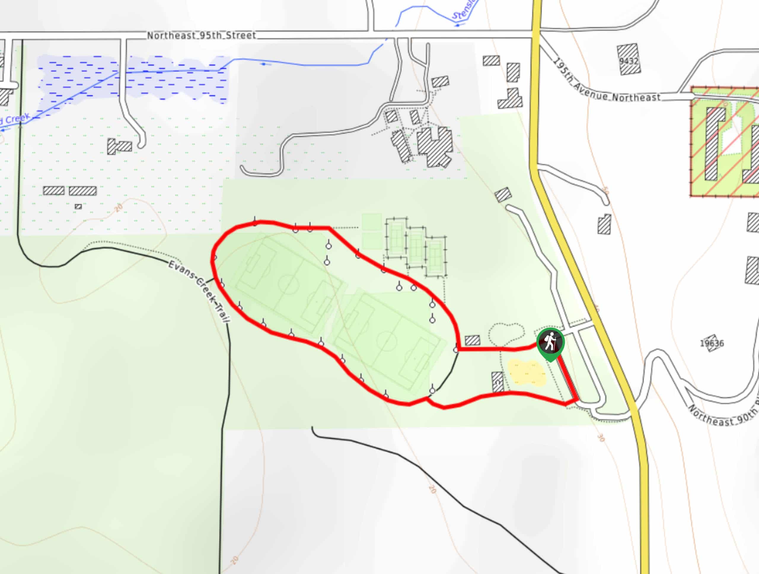
The Perrigo Park Loop Trail is a very quick and easy stroll, totalling 0.5mi and only 13ft of elevation gain. This little loop can be enjoyed on its own by all, or it can be combined with the walk into Arthur Johnson Park for a longer outing. This walk is stroller-friendly and welcoming to dogs on leash.
Getting there
The trailhead for the Perrigo Park Loop is in the parking area for the park off 195th Ave NE.

About
| Backcountry Campground | No |
| When to do | Year-round |
| Pets allowed | Yes - On Leash |
| Family friendly | Yes |
| Route Signage | Average |
| Crowd Levels | Moderate |
| Route Type | Loop |
Perrigo Park Loop Trail
Elevation Graph
Weather
Perrigo Park Loop Trail Description
Perrigo Park is a charming spot, and the loop walk around it is a great way to get a few steps in without any real difficulty. It’s very suitable for all ages and skill levels and won’t take long at all to complete. You can also extend your walk by continuing down into Arthur Johnson Park for a longer adventure.
Begin from the park’s parking area. There are trails leaving the parking area at the top and bottom, but you can take either. If you take the top trail, you’ll walk straight through a junction to the Loop Path. Stroll in a long oval around the park. Stay left at the connector to the Evans Creek Trail to complete your loop through the park, ending up back at the parking area.
Similar hikes to the Perrigo Park Loop Trail hike

Sky Country to Harvey Manning Loop
The Sky Country to Harvey Manning Loop is a 4.2mi loop trail in the northern part of Cougar…

Iverson Spit Preserve Loop
The Iverson Spit Preserve Loop is a 1.2mi loop hike right on the beach, coursing through a beaver…

Lowell Riverfront Trail
The Lowell Riverfront Trail is a 3.0mi route alongside the Snohomish River in Everett. This trail is heavily…
Comments