
Talus Rocks Loop
View Photos
Talus Rocks Loop
Difficulty Rating:
The Talus Rocks Loop Trail is an easy-moderate 2.4mi hike that sees heavy traffic. This trail is just a touch more challenging than most beginner trails without being too strenuous for kids or new hikers. The setting isn’t as grand as others in the area, but it’s a lovely hike if you enjoy being enveloped by the trees around you. You’ll need to have a Discover Pass for this hike.
Getting there
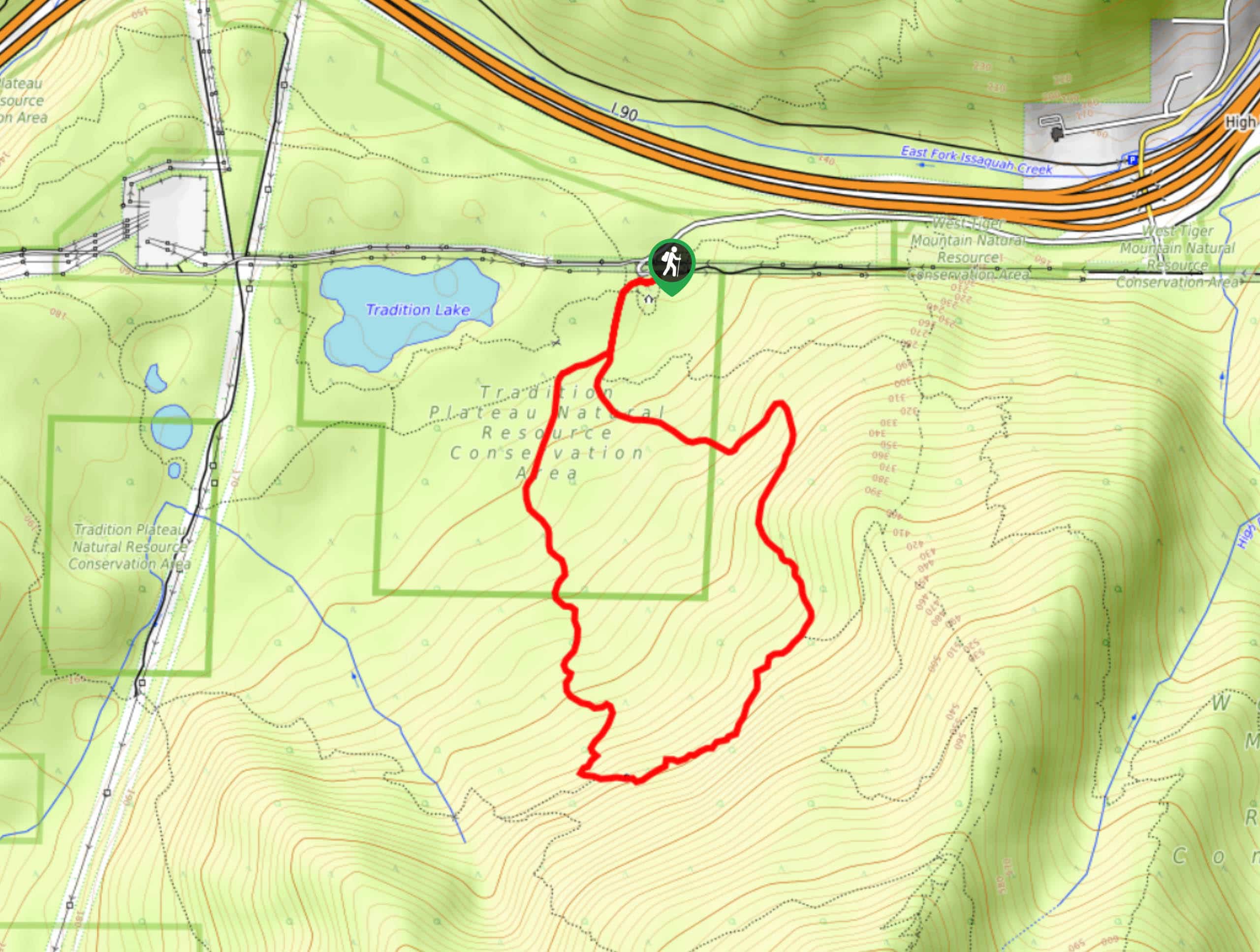
The trailhead for the Talus Rocks Loop is on Puget Power Road off I-90.

About
| Backcountry Campground | No |
| When to do | March-October |
| Pets allowed | Yes - On Leash |
| Family friendly | Yes |
| Route Signage | Average |
| Crowd Levels | High |
| Route Type | Loop |
Talus Rocks Loop
Elevation Graph
Weather
Talus Rocks Loop Description
The hike on Talus Rocks Loop is a good choice for new adventurers and less experienced hikers thanks to its modest distance and elevation gain. With just enough to break a sweat but not enough to challenge most kids or beginners, it’s a great choice for families. The views aren’t as expansive as some others nearby, but if you enjoy hiking in the trees, this is the one for you.
Begin from the trailhead. You can do this loop either way. You’ll walk on the obvious path as it meanders through the dense trees, which are often singing with birds. The loop heads roughly south before rising back up towards the trailhead. There are a couple of junctions, but you’ll just want to stay on the inside of the loop through all of them- unless you’d like to explore further!
Similar hikes to the Talus Rocks Loop hike

Explorer Falls Hike
The Explorer Falls hike is a 5.3mi moderate hike near Sultan, Washington. This trail takes you to a…

Sky Country to Harvey Manning Loop
The Sky Country to Harvey Manning Loop is a 4.2mi loop trail in the northern part of Cougar…

Iverson Spit Preserve Loop
The Iverson Spit Preserve Loop is a 1.2mi loop hike right on the beach, coursing through a beaver…
Comments