
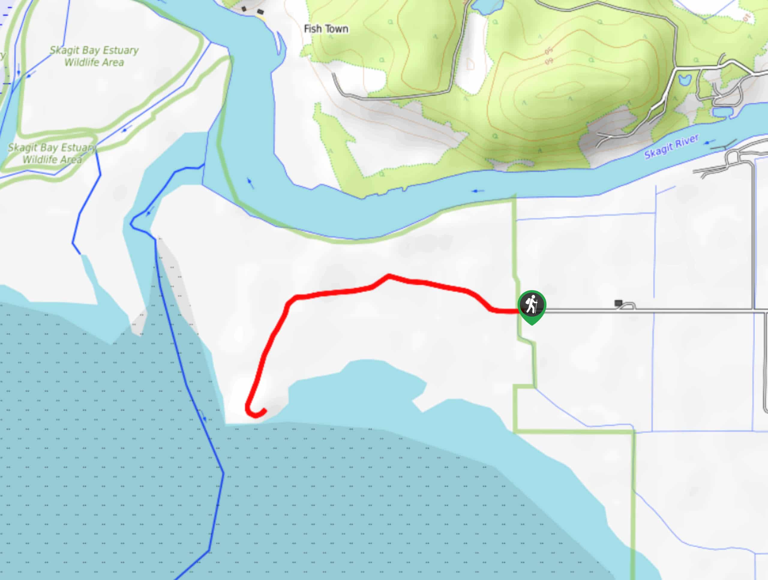
Craft Island Trail from Rawlins Road
View Photos
Craft Island Trail from Rawlins Road
Difficulty Rating:
Craft Island Trail from Rawlins Road is a 1.8mi hike near Mount Vernon that is rated as easy. This lightly trafficked route has wildflower meadows, the opportunity to spot wildlife, and a perfect beach view at the end. It’s a bit of a muddy hike most days, but it’s well worth rinsing your boots off at the end of the day.
Getting there
The trailhead for the Craft Island Trail from Rawlins Road hike is at the end of Rawlins Road.

About
| Backcountry Campground | No |
| When to do | Year-round |
| Pets allowed | Yes - On Leash |
| Family friendly | Yes |
| Route Signage | Average |
| Crowd Levels | Low |
| Route Type | Out and back |
Craft Island Trail from Rawlins Road
Elevation Graph
Weather
Craft Island Trail from Rawlins Road Description
The hike on Craft island Trail from Rawlins Road boasts a solid reward for fairly minimal effort. The wildflower blooms are lovely and the beach view is great. The trail does tend to get quite muddy, so we recommend visiting on a dry day if you’re able to. Additionally, a hike at minus tide is ideal.
Begin from the trailhead, following the obvious route west. The trail isn’t in great condition but it’s nothing too intense. Just watch your step on wet sections. You’ll walk along the flower fields and through the marshes to the island, where the views are wonderful. Watch for birds of prey in the trees before retracing your steps back to the trailhead.
Similar hikes to the Craft Island Trail from Rawlins Road hike

Sky Country to Harvey Manning Loop
The Sky Country to Harvey Manning Loop is a 4.2mi loop trail in the northern part of Cougar…

Iverson Spit Preserve Loop
The Iverson Spit Preserve Loop is a 1.2mi loop hike right on the beach, coursing through a beaver…

Lowell Riverfront Trail
The Lowell Riverfront Trail is a 3.0mi route alongside the Snohomish River in Everett. This trail is heavily…
Comments