
Lewis Creek Park Loop
View Photos
Lewis Creek Park Loop
Difficulty Rating:
The Lewis Creek Park Loop is a quick walk suitable for the whole family. This 0.6mi loop trail is flat and paved, making it a good choice for strollers, wheelchairs, beginners, and anyone else just wanting to appreciate some greenery. There are other trails in the park that allow you the chance to extend your walk if you wish.
Getting there
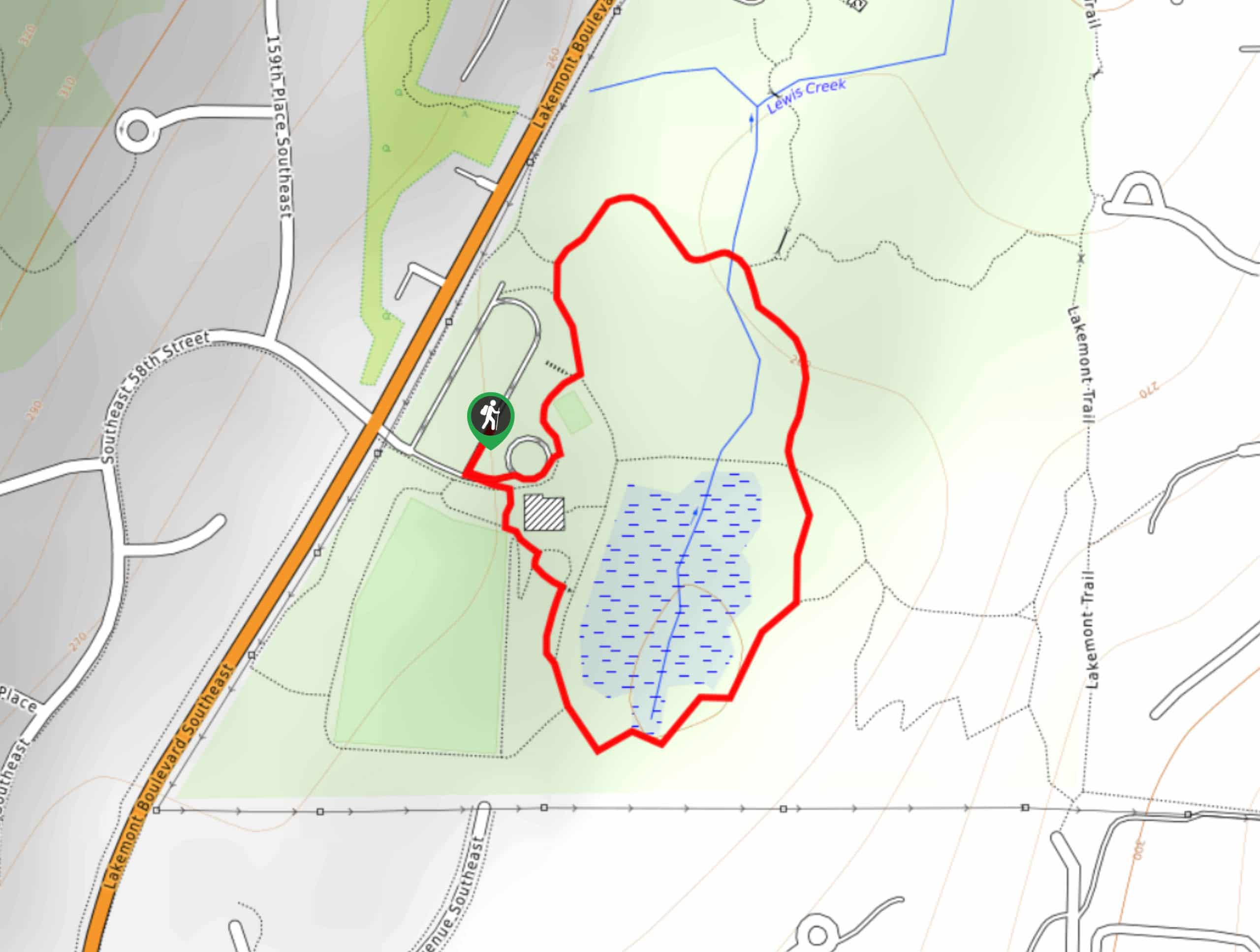
The trailhead for the Lewis Creek Park Loop is in the parking area for the park off Lakemont Blvd SE.

About
| Backcountry Campground | No |
| When to do | Year-round |
| Pets allowed | Yes - On Leash |
| Family friendly | Yes |
| Route Signage | Average |
| Crowd Levels | Low |
| Route Type | Loop |
Lewis Creek Park Loop
Elevation Graph
Weather
Lewis Creek Park Loop Description
With distance and elevation gain about as mild as it gets, the loop walk around Lewis Creek can be enjoyed by nearly anyone. This park is a local favorite with nice views and lots of side trails to explore if you want to keep walking.
Begin from the parking area. There are restrooms and a play area to the right. Take the trail on your left, looping up to cross the creek. Once you cross the creek, stay right., then go straight through the next junction. Go right to walk under the point where the creek ends and head back up past the field to where you started. You can also just as easily take this loop the opposite way.
Similar hikes to the Lewis Creek Park Loop hike

Sky Country to Harvey Manning Loop
The Sky Country to Harvey Manning Loop is a 4.2mi loop trail in the northern part of Cougar…

Iverson Spit Preserve Loop
The Iverson Spit Preserve Loop is a 1.2mi loop hike right on the beach, coursing through a beaver…

Lowell Riverfront Trail
The Lowell Riverfront Trail is a 3.0mi route alongside the Snohomish River in Everett. This trail is heavily…
Comments