
Farrel-McWhirter Park and Juel Park Trail
View Photos
Farrel-McWhirter Park and Juel Park Trail
Difficulty Rating:
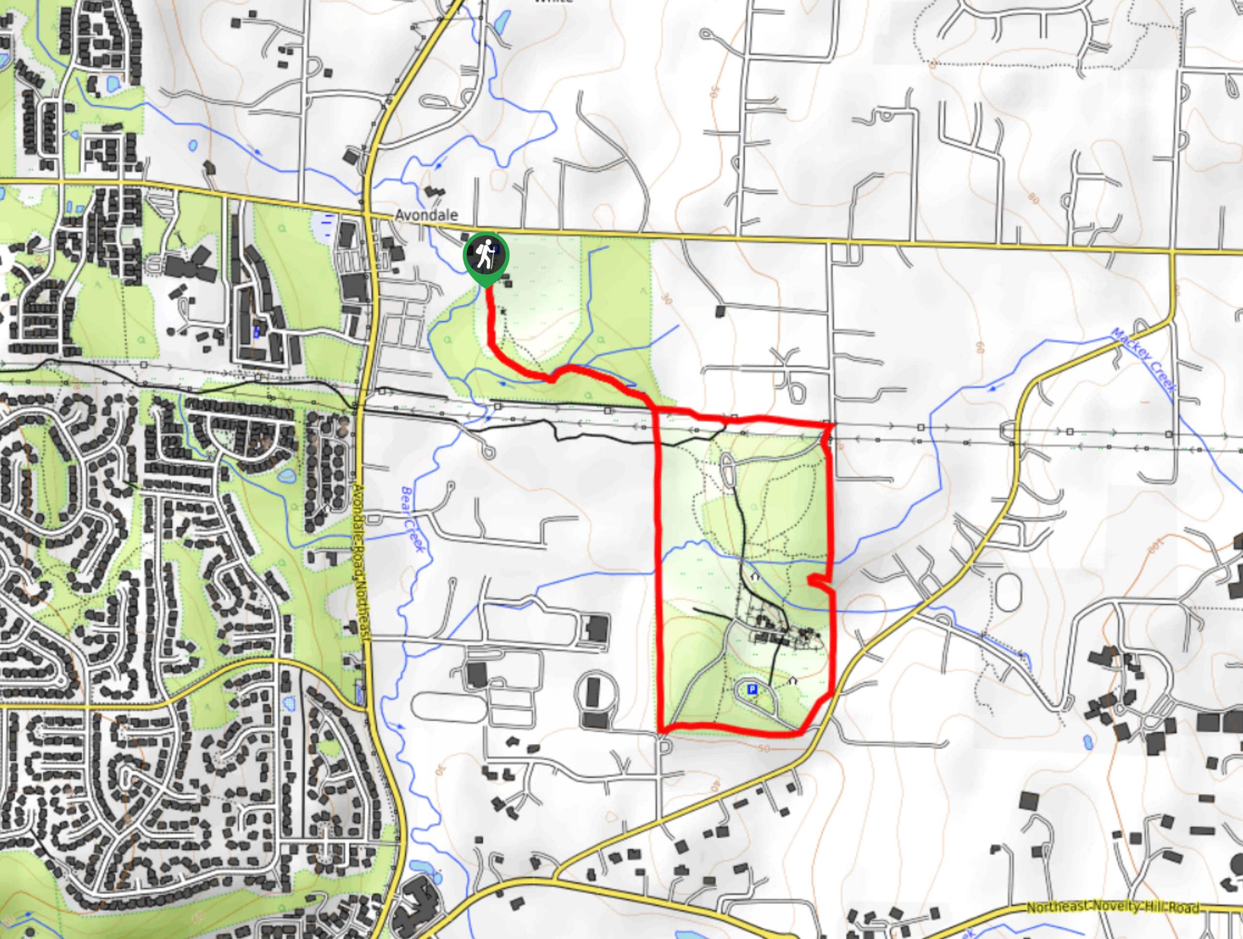
The Farrel-McWhirter Park and Juel Park Trail is an easy 2.1mi walk through an interesting stretch of forest. The walk connects the two parks and offers the chance to extend your trip via the network of trails in the park. This route is most often used by equestrians, so be aware of horse traffic and make sure you keep dogs leashed at all times.
Getting there
The trailhead for the Farrel-McWhirter Park and Juel Park Trail is at the end of the Juel Park access road off NE 116th St.

About
| Backcountry Campground | No |
| When to do | Year-round |
| Pets allowed | Yes - On Leash |
| Family friendly | Yes |
| Route Signage | Average |
| Crowd Levels | Low |
| Route Type | Loop |
Farrel-McWhirter Park and Juel Park Trail
Elevation Graph
Weather
Farrel-McWhirter Park and Juel Park Trail Description
The trail that connects Farrel-McWhirter Park and Juel Park is an easy, meandering walk through the lush woods of these two scenic parks. It’s a pleasant outing on foot but watch for the horse traffic that frequents the park and remember to give equestrians the right of way wherever possible.
Begin near the community gardens, walking down to cross Juel Creek. The trail splits where it approaches Farrel-McWhirter Park, and you can go either way. The route loops around the perimeter of the park, so as long as you stay to the far outside trail, you’ll make it around.
Circumnavigating the park, you’ll arrive back at the corner of Juel Park, where you’ll retrace your steps back to the gardens where you began. There is a network of trails in Farrel-McWhirter Park you can use to extend your adventure if you’d like to go further.
Similar hikes to the Farrel-McWhirter Park and Juel Park Trail hike

Sky Country to Harvey Manning Loop
The Sky Country to Harvey Manning Loop is a 4.2mi loop trail in the northern part of Cougar…

Iverson Spit Preserve Loop
The Iverson Spit Preserve Loop is a 1.2mi loop hike right on the beach, coursing through a beaver…

Lowell Riverfront Trail
The Lowell Riverfront Trail is a 3.0mi route alongside the Snohomish River in Everett. This trail is heavily…
Comments