
Dykstra Park and Isaac Evans Park Trail
View Photos
Dykstra Park and Isaac Evans Park Trail
Difficulty Rating:
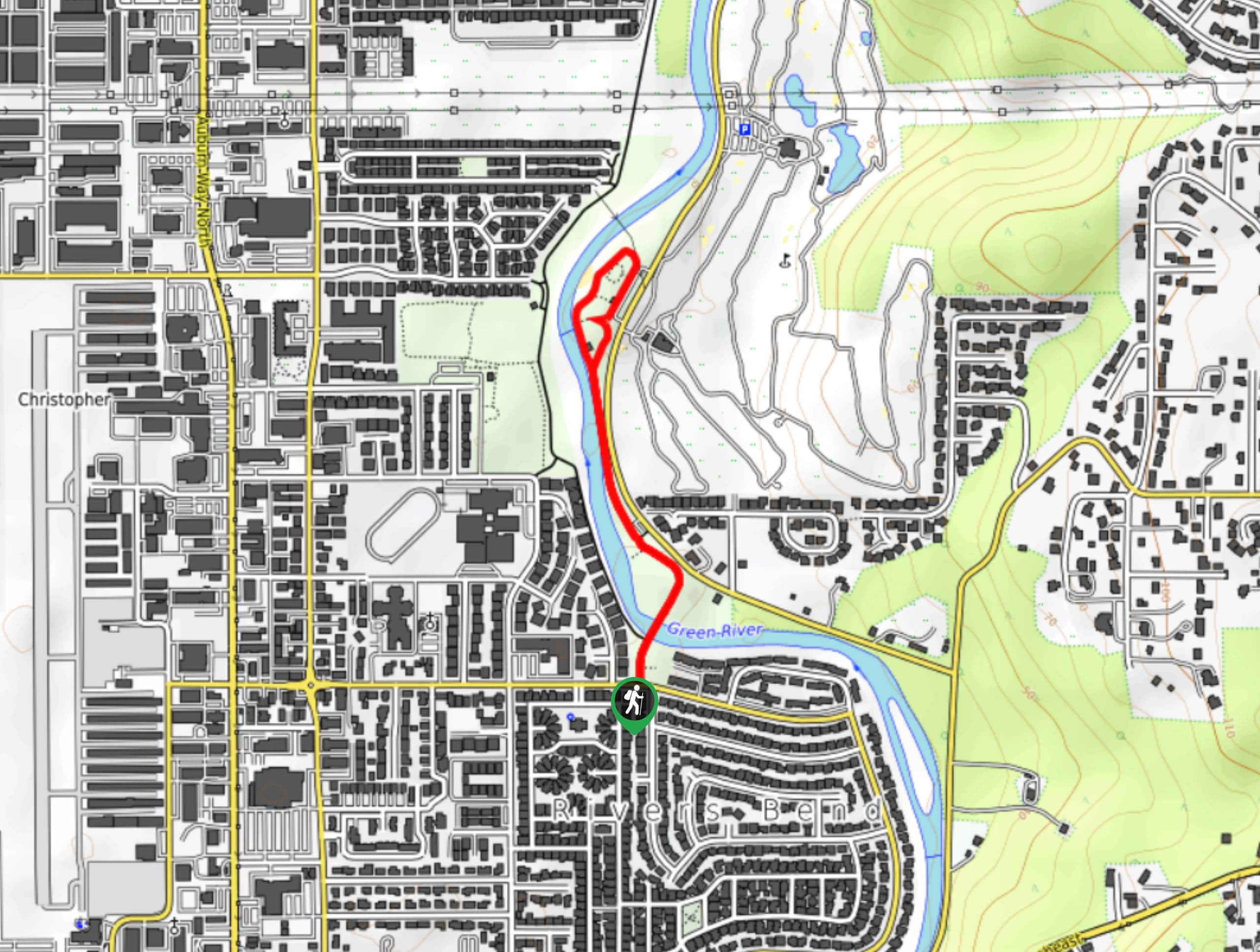
The Dykstra Park and Isaac Evans Park Trail is a 1.2mi easy walk in Auburn. This trail is suitable for all skill levels, and since it’s paved, it’s a good choice for strollers. There are play areas at two parts of the trail for young ones. Watch for bike traffic as you enjoy this walk.
Getting there
The trailhead for the Dykstra Park and Isaac Evans Park Trail is at Dykstra Park off Green River Road SE. There is street parking here.

About
| Backcountry Campground | No |
| When to do | Year-round |
| Pets allowed | Yes - On Leash |
| Family friendly | Yes |
| Route Signage | Average |
| Crowd Levels | Low |
| Route Type | Out and back |
Dykstra Park and Isaac Evans Park Trail
Elevation Graph
Weather
Dykstra Park and Isaac Evans Trail Description
The route that runs through Dykstra Park and Isaac Evans Park is a great choice for families, partly for its simplicity and lack of difficulty and partly for the play areas along the route. Whether you’re teaching little ones to ride a bike on the paved pathway or just getting some fresh air in the neighborhood, this is a great choice.
Begin in Dykstra Park. The trail follows a small loop around the park and there is the first of two playgrounds in this area. Walk along the path south to Isaac Evans Park. There is river access here and a fantastic playground with ziplines. Enjoy the park before retracing your steps back to the beginning.
Similar hikes to the Dykstra Park and Isaac Evans Park Trail hike

Sky Country to Harvey Manning Loop
The Sky Country to Harvey Manning Loop is a 4.2mi loop trail in the northern part of Cougar…

Iverson Spit Preserve Loop
The Iverson Spit Preserve Loop is a 1.2mi loop hike right on the beach, coursing through a beaver…

Lowell Riverfront Trail
The Lowell Riverfront Trail is a 3.0mi route alongside the Snohomish River in Everett. This trail is heavily…
Comments