
Lake Wilderness Trail
View Photos
Lake Wilderness Trail
Difficulty Rating:
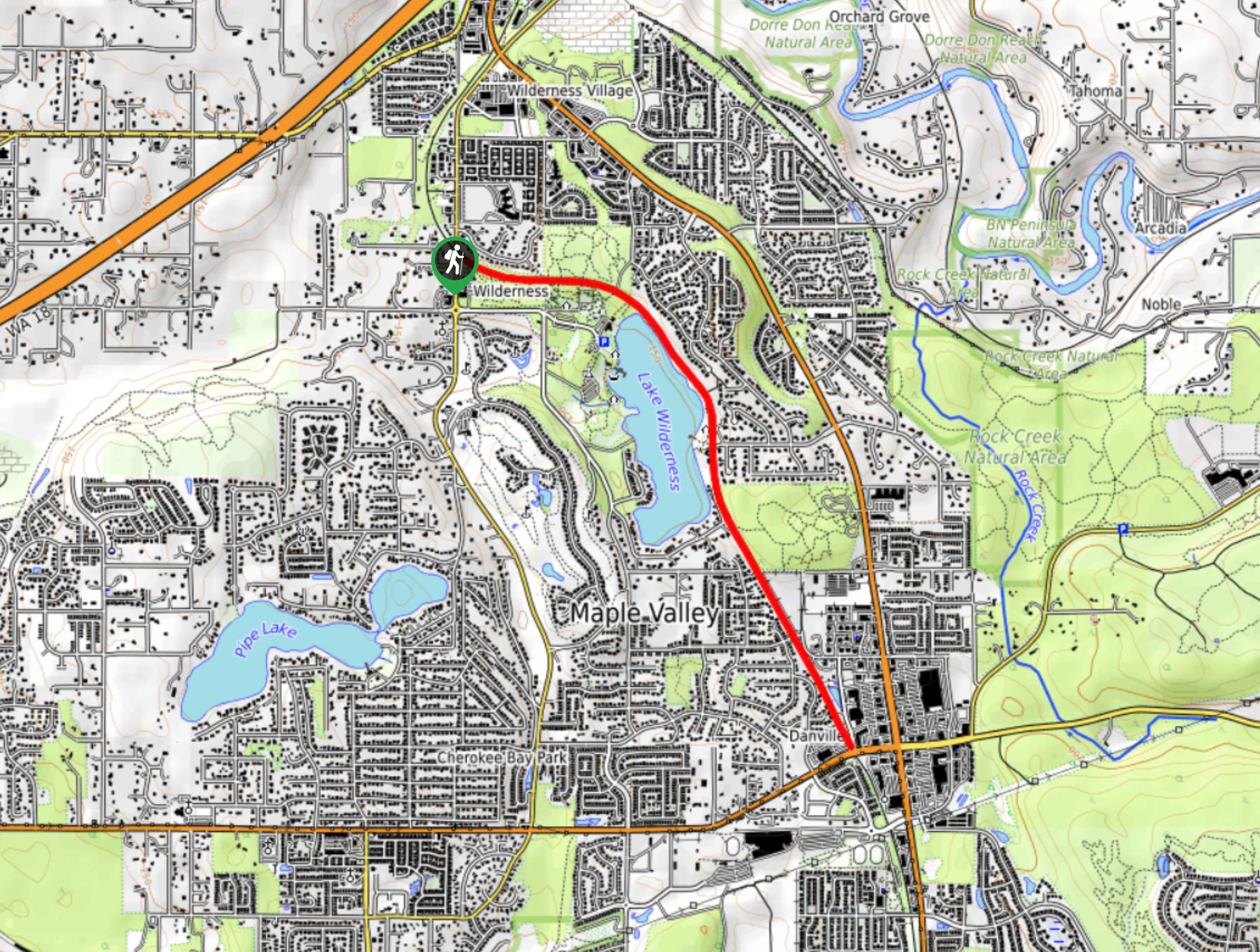
The Lake Wilderness Trail is a 4.0mi moderately trafficked out and back trail in Maple Valley that is frequented by walkers, runners, and dog walkers. This multi-use path is a great choice for an easy stroll and it is suitable for all skill levels, and the view of the lake most of the way is a wonderful sight. The path is mostly gravel.
Getting there
The trailhead for the Lake Wilderness Trail is off Witte Road SE near the Fire Engine Museum.

About
| Backcountry Campground | No |
| When to do | March-November |
| Pets allowed | Yes - On Leash |
| Family friendly | Yes |
| Route Signage | Average |
| Crowd Levels | Moderate |
| Route Type | Out and back |
Lake Wilderness Trail
Elevation Graph
Weather
Lake Wilderness Trail Description
The Lake Wilderness Trail is an easy to follow gravel pathway that offers beautiful views of the lake and a level surface for walking and running. It’s ideal for an easy walk with family or a break to take the dogs out.
Watch for horse traffic on this path and keep dogs leashed.
Begin from the trailhead in front of the museum, hiking on the Green to Cedar Rivers Trail. There are several junctions in the first part of the trail, but just keep going straight through all of them. Pass the gorgeous gardens on your right (perhaps ducking in to get a closer look) and then head towards the lake.
Walk along the lakeshore, enjoying the views and the calm atmosphere. You can either turn back at the end of the lake or walk the entire length of the trail to SE Kent-Kangley Road and back.
Similar hikes to the Lake Wilderness Trail hike

Sky Country to Harvey Manning Loop
The Sky Country to Harvey Manning Loop is a 4.2mi loop trail in the northern part of Cougar…

Iverson Spit Preserve Loop
The Iverson Spit Preserve Loop is a 1.2mi loop hike right on the beach, coursing through a beaver…

Lowell Riverfront Trail
The Lowell Riverfront Trail is a 3.0mi route alongside the Snohomish River in Everett. This trail is heavily…
Comments