Titlow Park Loop
View Photos
Titlow Park Loop
Difficulty Rating:
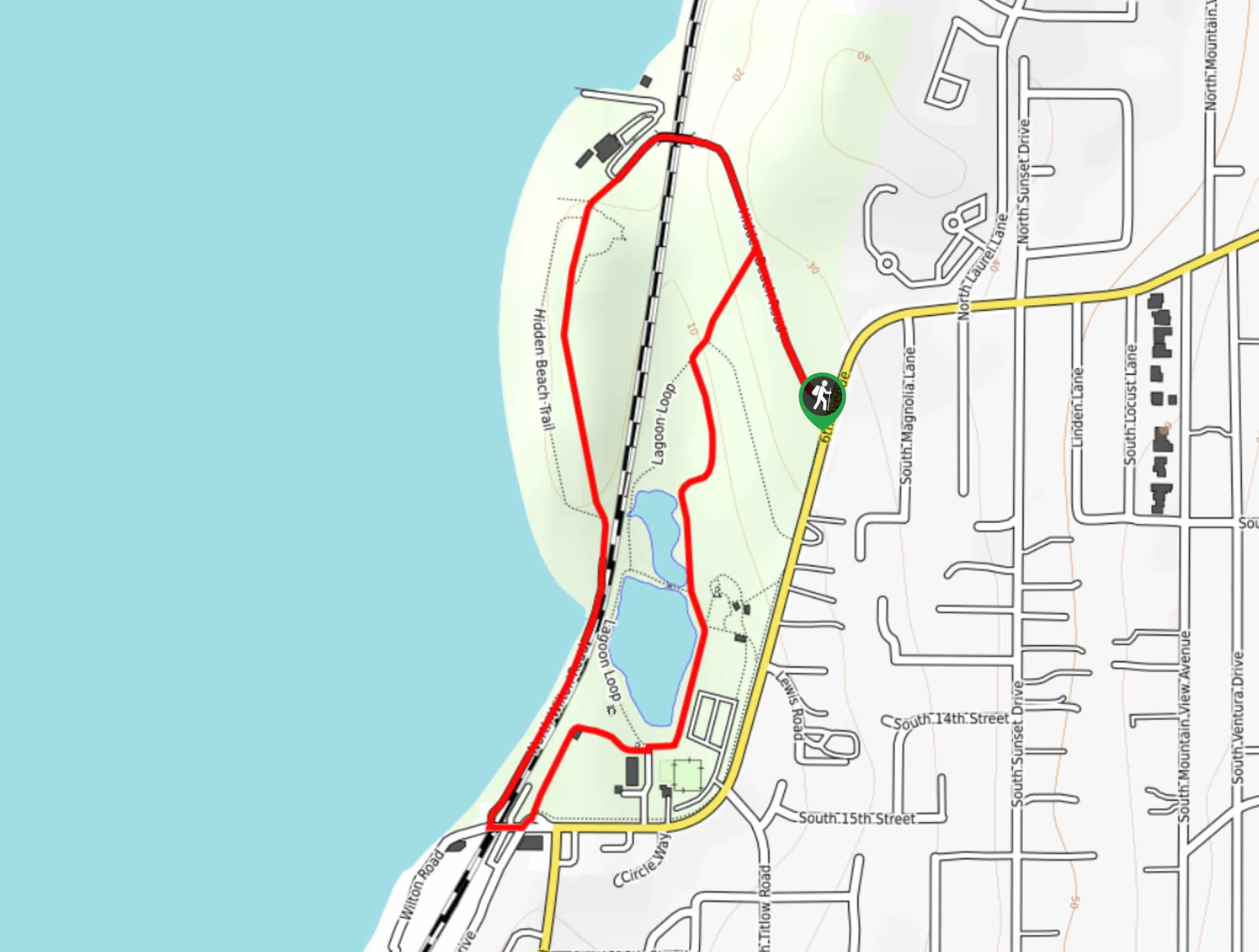
The Titlow Park Loop is a 1.6mi loop trail that takes you from one end of the park to another, offering the perfect way to enjoy the scenery and start your adventures in the park. This route is easy, flat, and suitable for all skill levels. After your walk, hit the beach or take the kids to the park’s playground.
Getting there
The trailhead for the Titlow Park Loop is near the intersection of Hidden Beach Road and 6th Ave.

About
| Backcountry Campground | No |
| When to do | Year-round |
| Pets allowed | Yes - On Leash |
| Family friendly | Yes |
| Route Signage | Average |
| Crowd Levels | High |
| Route Type | Loop |
Titlow Park Loop
Elevation Graph
Weather
Titlow Park Loop Description
The Titlow Park Loop is one of the best ways to enjoy the park, taking you from top to bottom so you can scope out where to chill on the beach or play with the dogs after your walk. This route is suitable for all skill levels.
Begin from the trailhead at the intersection of the access road to the park. You can walk this loop either way, but we’ll describe it counterclockwise. Head up to where the trail splits and stay right. You’ll walk over to the trail near the shore, strolling with an ocean view.
Pass the lagoons on your left and then loop back up towards them once you reach the seafood restaurant and the tavern. You’ll walk between the Titlow Lodge and the lagoon, then up between the lagoon and the play area. Following this trail takes you back to the original junction, where you can turn right back to the trailhead or head back to the beach, lagoon, or playground.
Similar hikes to the Titlow Park Loop hike

Sky Country to Harvey Manning Loop
The Sky Country to Harvey Manning Loop is a 4.2mi loop trail in the northern part of Cougar…

Iverson Spit Preserve Loop
The Iverson Spit Preserve Loop is a 1.2mi loop hike right on the beach, coursing through a beaver…

Lowell Riverfront Trail
The Lowell Riverfront Trail is a 3.0mi route alongside the Snohomish River in Everett. This trail is heavily…
Comments