
Holly and Bluff Loop
View Photos
Holly and Bluff Loop
Difficulty Rating:
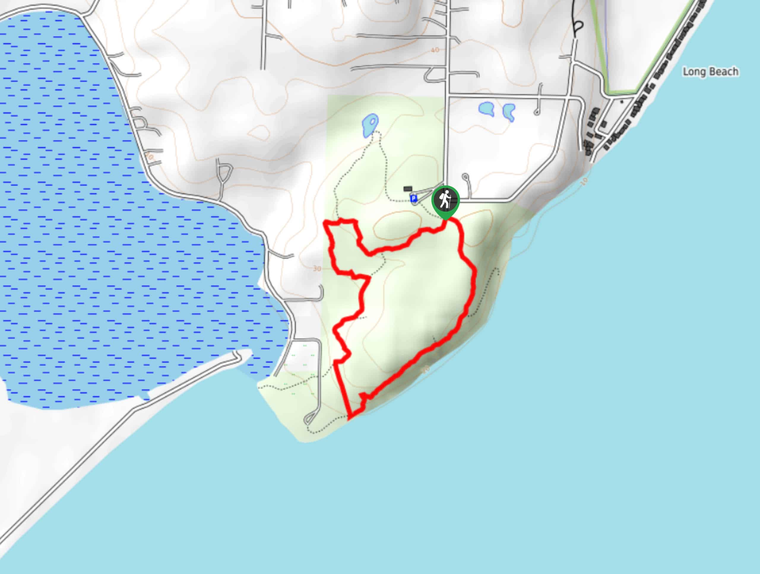
The Holly and Bluff Loop is a 1.5mi trail near Long Beach. This hike is easy and moderately trafficked. It’s a good choice for beginners and all skill levels and boasts a pretty coastal setting. Expect good signage and well-maintained trails in the area.
Getting there
The trailhead for the Holly and Bluff Loop is at the end of S Sunrise Blvd.

About
| Backcountry Campground | No |
| When to do | April-October |
| Pets allowed | Yes - On Leash |
| Family friendly | Yes |
| Route Signage | Good |
| Crowd Levels | Moderate |
| Route Type | Loop |
Holly and Bluff Loop
Elevation Graph
Weather
Holly and Bluff Loop Description
The Holly and Bluff Loop is a wonderful hike. The trails are well-maintained, the signage is clear, and the scenery is excellent. Pop by the area for an outing on your own or with family and friends. It’s especially nice on a sunny day. Consider staying for a picnic if you can!
Begin from the end of the road. You can do the loop either clockwise or counterclockwise. There is a spur trail at the trailhead that heads up to a small pond nearby, and if you want to see it, you can reconnect with the main trail in a mini loop. Walk down to the beach, do some low-tide exploring, and find a good place to relax a while before completing your loop and heading back to the trailhead.
Similar hikes to the Holly and Bluff Loop hike

Sky Country to Harvey Manning Loop
The Sky Country to Harvey Manning Loop is a 4.2mi loop trail in the northern part of Cougar…

Iverson Spit Preserve Loop
The Iverson Spit Preserve Loop is a 1.2mi loop hike right on the beach, coursing through a beaver…

Lowell Riverfront Trail
The Lowell Riverfront Trail is a 3.0mi route alongside the Snohomish River in Everett. This trail is heavily…
Comments