
North Creek Trail: McCollum Pioneer Park to Mill Creek
View Photos
North Creek Trail: McCollum Pioneer Park to Mill Creek
Difficulty Rating:
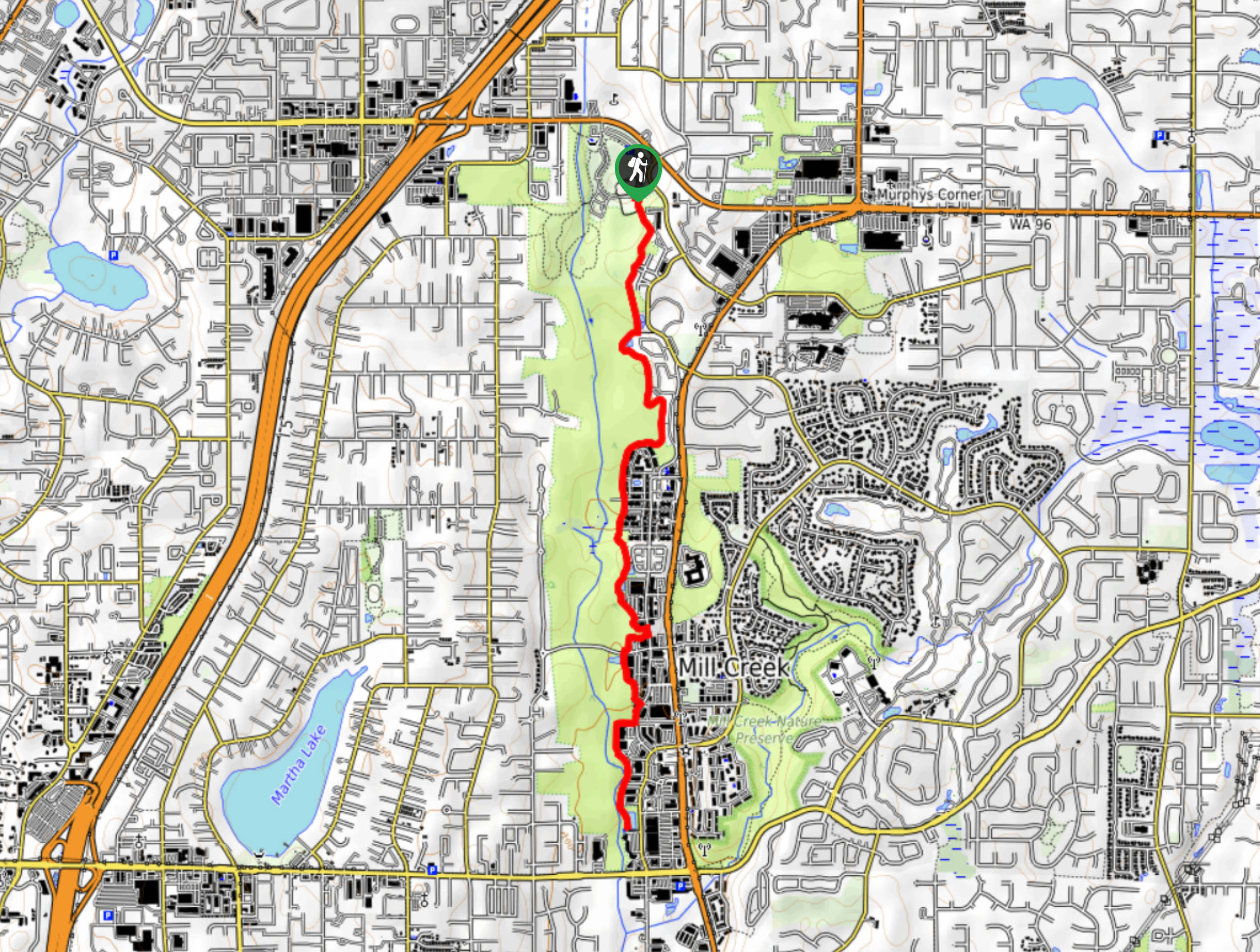
This section of the North Creek Trail goes from McCollum Pioneer Park down North Creek to Mill Creek Blvd, covering 4.9mi. The route is very easy and mostly flat, comprised mostly of sidewalks. This is a good trail to take the dogs out on or to run if you live in the area. You can continue further on the North Creek Trail for more distance if desired- try the section from U of WA Bothell to Thrasher’s Corner.
Getting there
The trailhead for this section of the North Creek Trail is in McCollum Pioneer Park on the east side of the parking area.

About
| Backcountry Campground | No |
| When to do | Year-round |
| Pets allowed | Yes - On Leash |
| Family friendly | Yes |
| Route Signage | Average |
| Crowd Levels | Moderate |
| Route Type | Out and back |
North Creek Trail: McCollum Pioneer Park to Mill Creek
Elevation Graph
Weather
North Creek Trail: McCollum Pioneer Park to Mill Creek Description
The North Creek Trail is a long multi-use trail that links Bothell, Mill Creek, and Everett. The route is designed to connect the Sammamish River Trail and the Burke Gilman Trail, so you can continue past the bounds of this guide for a longer adventure if you’d like. The route is mostly sidewalk. This section offers greener views than other parts of the trail, and it’s perfect for getting outside and getting some movement in.
This section of the North Creek Trail begins in McCollum Pioneer Park. You’ll take the path south through the park with North Creek on your right. Enjoy the greenery as you continue south. The trail is very easy to follow to its end at Mill Creek Boulevard, where you’ll turn around and retrace your steps to where you started.
Similar hikes to the North Creek Trail: McCollum Pioneer Park to Mill Creek hike

Sky Country to Harvey Manning Loop
The Sky Country to Harvey Manning Loop is a 4.2mi loop trail in the northern part of Cougar…

Iverson Spit Preserve Loop
The Iverson Spit Preserve Loop is a 1.2mi loop hike right on the beach, coursing through a beaver…

Lowell Riverfront Trail
The Lowell Riverfront Trail is a 3.0mi route alongside the Snohomish River in Everett. This trail is heavily…
Comments