
Birds Nest and Lookout Beach Hike
View Photos
Birds Nest and Lookout Beach Hike
Difficulty Rating:
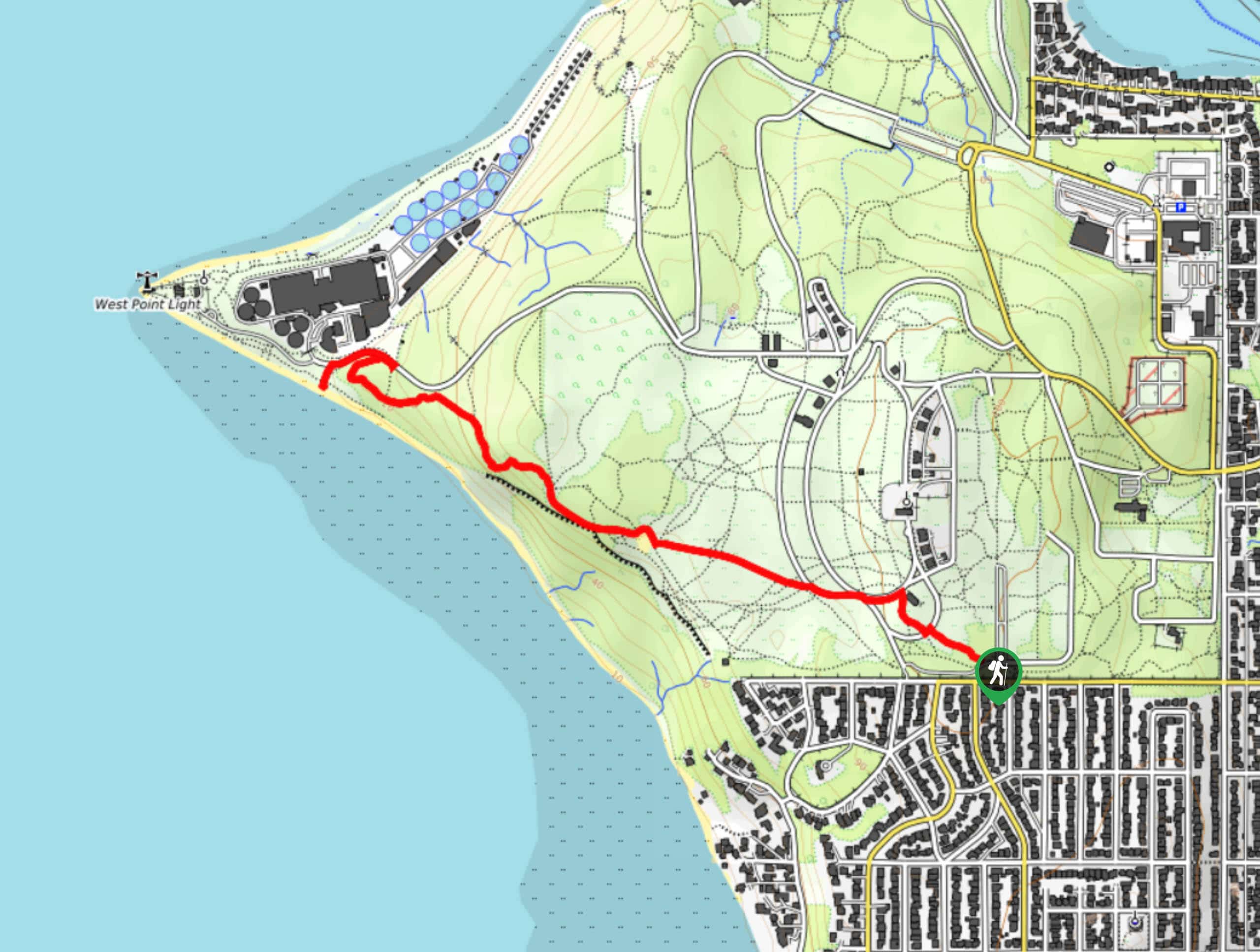
The Birds Nest and Lookout Beach hike is a moderately trafficked easy hike in Discovery Park, one of Seattle’s most popular parks. This trail takes you through the southern end of the park over 2.6mi to a lookout over the water. There are lots of other trails in Discovery Park if you want to keep going.
Getting there
The trailhead for the Birds Nest and Lookout Beach hike is on Caroline Street near the park’s parking area.

About
| Backcountry Campground | No |
| When to do | April-September |
| Pets allowed | Yes - On Leash |
| Family friendly | Yes |
| Route Signage | Average |
| Crowd Levels | Moderate |
| Route Type | Loop |
Birds Nest and Lookout Beach Hike
Elevation Graph
Weather
Birds Nest and Lookout Beach Hike Description
There are lots of ways to enjoy Discovery Park, and the Birds Nest and Lookout Beach hike is a great option for those who want an easy-moderate hike with excellent views. This trail takes you through the southern portion of the park to a lookout over the beach. It’s quite straightforward. You can continue to hike through the park on the connecting trails if you would like more distance.
Begin from the parking area. Take Loop Trail up to the boardwalk and then get onto Dakota Avenue heading towards the water. The Birds Nest will be on your left before you get back onto Loop Trail, which takes you to the lookout. There’s a bench before the end of the trail that’s ideal to sit on if you want to stop and savor the views. At the end of the trail on the beach, turn around and retrace your steps (after relaxing on the beach for a while, of course!).
Similar hikes to the Birds Nest and Lookout Beach Hike hike

Explorer Falls Hike
The Explorer Falls hike is a 5.3mi moderate hike near Sultan, Washington. This trail takes you to a…

Sky Country to Harvey Manning Loop
The Sky Country to Harvey Manning Loop is a 4.2mi loop trail in the northern part of Cougar…

Iverson Spit Preserve Loop
The Iverson Spit Preserve Loop is a 1.2mi loop hike right on the beach, coursing through a beaver…
Comments