
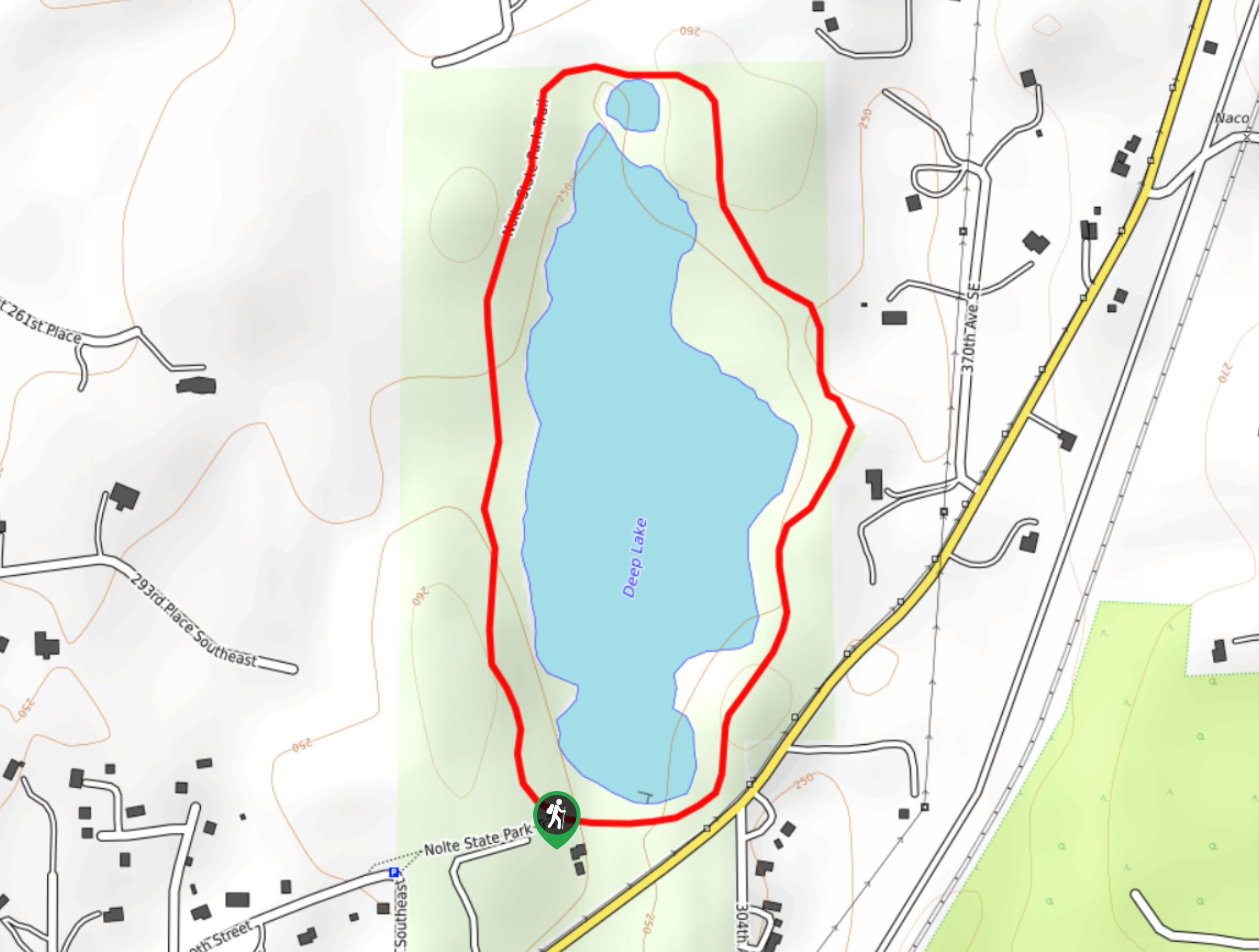
Nolte State Park Deep Lake Loop Trail
View Photos
Nolte State Park Deep Lake Loop Trail
Difficulty Rating:
The loop trail around Deep Lake in Nolte State Park is a quick and easy 1.4mi trail that is suitable for all skill levels. With a mostly flat trail and plenty of benches on the way, this is a good choice for those who need frequent rest breaks as they walk. The loop is dog-friendly (on leash) and a popular stop for families visiting the park. Expect higher traffic on this trail.
Getting there
The trailhead for the Nolte State Park Deep Lake Loop is on 300th Ave SE off Veazie-Cumberland Road SE.

About
| Backcountry Campground | No |
| When to do | Year-round |
| Pets allowed | Yes - On Leash |
| Family friendly | Yes |
| Route Signage | Average |
| Crowd Levels | High |
| Route Type | Loop |
Nolte State Park Deep Lake Loop Trail
Elevation Graph
Weather
Nolte State Park Deep Lake Loop Trail Description
The hike around Deep Lake in Nolte State Park is a popular choice for its scenery and its ease. This trail has lots of benches along the way and is both short and mostly flat, making it a great choice for hikers with limited stamina or families seeking a shorter trip. Watch for fishers in the lake or bring a picnic to set up after your hike.
Begin from the southwest corner of the lake where the trail splits off from the road. You can hike this either way. The trail is easy to follow and there are no junctions, so you’ll simply loop around the lake, enjoying the calm waters and spotting birds in the trees. Finish the loop to end up back at the trailhead, then head on to your next adventure.
Similar hikes to the Nolte State Park Deep Lake Loop Trail hike

Sky Country to Harvey Manning Loop
The Sky Country to Harvey Manning Loop is a 4.2mi loop trail in the northern part of Cougar…

Iverson Spit Preserve Loop
The Iverson Spit Preserve Loop is a 1.2mi loop hike right on the beach, coursing through a beaver…

Lowell Riverfront Trail
The Lowell Riverfront Trail is a 3.0mi route alongside the Snohomish River in Everett. This trail is heavily…
Comments