
Coal Creek Trail
View Photos
Coal Creek Trail
Difficulty Rating:
Coal Creek Trail is an 5.3mi easy hiking trail in the Coal Creek Natural Area that is suitable for all skill levels. This hike explores the history of coal mining in the region, showing you artifacts from the mining days and allowing you to check out an old mine shaft. This is a fun choice for families with young children and history buffs.
Getting there
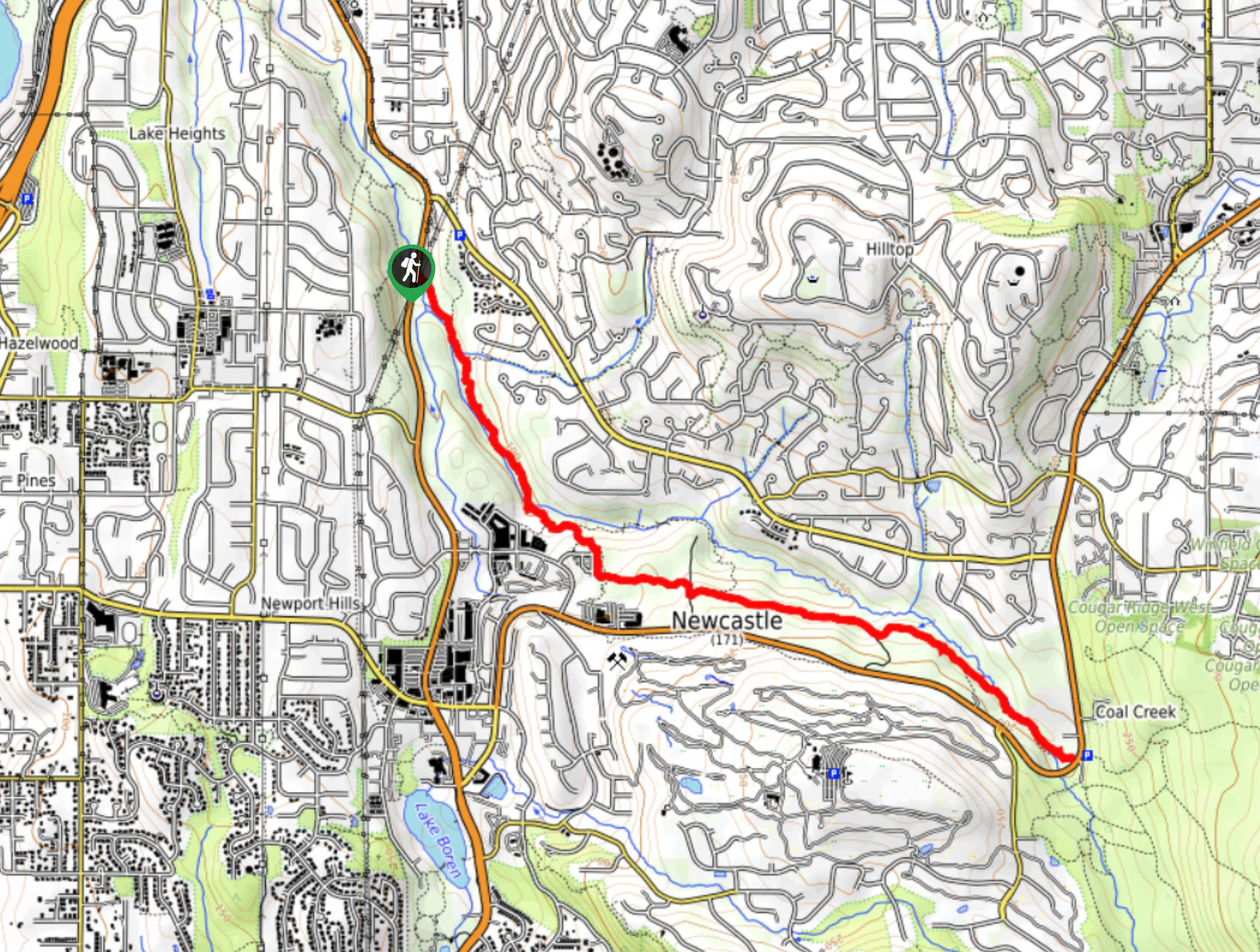
The trailhead for Coal Creek Trail is off Lakemont Blvd SE near Coal Creek. Using the Red Town parking lot is recommended.

About
| Backcountry Campground | No |
| When to do | Year-round |
| Pets allowed | Yes - On Leash |
| Family friendly | Yes |
| Route Signage | Average |
| Crowd Levels | High |
| Route Type | Out and back |
Coal Creek Trail
Elevation Graph
Weather
Coal Creek Trail Description
Coal Creek Trail is a fun historical hike that educates adventurers on the coal mining history of the region. Check out the information kiosks, look at old artifacts, and snap photos of the abandoned mine shaft. This is a fun hike for kids!
Begin from the trailhead off the road. If you parked at Red Town, be careful crossing the street as there is no pedestrian crosswalk. You’ll take the obvious path towards Coal Creek. Check out the interpretive signs as you walk, then look for the sealed mine shaft to your left when North Fork Falls are on your right.
Continue along the creek. Further on, the route curves away from the water. You’ll stay left at the junction with Primrose Trail. When the vertical section of the trail intersects, go right for just a couple of steps before taking the westbound trail again on your left.
At the next junction, go right. You’ll get closer to the creek once more and follow it for the rest of the trail. There are a few more junctions, but you’ll stay straight on your path through all of them. At Coal Creek Parkway, turn around and retrace your steps.
Similar hikes to the Coal Creek Trail hike

Explorer Falls Hike
The Explorer Falls hike is a 5.3mi moderate hike near Sultan, Washington. This trail takes you to a…

Sky Country to Harvey Manning Loop
The Sky Country to Harvey Manning Loop is a 4.2mi loop trail in the northern part of Cougar…

Iverson Spit Preserve Loop
The Iverson Spit Preserve Loop is a 1.2mi loop hike right on the beach, coursing through a beaver…
Comments