
Penrose Point State Park Trail
View Photos
Penrose Point State Park Trail
Difficulty Rating:
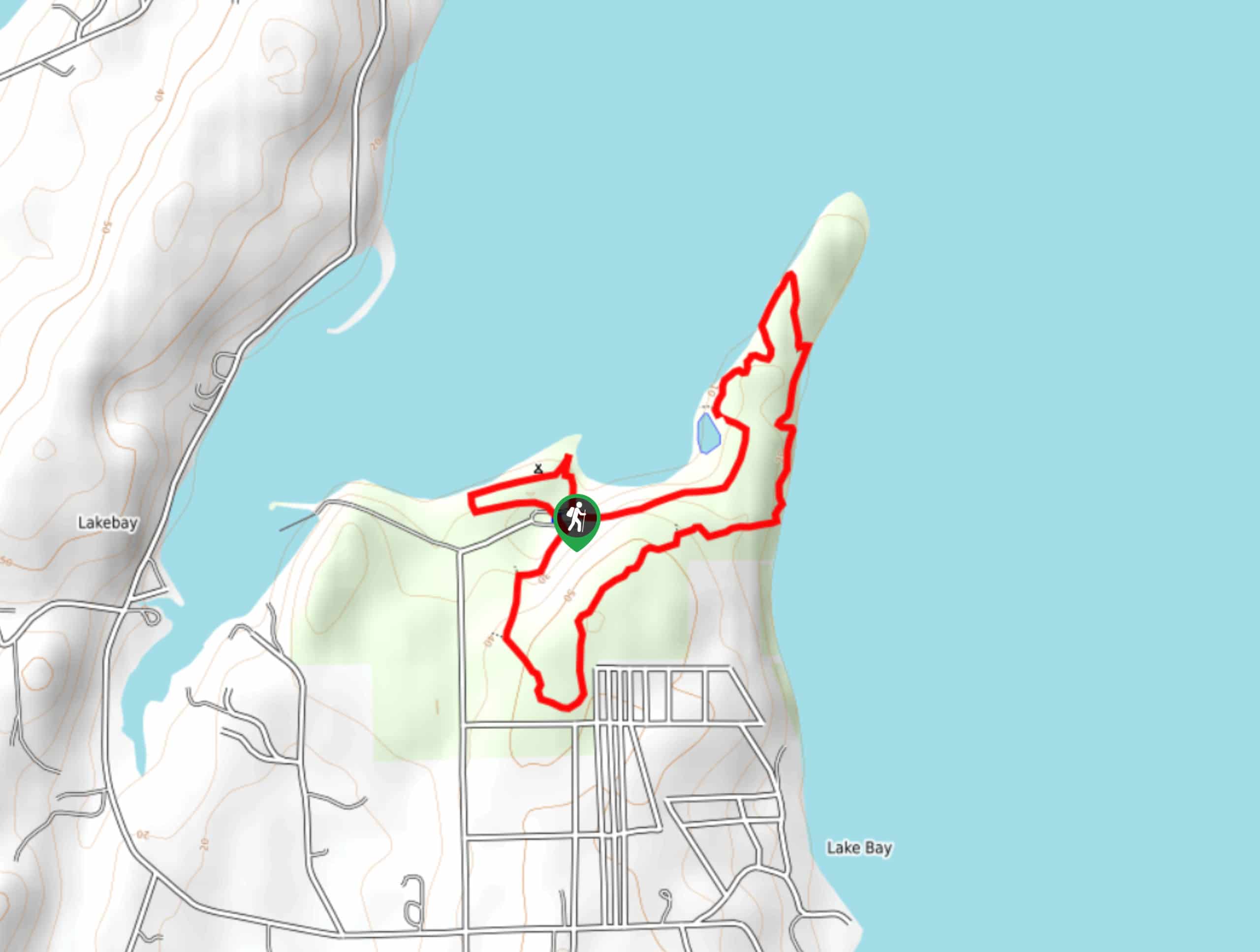
Penrose Point State Park Trail is a 2.3mi easy hike that loops around this family-friendly park near Lakebay. The hike is mostly flat and offers beach access and great views, making it a perfect outing for the whole family. The trail doesn’t get too busy, so it’s a good option for weekends where other nearby trails might be crowded.
Getting there
The trailhead for the Penrose Point State Park Trail is at the end of the access loop road off 158th Ave Kp S.

About
| Backcountry Campground | WWTA Campsite |
| When to do | Year-round |
| Pets allowed | Yes - On Leash |
| Family friendly | Yes |
| Route Signage | Average |
| Crowd Levels | Moderate |
| Route Type | Loop |
Penrose Point State Park Trail
Elevation Graph
Weather
Penrose State Park Trail Description
Penrose State Park is a delightful beachfront park with ocean views and lots of shoreline to enjoy. This loop trail is a perfect way to enjoy the whole park before picking a spot to lay down your picnic blanket and relax.
Begin from the trailhead. You can do this loop either way, but we’ll describe it clockwise. Head east on a trail that soon curves up to meet the shoreline, walking around a small lagoon before heading out onto the peninsula. Enjoy views of the water here.
The trail loops back on itself on the peninsula, and you’ll walk back inland on the other side. Hiking next to the shore, the trail turns to your right to cut through the middle of the park. You’ll then curve to the right again to loop back to the trailhead.
Similar hikes to the Penrose Point State Park Trail hike

Sky Country to Harvey Manning Loop
The Sky Country to Harvey Manning Loop is a 4.2mi loop trail in the northern part of Cougar…

Iverson Spit Preserve Loop
The Iverson Spit Preserve Loop is a 1.2mi loop hike right on the beach, coursing through a beaver…

Lowell Riverfront Trail
The Lowell Riverfront Trail is a 3.0mi route alongside the Snohomish River in Everett. This trail is heavily…
Comments