Coal Creek Falls via Cave Hole Trail
View Photos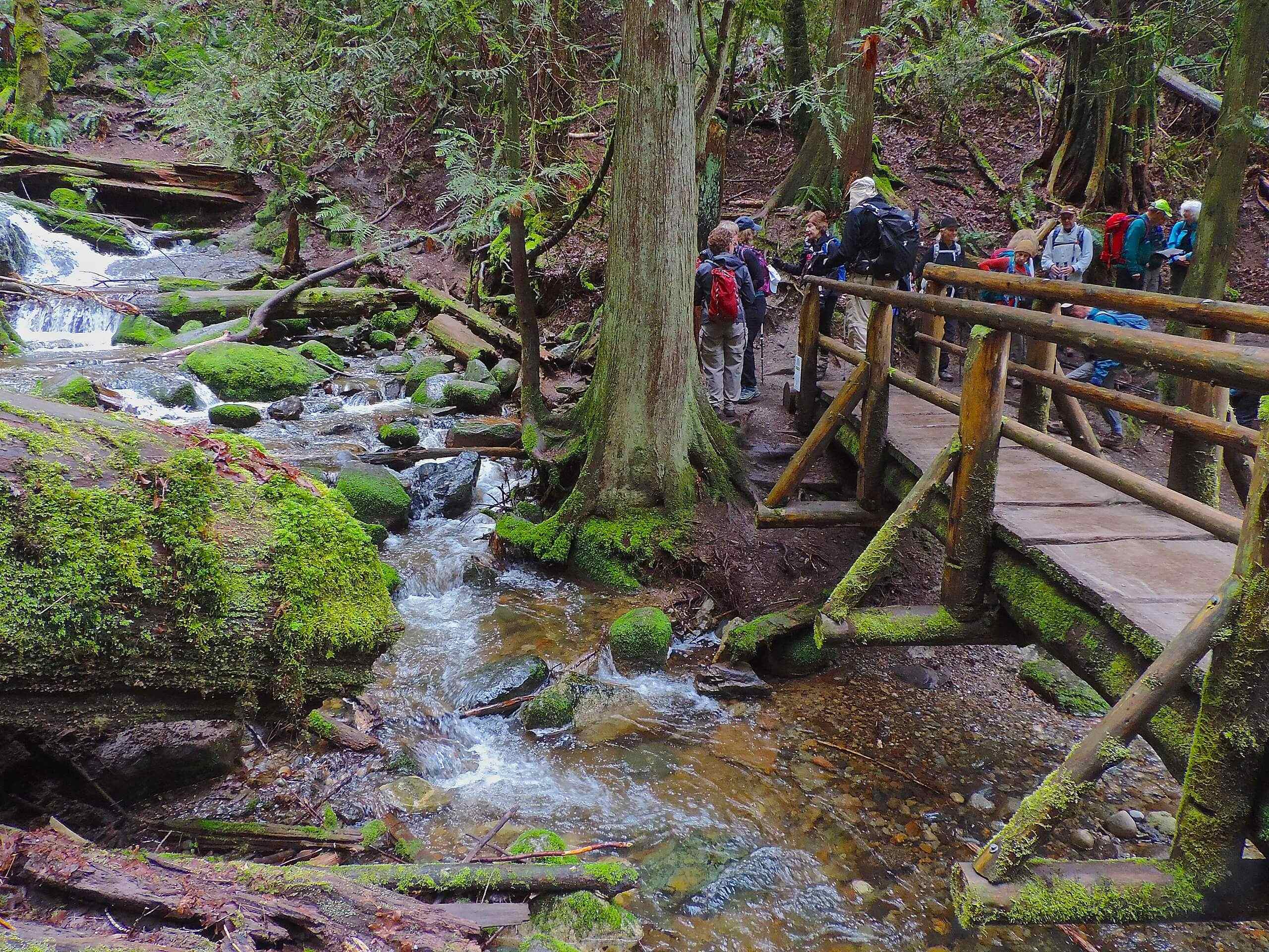
Coal Creek Falls via Cave Hole Trail
Difficulty Rating:
The hike to Coal Creek Falls on the Cave Hole Trail is an enjoyable moderate hike. This trail is 2.6mi long and suitable for most skill levels with no major climbs and no technical challenges. For the best experience at the falls, try to visit in late spring or after a good rain. They can sometimes dry up in the late summertime.
Although this hike is suitable for all skill levels, it’s not stroller-friendly. Dogs are permitted, but remember to keep them on a leash, especially with the potential for horse traffic on the second half of this route.
Getting there
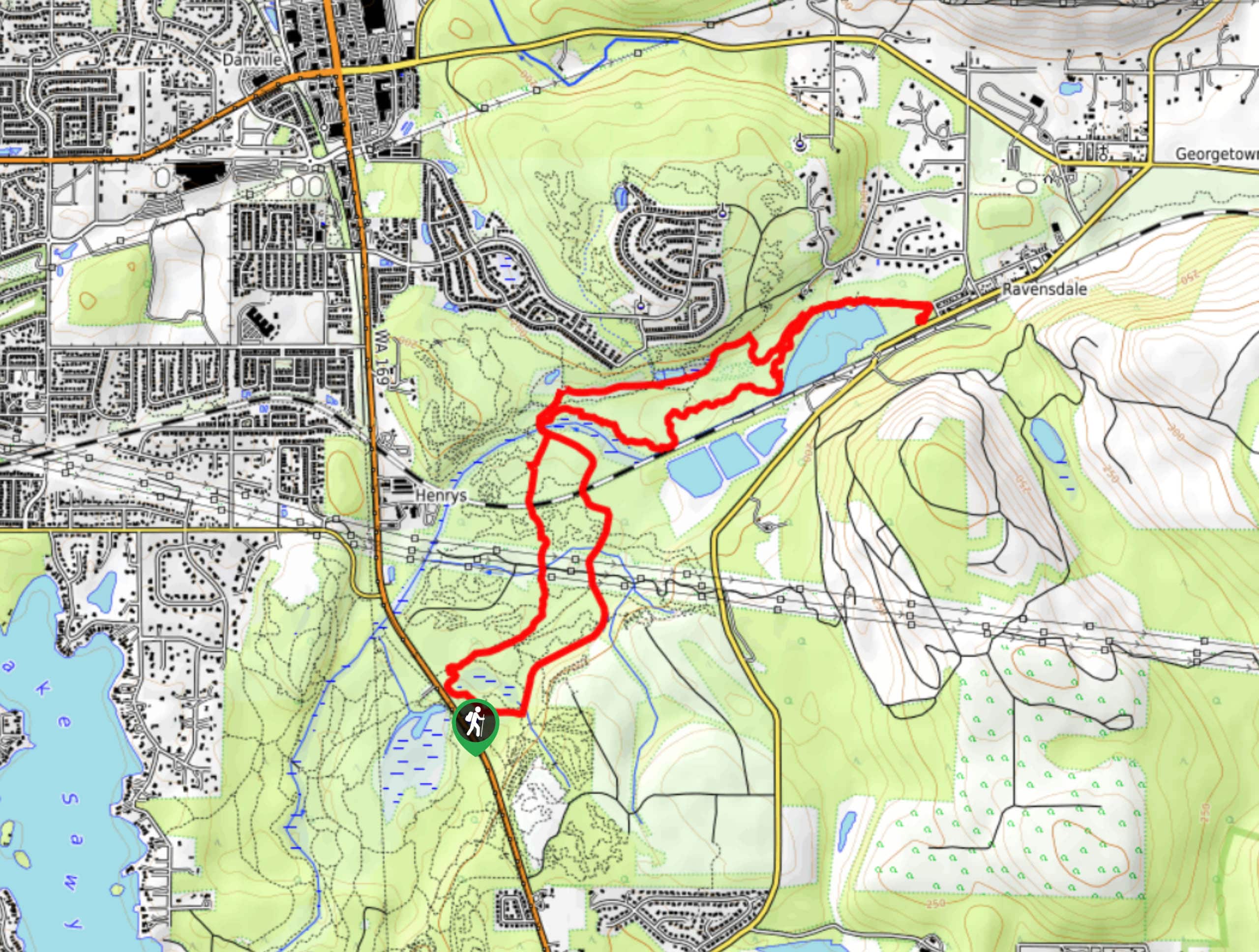
The trailhead for Coal Creek Falls via Cave Hole Trail is in the parking loop at the end of Red Town Trailhead Access Road.

About
| Backcountry Campground | No |
| When to do | March-October |
| Pets allowed | Yes - On Leash |
| Family friendly | Yes |
| Route Signage | Average |
| Crowd Levels | Moderate |
| Route Type | Out and back |
Coal Creek Falls via Cave Hole Trail
Elevation Graph
Weather
Coal Creek Falls via Cave Hole Trail Description
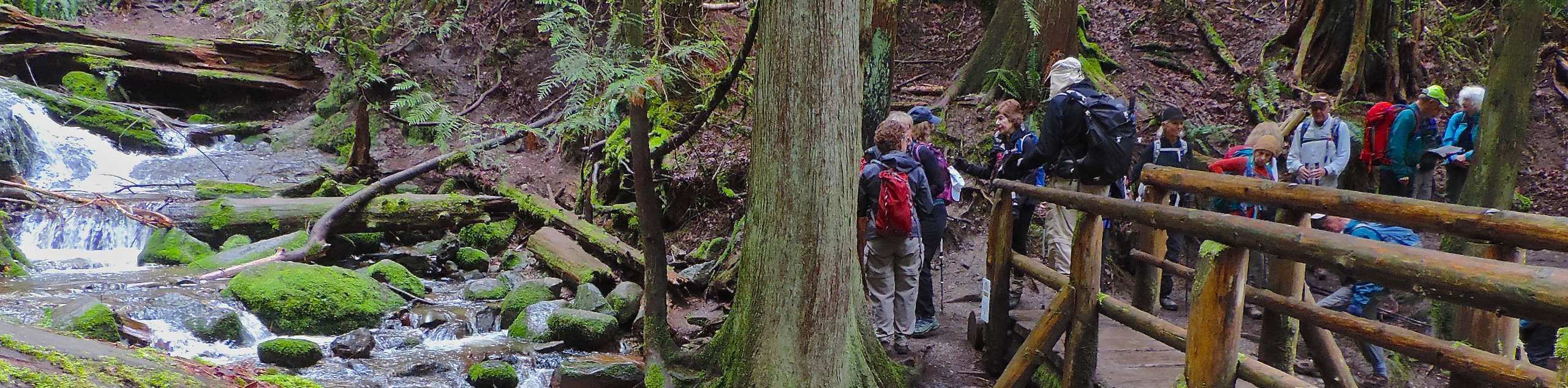
Coal Creek Falls is a small, beautiful waterfall that can be reached on this popular trail or by taking the less-traveled Nike Horse Trail. This route is suitable for most skill levels with only modest climbs and plenty of flat spots to catch your breath at. Try to visit after a good rain to get the best experience at the falls.
There may be horse traffic on the second half trail, so keep dogs leashed and give riders the right of way whenever possible.
Begin from the end of the Red Town access road. There are a few trails that begin here, so take care to take the one on your far right. Keep left at the first junction and then right at the second. Follow Cave Hole Trail to where it intersects with the Nike Horse Trail. Turn right here.
Following the horse trail south, it’s not far to the falls. After enjoying the view, you’ll turn around and retrace your steps back to the trailhead.
Similar hikes to the Coal Creek Falls via Cave Hole Trail hike

Explorer Falls Hike
The Explorer Falls hike is a 5.3mi moderate hike near Sultan, Washington. This trail takes you to a…

Sky Country to Harvey Manning Loop
The Sky Country to Harvey Manning Loop is a 4.2mi loop trail in the northern part of Cougar…
Black Diamond Coal Mine Trail
The Black Diamond Coal Mine Trail is a 6.7mi moderate trail that is mostly used by mountain bikers.…
Comments