
Kopachuck State Park Lower Loop Trail
View Photos
Kopachuck State Park Lower Loop Trail
Difficulty Rating:
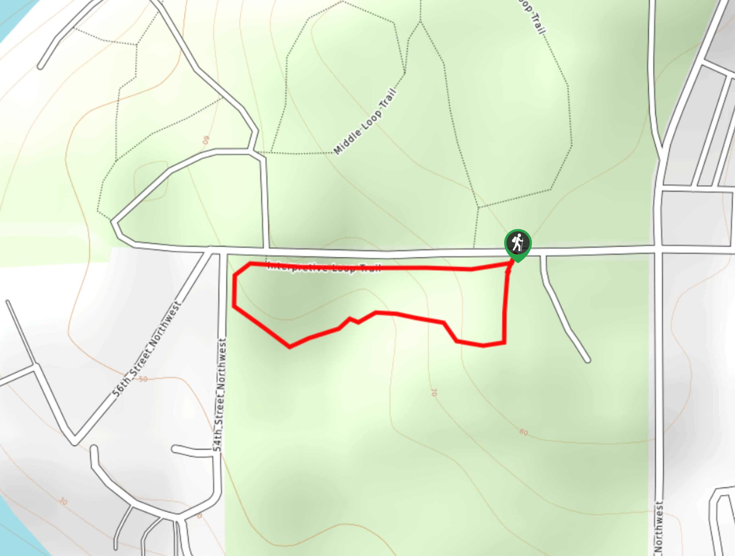
The Kopachuck State Park Lower Loop Trail is a very quick, simple walk in the Gig Harbor area. This loop is just over a quarter of a mile in length with hardly any elevation change, making it a walk suitable for all skill levels. You can also combine this loop with the Upper Loop Trail to make a longer trip out of it.
Getting there
The trailhead for the Kopachuck State Park Lower Loop Trail is off 56th St NW.

About
| Backcountry Campground | No |
| When to do | Year-round |
| Pets allowed | Yes - On Leash |
| Family friendly | Yes |
| Route Signage | Average |
| Crowd Levels | Low |
| Route Type | Loop |
Kopachuck State Park Lower Loop Trail
Elevation Graph
Weather
Kopachuck State Park Lower Loop Trail Description
The Kopachuck State Park Lower Loop Trail is a less than quarter-mile walking path in Kopachuck State Park with a beautiful forest setting. This loop is easy enough for nearly anyone to complete and can be combined with the Upper Loop Trail for a longer walk. Grab your dog or your friends and enjoy a stroll in the oceanside forest!
The trail begins off the road. You can hike this either way. No matter which way you’ll go, there are no intersecting trails, so it’s easy to find your way. Walk through the trees and look for the signs that identify the different trees, bushes, and plants in the forest. You’ll loop along the obvious path and end up back at the roadside trailhead. The Upper Loop Trail is just across the road if you’d like to combine the two.
Similar hikes to the Kopachuck State Park Lower Loop Trail hike

Sky Country to Harvey Manning Loop
The Sky Country to Harvey Manning Loop is a 4.2mi loop trail in the northern part of Cougar…

Iverson Spit Preserve Loop
The Iverson Spit Preserve Loop is a 1.2mi loop hike right on the beach, coursing through a beaver…

Lowell Riverfront Trail
The Lowell Riverfront Trail is a 3.0mi route alongside the Snohomish River in Everett. This trail is heavily…
Comments