
South Beach Trail
View Photos
South Beach Trail
Difficulty Rating:
The South Beach Trail is a 1.5mi trail in the Seattle-Tacoma area that is rated as easy. This hike takes you to South Beach, so it’s a great one to use if you’re in the park and want some time by the water. It’s popular with runners and walkers and can be enjoyed all year. This trail gets busy, so if you prefer a quieter hike, try visiting early in the morning, later in the afternoon, or midweek.
Getting there
The trailhead for South Beach Trail is at the 5-way junction near the Birds Nest in the Park.

About
| Backcountry Campground | No |
| When to do | April-September |
| Pets allowed | Yes - On Leash |
| Family friendly | Yes |
| Route Signage | Average |
| Crowd Levels | High |
| Route Type | Out and back |
South Beach Trail
Elevation Graph
Weather
South Beach Trail Description
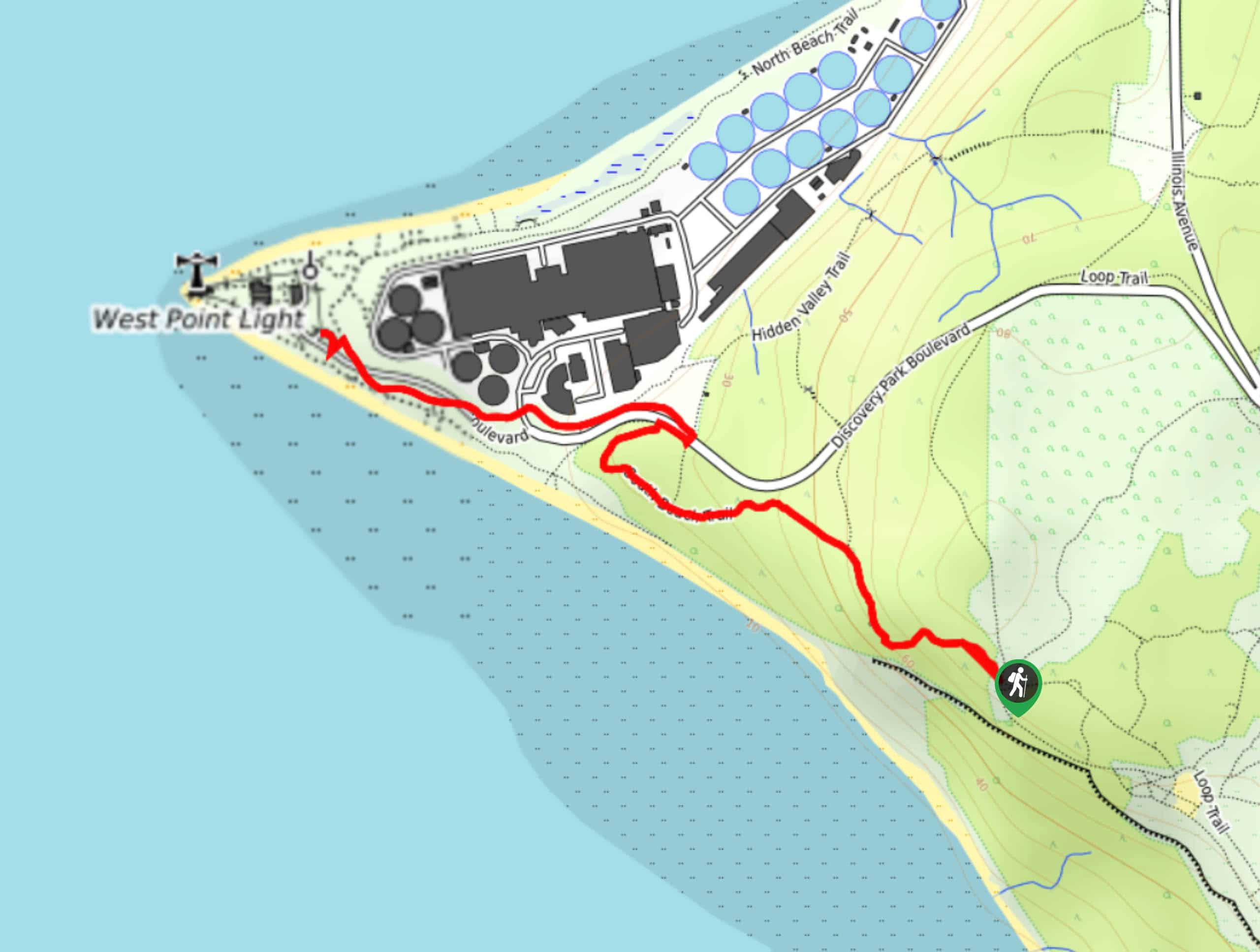
Discovery Park is a gorgeous recreation park north of Seattle that is frequented by walkers, runners, bikers, and adventurers of all ages. The South Beach Trail takes you to the beach and back from the junction near the Birds Nest. You can use the Birds Nest and Lookout Beach guide to get you to this point if needed.
Begin from the junction. Take South Beach Trail, but don’t rush it- there are great viewpoints to see as soon as you’re on the trail. Keep left at the first junction and then pause for a moment at the Lookout Bench. The trail curves up and then turns left past the road. Follow it to the beach. When you’re ready to return, retrace your steps.
Similar hikes to the South Beach Trail hike

Sky Country to Harvey Manning Loop
The Sky Country to Harvey Manning Loop is a 4.2mi loop trail in the northern part of Cougar…

Iverson Spit Preserve Loop
The Iverson Spit Preserve Loop is a 1.2mi loop hike right on the beach, coursing through a beaver…

Lowell Riverfront Trail
The Lowell Riverfront Trail is a 3.0mi route alongside the Snohomish River in Everett. This trail is heavily…
Comments