Camelback Mountain via Echo Canyon and Cholla Trail
View Photos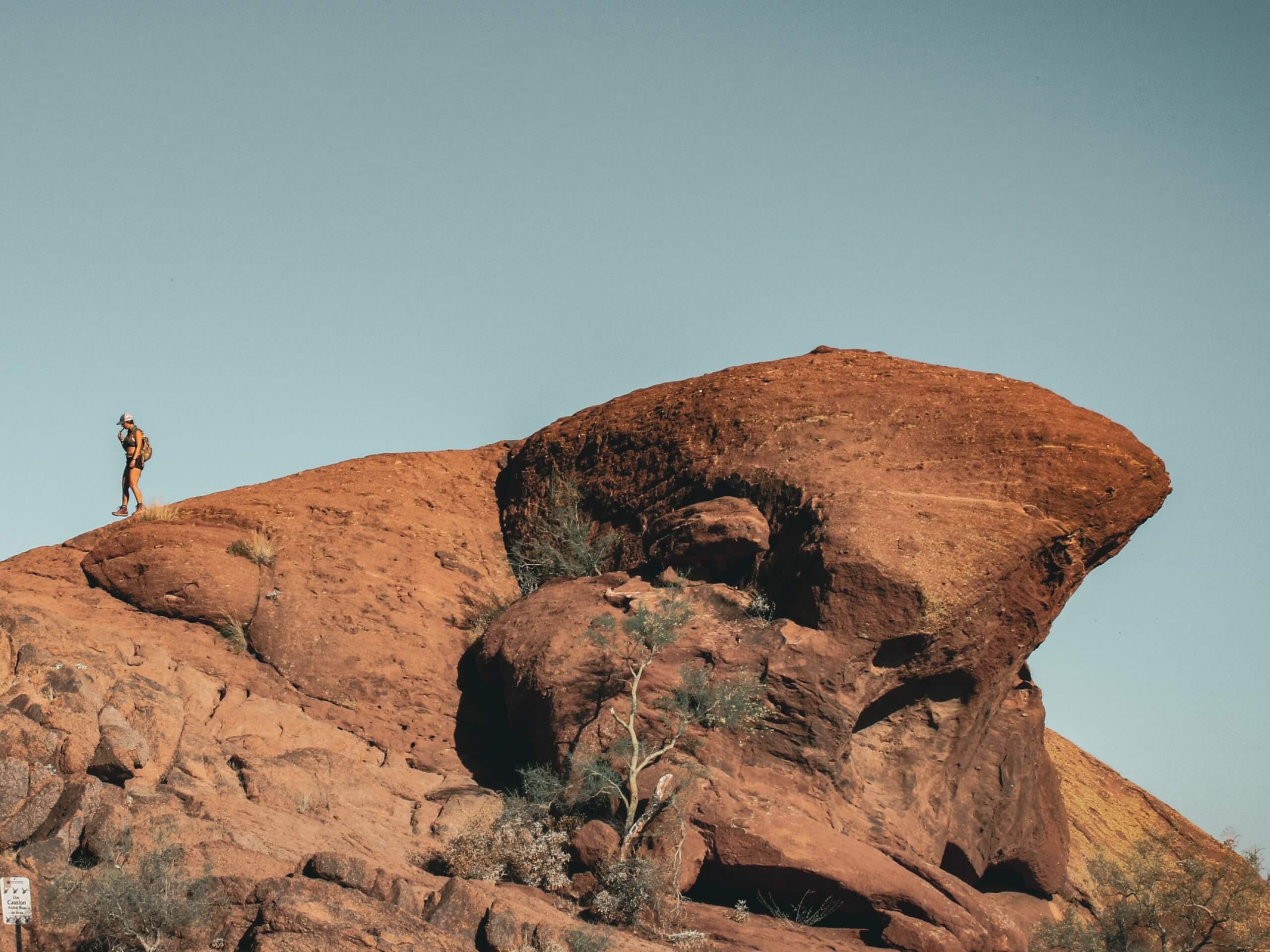
Camelback Mountain via Echo Canyon and Cholla Trail
Difficulty Rating:
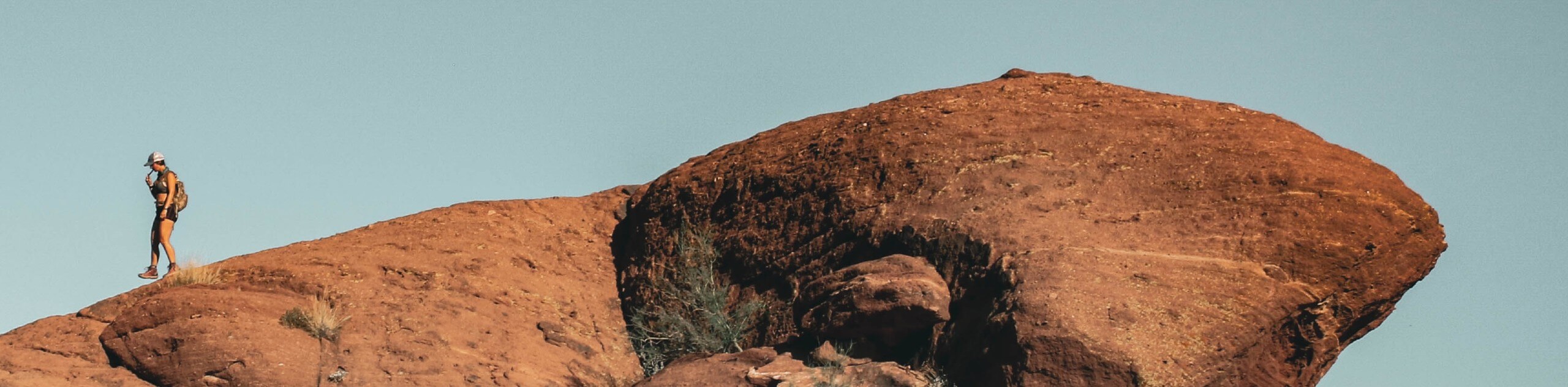
Camelback Mountain is Phoenix’s most dominant peak, begging to be climbed as it rises above the city, resembling a camel laying down. This approach to the mountain is a point-to-point route, but you can simply double the distance and climb it as an out and back if you don’t have a car shuttle. The beginning of your hike starts from the Echo Canyon Trailhead, following Echo Canyon Trail up the west side of the mountain, descending via Cholla Trail. You’ll have an incredible view of the city and the surrounding mountains since this is the tallest peak in the Phoenix area.
Camelback Mountain is not a beginner or kid-friendly hike. There are multiple rescues on this mountain every season and hikers have died from dehydration and accidents up here. If you’re a new hiker or you’re not used to hiking in desert conditions, save this one for the future.
Getting there
The trailhead for Camelback Mountain via Echo Canyon and Cholla Trail is on N Echo Canyon Parkway.

About
| Backcountry Campground | No |
| When to do | October-May |
| Family friendly | No |
| Route Signage | Good |
| Crowd Levels | High |
| Route Type | One Way |
Camelback Mountain via Echo Canyon and Cholla Trail
Elevation Graph
Weather
Camelback Mountain via Echo Canyon and Cholla Trail Description
Camelback Mountain, named for its resemblance to a camel laying down, is the tallest mountain in the Phoenix area. Clearly visible from its dominating spot on the skyline, it beckons hikers with its sloping summit. Camelback Mountain offers excellent views of the city and the surrounding mountains since it’s the tallest mountain in the area.
There are two routes up Camelback Mountain. Echo Canyon Trail starts on the west end of the mountain and Cholla Trail starts on the east. Cholla Trail is the most technical of the two, but both are demanding.
This guide gives you the full experience by making a point-to-point trail using both routes, starting at Echo Canyon and ending at the end of Cholla. Should you prefer an out and back approach, you can turn around from the top and head back down Echo Canyon. Check out our Camelback Mountain hike guide for this shorter approach.
Despite the short distance of these trails, they are not beginner-friendly. There have been countless rescues off this mountain and hikers have died in accidents. This hike is suited to strong hikers with some technical experience who are used to the unique demands of hiking in the desert. You’ll need lots of water, sun protection, an early start, and some gumption.
From the Echo Canyon Trailhead, take the wide dirt path to the switchbacks. Enjoy the interesting landscapes with boulders that look like Swiss cheese. At 0.4mi you’ll hike up a set of wooden stairs. There are railings anchored into the rock to help you along after this. The footing gets less defined, so hold onto these railings to help you along.
The route becomes more scrambly after this as the grade increases. You’ll be making your way up smooth undulations in the rock, which give way to large boulders you’ll climb over. At 0.7mi, stay straight where it seems like the route veers to the right. Going right gets you off-trail near the edge of the mountain. We don’t want that!
At 1.1mi, make the final push to the top. With a panoramic view of the whole city and surrounding mountains, it’s quite the viewpoint. Many hikers will turn back to descend via the same trail, but our route continues down the other side of the mountain on Cholla Trail.
The descent on Cholla begins with an exposed ridgeline. Take your time on this section where the trail is narrow and rocky. The beginning of the descent will be the most challenging. Eventually, the trail drops off the north side of the ridge and becomes easier to traverse.
Descend gradually to the Cholla Trailhead. There isn’t parking immediately at the trailhead, so you’ll need to have your car parked about 0.3mi away.
Hiking Route Highlights
Phoenix
The highlight of your view from the top of Camelback Mountain is the entire city of Phoenix. Phoenix is the largest city in Arizona and has been the capital of the state since 1889 (Tucson and Prescott were previously the capitals). The city has become a sprawling metropolis of over 1.6 million people known for its golfing, resorts, and entertainment. With access to nearby mountain ranges and a hot, snowless climate, Phoenix is a great base for hikers wanting to explore the desert mountains.
Frequently Asked Questions
Is Camelback Mountain hard to hike?
Yes. The climb up Camelback Mountain is a very hard hike no matter which trail you take.
Which trail up Camelback Mountain is easier?
Cholla Trail might be the easier of the two, but it still becomes demanding with its exposed ridgeline near the summit.
Are there snakes on Camelback Mountain?
There are snakes on Camelback Mountain, but it’s relatively uncommon that you’ll see them.
Insider Hints
There is limited parking at the Echo Canyon Trailhead. Arrive early.
Bring more water than you think you’ll need for this hike!
Similar hikes to the Camelback Mountain via Echo Canyon and Cholla Trail hike

Two Bit and Rattle Saddle Loop
The Two Bit and Rattle Saddle Trail is a moderately challenging hike in the Phoenix’s Mountain Preserve near Piestewa Peak.…

Ma-Ha-Tauk and Crosscut Loop
The Ma-Ha-Tauk and Crosscut Loop is a moderate hike in Phoenix’s South Mountain Preserve. With pleasant views and not much…
Coach Whip Hike
The Coach Whip hike is a route in the Thunderbird Conservation Park in Glendale. The park mostly draws residents who…
Comments