
Holbert Trail
View Photos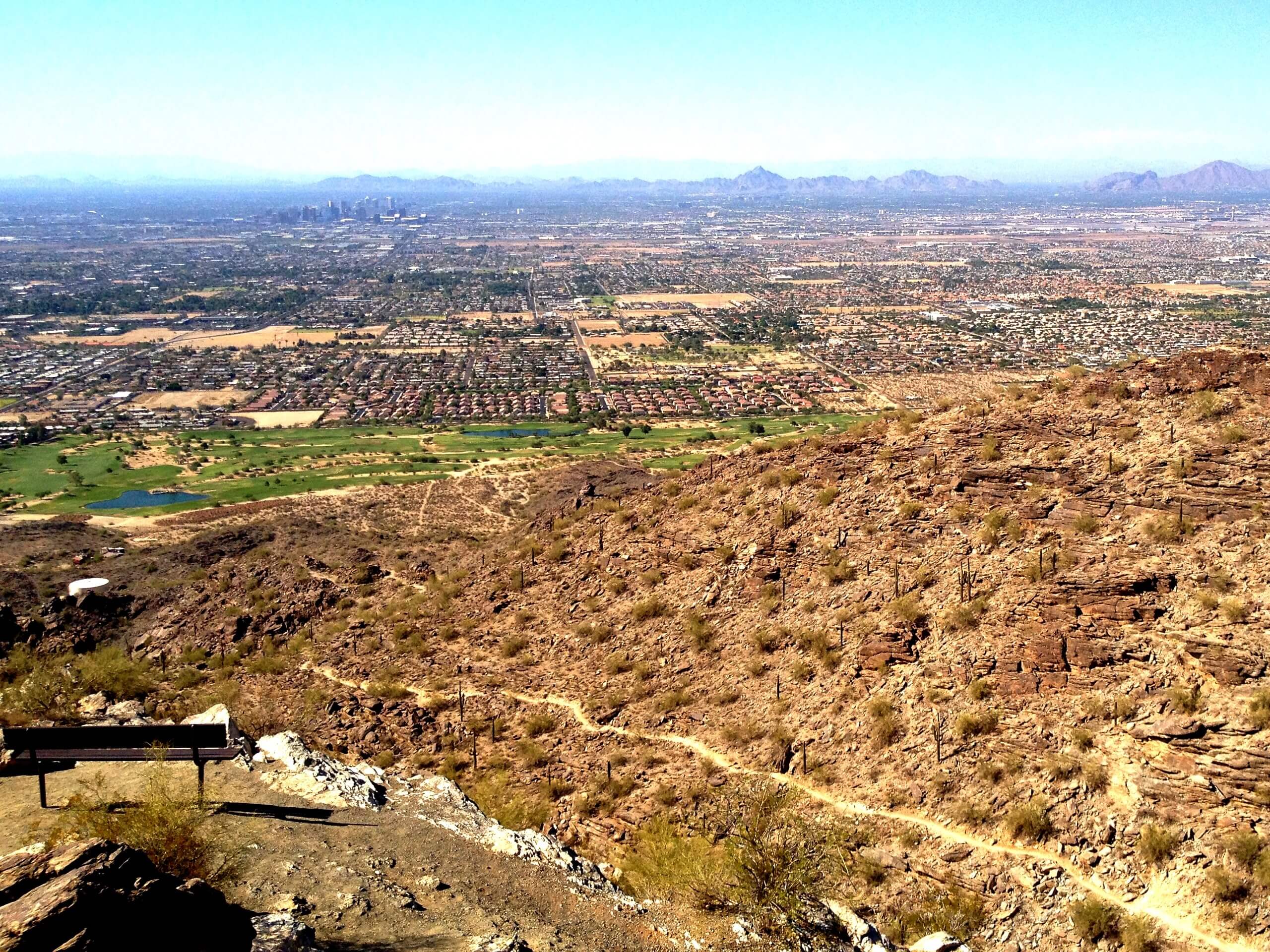
Holbert Trail
Difficulty Rating:
The Holbert Trail is an awesome hike in Phoenix’s South Mountain Preserve. This trail boasts petroglyphs and rock art, a gorgeous canyon, big boulders to climb over, and views of the city below. It’s a diverse, adventurous hike. Little kids may have difficulty with the bouldery sections of this trail, but otherwise, it’s suitable for strong beginners. Expect heavy traffic on this trail.
Getting there
The trailhead for the Holbert Trail is on Phoenix S Mountain Park.

About
| Backcountry Campground | No |
| When to do | October-May |
| Pets allowed | Yes - On Leash |
| Family friendly | Older Children only |
| Route Signage | Average |
| Crowd Levels | High |
| Route Type | Out and back |
Holbert Trail
Elevation Graph
Weather
Holbert Trail Description
Holbert Trail is a varied, beautiful hike in Phoenix’s South Mountain Park. This route shows off impressive samples of rock art and petroglyphs, canyon views, and city views. Hikers can catch their breath in the stone ramada at the top to take in the view of Phoenix or enjoy a mid-hike sandwich break. For an adventure that only takes a couple of hours, the bang for your buck is definitely there.
Begin from the main entrance to the South Mountain Park. Make a left past the visitor center and continue to the end of the road, where Holbert Trail starts. The route is mostly gravel and sand. Follow the obvious trail as it starts flat, crossing a wash and meandering towards a canyon. The grade increases as you climb up through the canyon and then traverse into the canyon next to it. Take a moment to turn around and appreciate the view of the city from the canyon as you hike.
Take on a heart-pumping ascent through the canyon that leads to Dobbins Lookout. You could easily make the short side trip to the lookout if you wanted; take the switchbacks on your right. Otherwise, continue straight ahead as the trail evens out a bit. The route continues to S TV Road, where it terminates. From here, turn back and retrace your steps.
Similar hikes to the Holbert Trail hike

Palisade to Basalt Loop
The Palisade to Basalt Loop is a short, easy trail in the Deem Hills Recreation Area. This hike is 1.4mi

Two Bit and Rattle Saddle Loop
The Two Bit and Rattle Saddle Trail is a moderately challenging hike in the Phoenix’s Mountain Preserve near Piestewa Peak.…

Ma-Ha-Tauk and Crosscut Loop
The Ma-Ha-Tauk and Crosscut Loop is a moderate hike in Phoenix’s South Mountain Preserve. With pleasant views and not much…
Comments