
Corona de Loma Trail
View Photos
Corona de Loma Trail
Difficulty Rating:
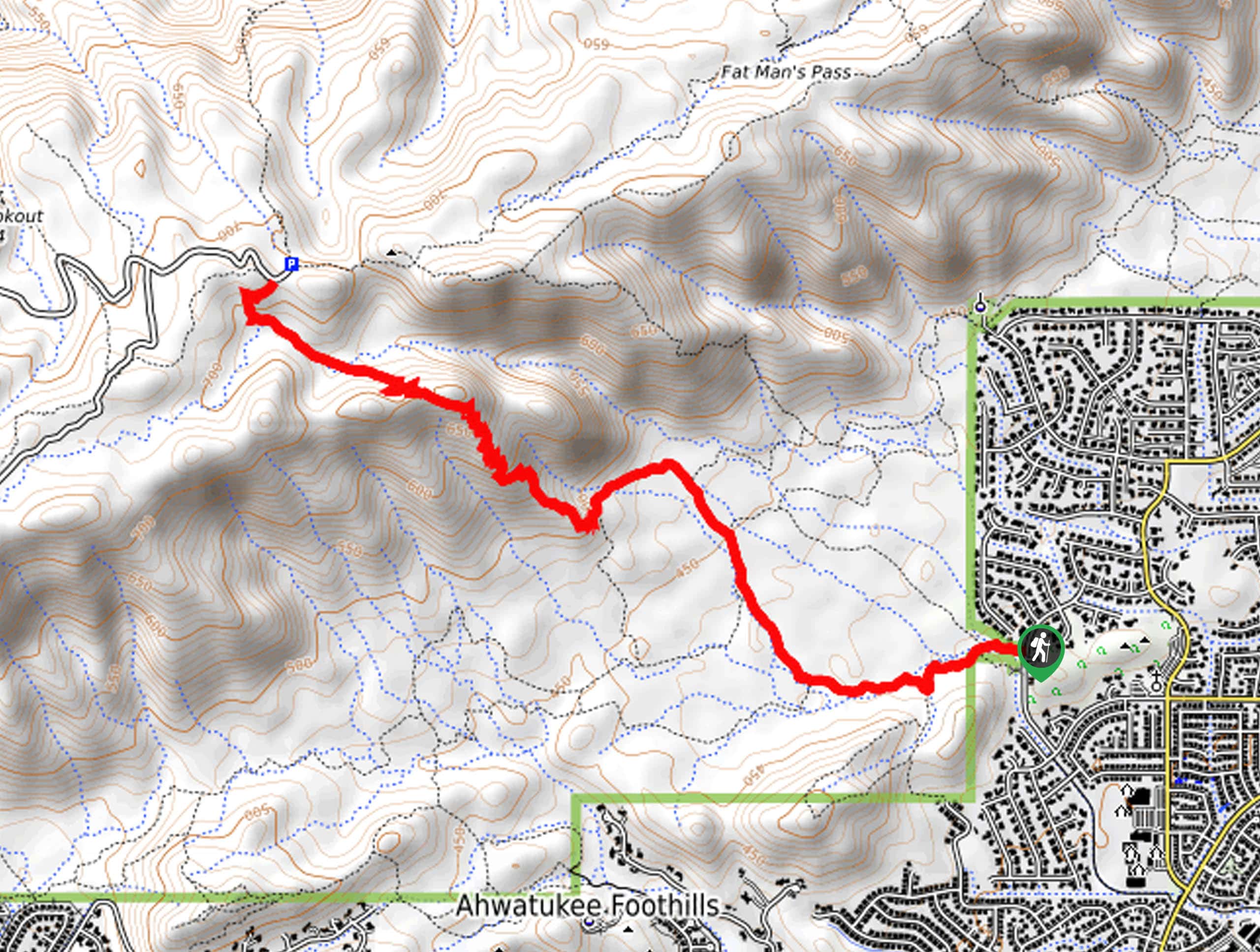
The Corona de Loma Trail is a hike in Phoenix’s South Mountain Preserve. This route is 6.4mi long and is rated as difficult. It’s popular for conditioning for backpackers and hikers training for longer hikes. It’s not the best choice for kids but it’s a good pick for those who want to work for their views. The trail offers pretty desert scenery, from plants to the hills and ridges of the preserve. Expect light traffic on this hike.
Getting there
The trailhead for the Corona de Loma Trail is on S Warpaint Drive.

About
| Backcountry Campground | No |
| When to do | October-May |
| Pets allowed | Yes - On Leash |
| Family friendly | No |
| Route Signage | Good |
| Crowd Levels | Low |
| Route Type | Out and back |
Corona de Loma Trail
Elevation Graph
Weather
Corona de Loma Trail Description
The Corona de Loma Trail is a route in Phoenix’s South Mountain Preserve that leads up a steep slope to a ridge with great views of the preserve and the city. This hike is strenuous, and it’s often used by hikers who are training for longer adventures or backpacking trips. Pick it on a day when you want to get a good sweat on!
This route isn’t the best choice for families or beginners. Since you’ll be working fairly hard and out in the sun, bring lots of water with you and avid hiking in the hot afternoons.
From the trailhead, the route is generally well-marked. Stay right at the first two junctions, taking Warpaint South Trail towards the ridge. Bear left twice onto Lower Corona Trail, then begin your switchbacks up the slope. It’s steep switchback after steep switchback until you reach the top, where you’ll still be working against the grade but at a more reasonable intensity. At the road, turn back and retrace your steps.
Similar hikes to the Corona de Loma Trail hike

Two Bit and Rattle Saddle Loop
The Two Bit and Rattle Saddle Trail is a moderately challenging hike in the Phoenix’s Mountain Preserve near Piestewa Peak.…

Ma-Ha-Tauk and Crosscut Loop
The Ma-Ha-Tauk and Crosscut Loop is a moderate hike in Phoenix’s South Mountain Preserve. With pleasant views and not much…

Coach Whip Hike
The Coach Whip hike is a route in the Thunderbird Conservation Park in Glendale. The park mostly draws residents who…
Comments