
National Trail Out and Back Hike
View Photos
National Trail Out and Back Hike
Difficulty Rating:
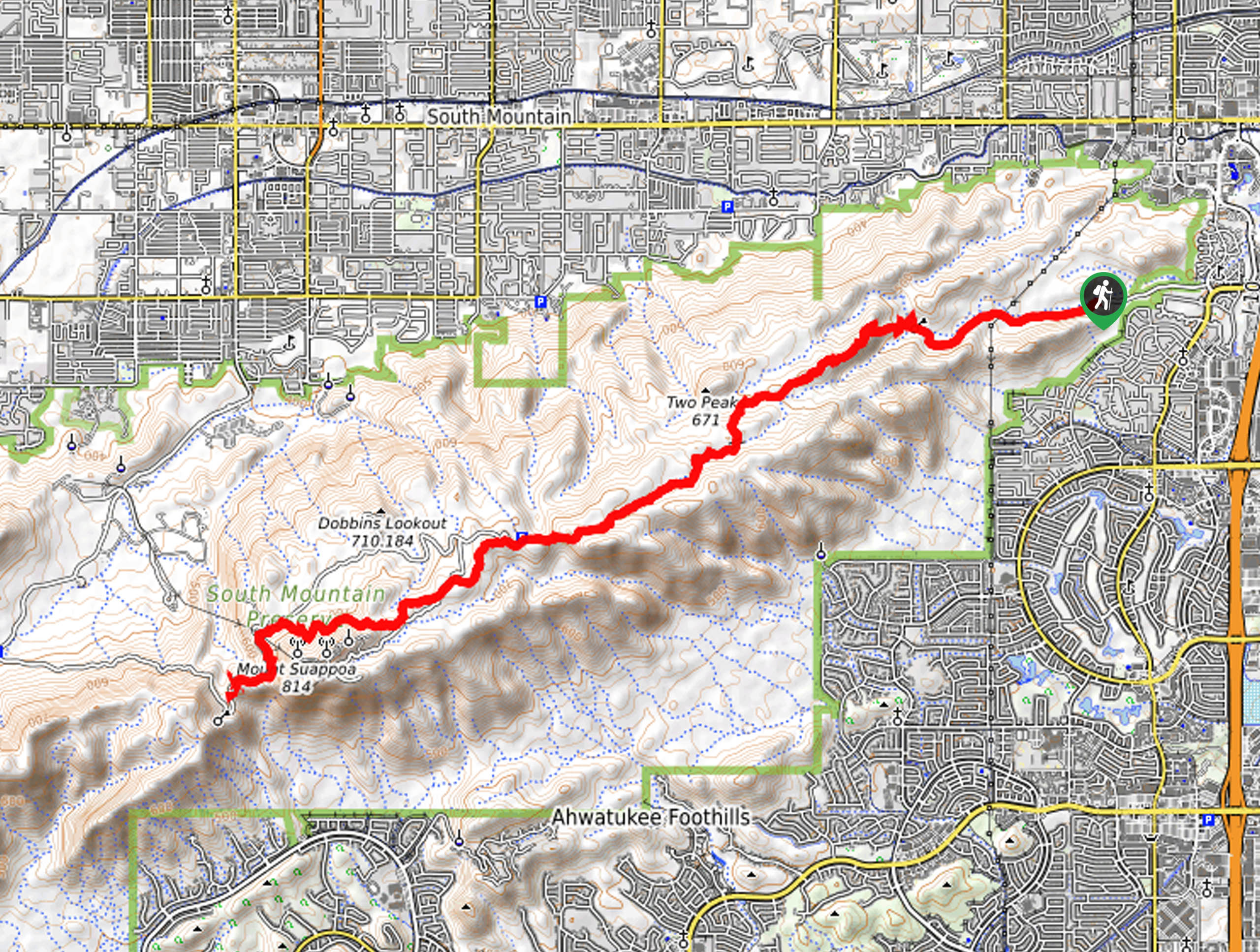
The National Trail Out and Back hike leads you from the Pima Canyon Trailhead to the overlook on National Trail, covering half of the entire distance of the point-to-point National Trail. This is a great way to experience the National Trail when you don’t have a car shuttle that makes the entire point-to-point route feasible. Expect varied terrain, a few steeper climbs, and an overall demanding hike due to the distance. Also, expect heavy traffic.
Getting there
The trailhead for this hike is at the end of E Pima Canyon Road.

About
| Backcountry Campground | No |
| When to do | October-May |
| Pets allowed | Yes - On Leash |
| Family friendly | No |
| Route Signage | Average |
| Crowd Levels | High |
| Route Type | Out and back |
National Trail Out and Back Hike
Elevation Graph
Weather
National Trail Out and Back Hike Description
The National Trail is one of the main trails in the South Mountain Preserve in Phoenix. Hiking the entire National Trail is generally considered too long of a day trip for most, and you’d require a car shuttle. This out and back approach gives you a full-day experience on the National Trail that doesn’t require two cars. If this distance is still too long, you can always turn back a bit sooner.
We recommend preparing for a full day on the trail to have the most successful experience on this trail. Bring more water than you think you’ll need, bring food, and definitely avoid this hike on hot days. The trail is quite rocky in some parts, so sturdy boots are recommended.
From the Pima Canyon Trailhead, the National Trail follows a canyon before climbing atop the mountain. Pass Two Peaks and Fat Man’s Pass. You’ll hike just underneath the top of another ridge, past Dobbins Lookout, and to the viewpoint at the turnaround point just past Mount Suappoa. From the viewpoint, you’ll retrace your steps back to the trailhead.
Similar hikes to the National Trail Out and Back Hike hike

Palisade to Basalt Loop
The Palisade to Basalt Loop is a short, easy trail in the Deem Hills Recreation Area. This hike is 1.4mi

Two Bit and Rattle Saddle Loop
The Two Bit and Rattle Saddle Trail is a moderately challenging hike in the Phoenix’s Mountain Preserve near Piestewa Peak.…

Ma-Ha-Tauk and Crosscut Loop
The Ma-Ha-Tauk and Crosscut Loop is a moderate hike in Phoenix’s South Mountain Preserve. With pleasant views and not much…
Comments