Upper Ranch and Brown's Ranch Road Trail
View Photos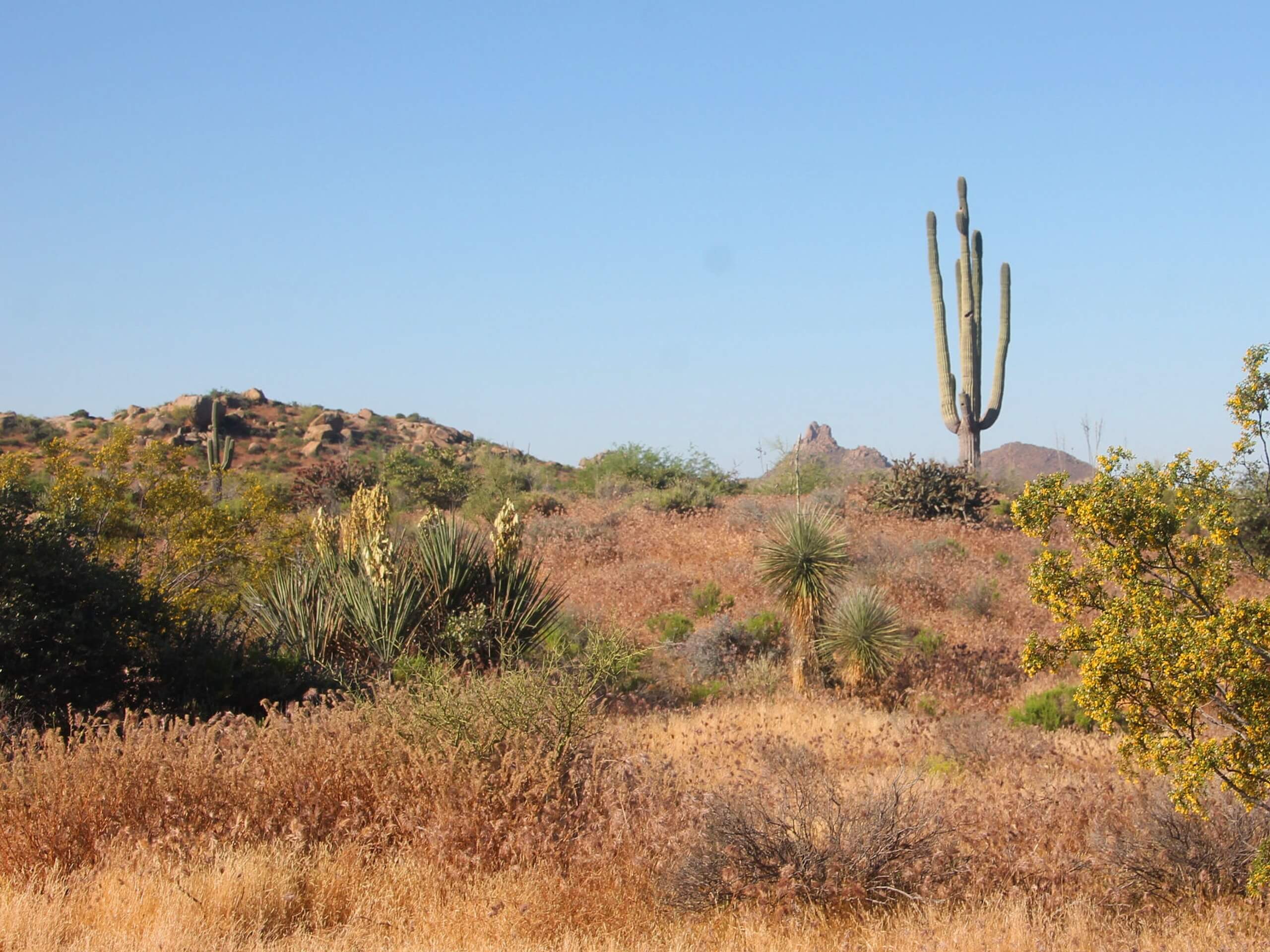
Upper Ranch and Brown's Ranch Road Trail
Difficulty Rating:
The Upper Ranch and Brown's Ranch Road Trail travels through the McDowell Sonoran Preserve, looping around Brown’s Summit. This route can be enjoyed by hikers, trail runners, and mountain bikers since it’s not too rocky. It’s mostly flat but with some undulations to keep things interesting. Because of the mixed nature of the traffic on this route, make sure you share the trail!
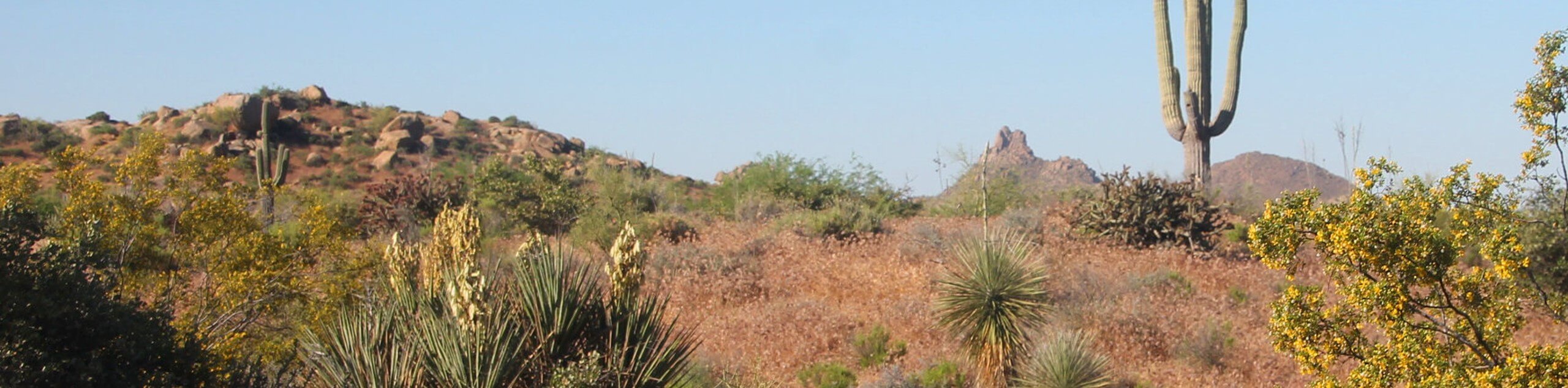
The view of Cone Mountain is great on this route, and the obvious star of the show is Brown’s Summit. Since there are so many interconnecting trails in this preserve, it’s easy to lengthen or shorten your adventure as you please. The junctions you’ll encounter are not always signed and there are lots of them, so having a GPS track on hand will make your adventures a bit easier. Expect moderate mixed traffic.
Getting there
The trailhead for the Upper Ranch and Brown's Ranch Road Trail is on Alma School Road.

About
| Backcountry Campground | No |
| When to do | October-May |
| Pets allowed | Yes - On Leash |
| Family friendly | Yes |
| Route Signage | Average |
| Crowd Levels | High |
| Route Type | Loop |
Upper Ranch and Brown's Ranch Road Trail
Elevation Graph
Weather
Upper Ranch and Brown's Ranch Road Trail Description
The Upper Ranch and Brown’s Ranch Road Trail is a great adventure through the McDowell Sonoran Preserve, one of the best natural areas near Scottsdale. This loop makes use of two main trails, both with gentle elevation gains and losses and generally good, smooth footing. You can tailor your adventure if needed by using the many interconnecting trails to shorten or lengthen your hike. Note that this route is also great for trail runners and mountain bikers, so remember to share the trail and look out for one another.
This loop circles Brown’s Summit while passing by Cone Mountain, giving you excellent views of both. You can also enjoy views of the wide-open preserve north of Brown’s Summit. With saguaros all around and wildflowers in the spring, the scenery out here is fabulous for being not far outside of Phoenix.
We recommend bringing along a downloaded GPS track to help you find your way in this area. The network of trails is extensive and it can be a bit tough to navigate in this area, especially if you decide to customize your trail and go off-track.
As with all hikes in this area, we don’t recommend going on this hike in the summer months, and no matter what time of year you visit, bring lots of water (especially if you plan on the entire loop), sun protection (there is little shade), and bring water for your dogs, too. This is a sensitive natural area, so please remember to stay on the designated trails, keep dogs on leash, and pack out what you pack in.
Our guide covers the route going clockwise. From the trailhead, take the Upper Ranch Trail. Continue on this trail past Cone Mountain, admiring this (very cone-like, indeed) peak on your left side. There is a trail that loops this little mountain if you want to add a side trip.
Hike between Cone Mountain and Brown’s Summit, keeping right twice and then going straight through the 4-way junction. Bear right with the trail to circle around the north side of Brown’s Summit, continuing onto Brown’s Ranch Road.
Look for Cholla Mountain on your left as you hike south. This trail will return you to the trailhead in short order.
Hiking Route Highlights
McDowell Sonoran Preserve
The McDowell Sonoran Preserve is a permanently protected desert habitat north of Scottsdale, Arizona. This preserve offers a vast network of hiking, biking, running, and equestrian trails. The preserve contains Granite Mountain and Brown’s Summit among other lower peaks. In this protected habitat, local flora and fauna are able to thrive, providing an excellent experience for visitors.
Frequently Asked Questions
Who owns the McDowell Sonoran Preserve?
The preserve is owned by the residents of Scottsdale and managed through a partnership with the City of Scottsdale and the McDowell Sonoran Conservancy, a nonprofit, volunteer-run organization.
How big is the McDowell Sonoran Preserve?
The preserve covers more than 30,500 acres.
Where was the Granite Mountain fire?
The Granite Mountain in this preserve was not the site of the highly publicized Yarnell Hill Fire that killed 19 members of the Granite Mountain Hotshots. The fire occurred near Yarnell, Arizona, about 80 miles northwest of Phoenix.
Insider Hints
Since this is a diverse protected natural area, make sure you stay on the designated trails to prevent damage to plants and wildlife habitat.
There can be rattlesnakes in this preserve. If you encounter a rattlesnake, leave it alone and back away slowly and deliberately. Rattlesnakes will not chase you.
Similar hikes to the Upper Ranch and Brown's Ranch Road Trail hike

Palisade to Basalt Loop
The Palisade to Basalt Loop is a short, easy trail in the Deem Hills Recreation Area. This hike is 1.4mi

Two Bit and Rattle Saddle Loop
The Two Bit and Rattle Saddle Trail is a moderately challenging hike in the Phoenix’s Mountain Preserve near Piestewa Peak.…

Ma-Ha-Tauk and Crosscut Loop
The Ma-Ha-Tauk and Crosscut Loop is a moderate hike in Phoenix’s South Mountain Preserve. With pleasant views and not much…
Comments