
Ridgeback Overlook Hike
View Photos
Ridgeback Overlook Hike
Difficulty Rating:
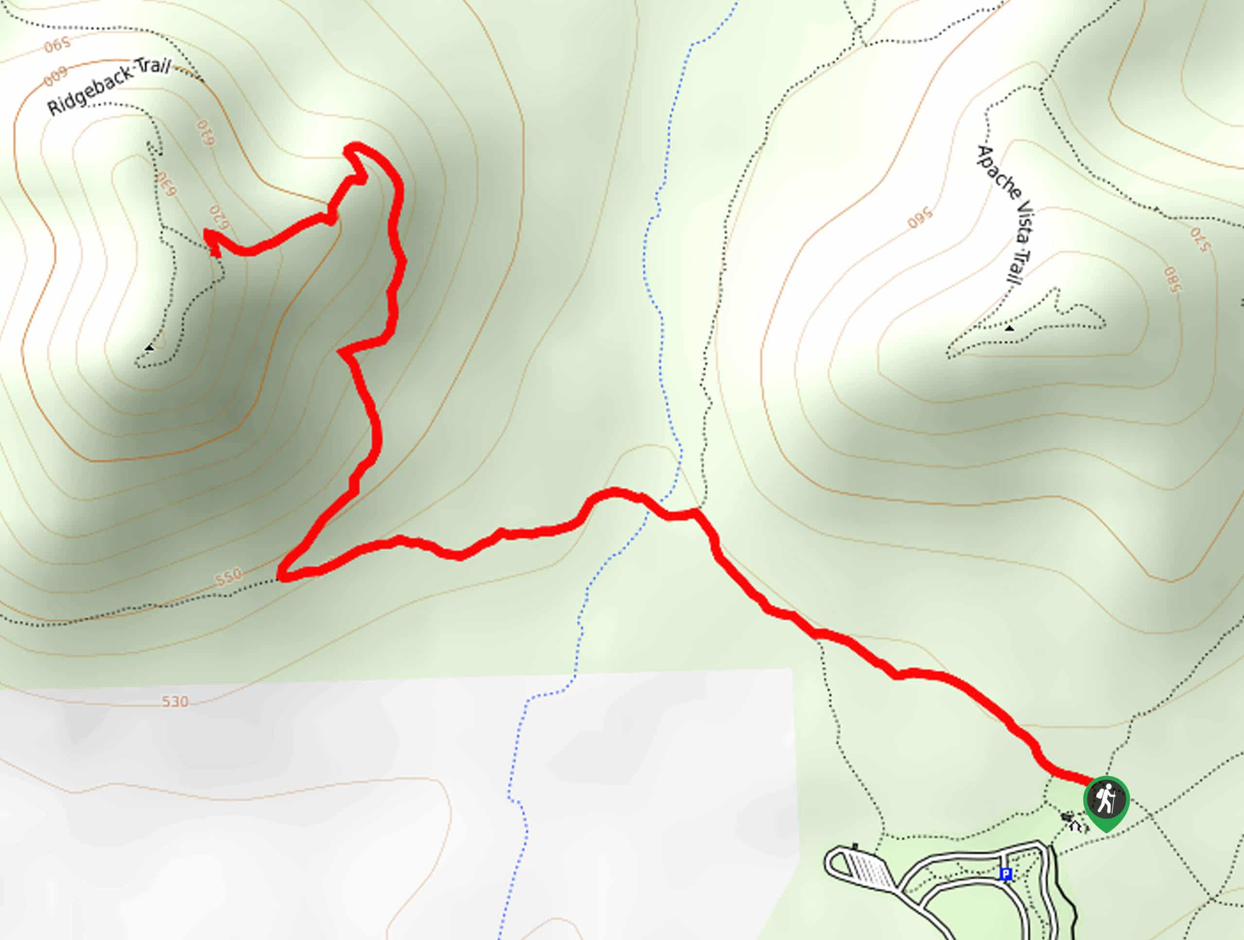
The Ridgeback Overlook is a moderately trafficked, moderately difficult hike in Phoenix, Arizona. This hike is 2.5mi long and leads you up to the top of a short ridge with lovely views of the surrounding hills, the saguaros, the cholla, and the wide blue sky. It’s a lesser-known crowd favorite, so add it to your list!
Getting there
The trailhead for the Ridgeback Overlook is off the access road for the Apache Wash Trailhead.

About
| Backcountry Campground | No |
| When to do | October-May |
| Pets allowed | Yes - On Leash |
| Family friendly | Yes |
| Route Signage | Average |
| Crowd Levels | Moderate |
| Route Type | Out and back |
Ridgeback Overlook Hike
Elevation Graph
Weather
Ridgeback Overlook Hike Description
The Ridgeback Overlook hike is a moderately difficult 2.5mi that’s worth the visit for its great desert views. Climb to the top of a short ridge for a view of the desert, the hills, the cacti, and the city in the distance. The trail is lined by cholla and saguaros and is easy to follow. This is a great pick for hikers of any skill level.
As with all hikes in this area, make sure you bring lots of water. Choose a cooler day for your adventure and consider sun protection.
From the trailhead, take Apache Wash/Ocotillo Trail to the northwest. Hike to the fork just before the wash and stay left. Across the wash, you’ll hike to the next junction, where you’ll take a right onto Ridgeback Trail. The trail climbs uphill a short distance, ending at a fork. You can opt to explore the area atop the ridge a bit more if you’d like, and when you’re ready, just retrace your steps to the trailhead.
Similar hikes to the Ridgeback Overlook Hike hike

Palisade to Basalt Loop
The Palisade to Basalt Loop is a short, easy trail in the Deem Hills Recreation Area. This hike is 1.4mi

Two Bit and Rattle Saddle Loop
The Two Bit and Rattle Saddle Trail is a moderately challenging hike in the Phoenix’s Mountain Preserve near Piestewa Peak.…

Ma-Ha-Tauk and Crosscut Loop
The Ma-Ha-Tauk and Crosscut Loop is a moderate hike in Phoenix’s South Mountain Preserve. With pleasant views and not much…
Comments