
Geronimo Trail
View Photos
Geronimo Trail
Difficulty Rating:
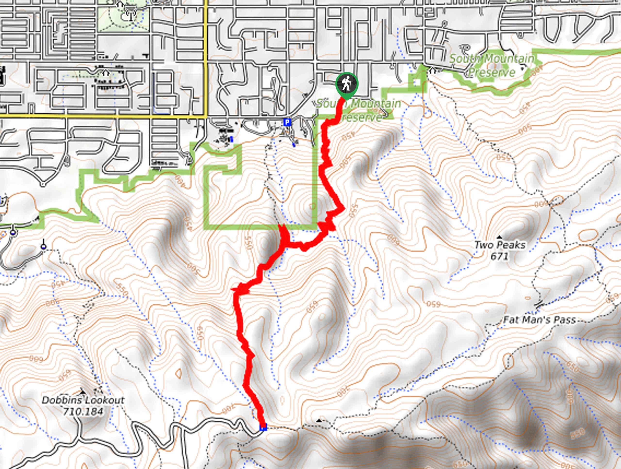
Geronimo Trail is a 4.8mi trail in Phoenix’s South Mountain Preserve. This hike is rated as moderate and has enough challenging terrain that some hikers might consider it difficult. With some big rocks to traverse, a few steep sections, and varied footing, this hike keeps it interesting. The final viewpoint looks over the city below and the preserve to the east and west. Expect moderate to heavy traffic on this hike.
Getting there
The trailhead for Geronimo Trail is at the intersection of E Beth Drive and S 21st Street.

About
| Backcountry Campground | No |
| When to do | October-May |
| Pets allowed | Yes - On Leash |
| Family friendly | Older Children only |
| Route Signage | Average |
| Crowd Levels | High |
| Route Type | Out and back |
Geronimo Trail
Elevation Graph
Weather
Geronimo Trail Description
The Geronimo Trail is an adventurous hike in Phoenix’s South Mountain Preserve. This route is 4.8mi of varied terrain, with some sections crossing over big boulders, some rocky footing, sandy parts, and a bit of everything in between. It’s a fun way to take on lightly technical terrain in a low-consequence way. At the end of the hike, there’s a bench from where you can admire the city sprawling below you. Watch for mountain bikers in the middle third of the hike. This route might be a bit too tough for small kids.
Note that there isn’t parking available right at the trailhead. You can park at the eastern end of E Dobbins or find a space along S 20th Street, but make sure you’re not in a tow-away zone.
This trail has 3 distinct sections. From the trailhead heading uphill, the first climb is very rocky. You’ll ascend through switchbacks before the route levels out with a bit of undulation. The final stretch of the route to the end is where you’re most likely to encounter mountain bikers, so stay aware of your surroundings. This final section is less rocky but much sandier so be sure of your footing.
From the top, take in the view before retracing your steps to the starting point.
Similar hikes to the Geronimo Trail hike

Palisade to Basalt Loop
The Palisade to Basalt Loop is a short, easy trail in the Deem Hills Recreation Area. This hike is 1.4mi

Two Bit and Rattle Saddle Loop
The Two Bit and Rattle Saddle Trail is a moderately challenging hike in the Phoenix’s Mountain Preserve near Piestewa Peak.…

Ma-Ha-Tauk and Crosscut Loop
The Ma-Ha-Tauk and Crosscut Loop is a moderate hike in Phoenix’s South Mountain Preserve. With pleasant views and not much…
Comments