High Rock Lookout Trail
View Photos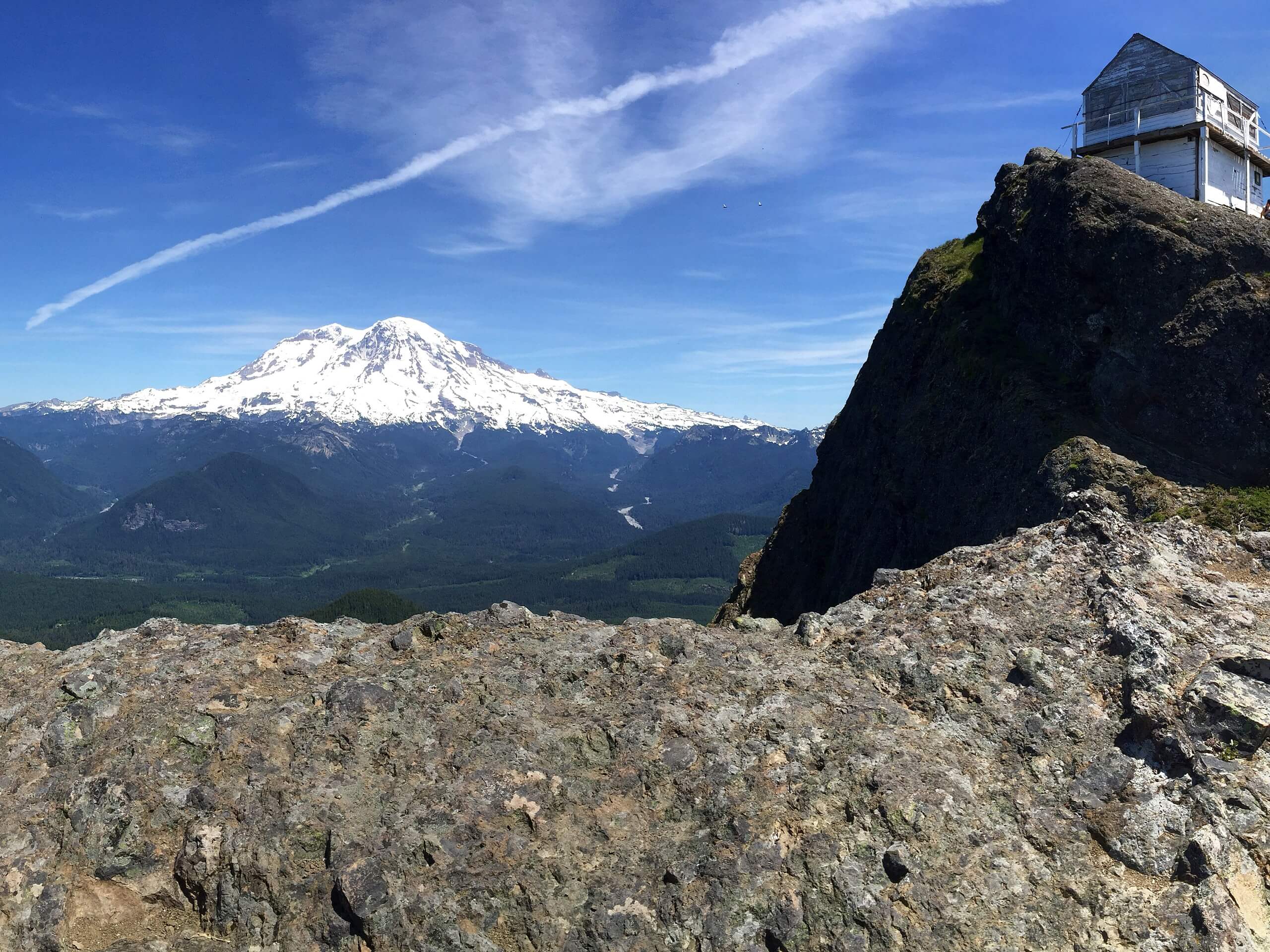
High Rock Lookout Trail
Difficulty Rating:
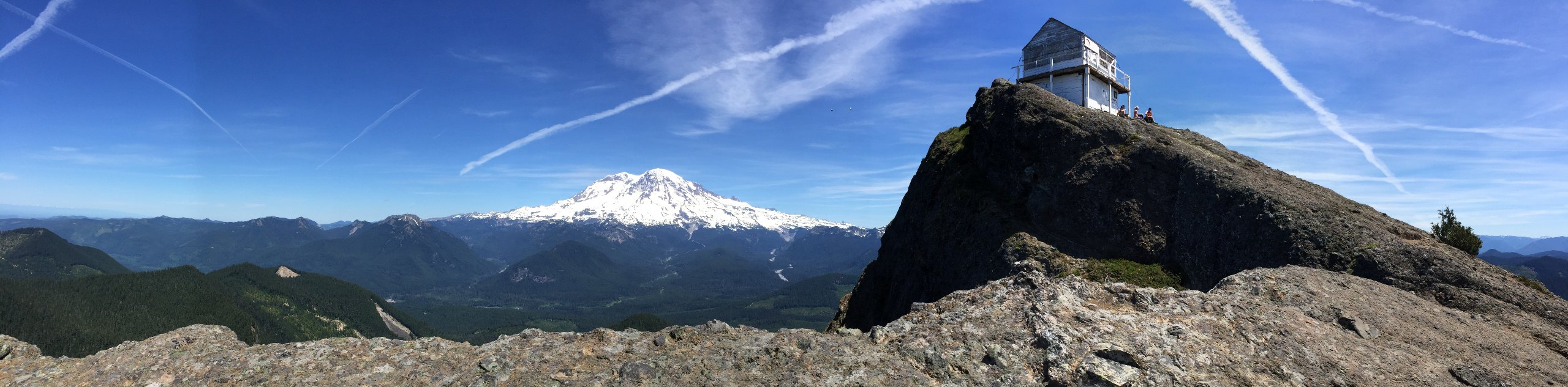
High Rock is high, indeed. This viewpoint soars above the surrounding region of the South Cascades, giving you the best view you can find in the area! The views are truly panoramic and the trail to reach them isn’t that difficult. At 3.2mi in length and with moderate elevation gain, it’s a suitable trail for most skill levels and for active families. You’ll climb up Sawtooth Ridge to a fire cabin, where you can relax and savor the sightlines.
Expect heavy traffic on this hike, making a visit during the week or early in the morning a good choice. Most of the trail is wide, save for a few skinner sections. That being said, no part of the trail is highly exposed.
Getting there
The trailhead for the High Rock Lookout Trail is at Towhead Gap on spur road 8440.

About
| Backcountry Campground | No |
| When to do | June-October |
| Pets allowed | Yes - On Leash |
| Family friendly | Older Children only |
| Route Signage | Average |
| Crowd Levels | High |
| Route Type | Out and back |
High Rock Lookout Trail
Elevation Graph
Weather
High Rock Lookout Trail Description
The view from High Rock is impressive, and you won’t need to work too hard or leave the kids at home to reach it. Sitting at 5685ft and elevated high above the rest of the surrounding mountains, it’s the best view in the region. You’ll climb up Sawtooth Ridge to gaze out over the Southern Cascades for miles and miles.
We recommend trying to plan this hike for a clear day. Getting to the top and being socked in certainly doesn’t provide the same experience. The trail is generally very easy to follow, but you’ll want to take care on the narrower sections if you’re hiking on a busy day. Remember to yield to uphill traffic.
Begin from the trailhead at Towhead Gap. There are signs on opposite sides of the road, so make sure you head to the one on the northwest side. You don’t want the wider trail beside it.
You’ll hike through the foliage and start ascending the ridgeline. Stroll underneath the tall trees, which offer nice shade on hot days. This beginning section is the narrowest and the trail widens nicely afterwards.
Climb gradually through a couple of switchbacks, stopping at the benches on the trail if needed. At about a mile, the trail gets steeper and the trees begin to fade out.
You’ll reach a viewpoint about 1.3mi in. From here, continue up the west side of the ridge. You’ll want to hike underneath the lookout cabin around to the north edge of the ridge. Turn right and complete your hike, reaching the big rock the lookout cabin is perched on.
You won’t be able to access the cabin, which is unstaffed and closed to public access. You can, however, see Mount Rainier, Cora Lake, and the vast forest around you.
When you’re ready, return to the trailhead by following the same path.
Hiking Route Highlights
Mount Rainier
The tallest mountain in the state is a dominant part of your view on the High Rock Lookout. This 14409ft stratovolcano is an iconic sight and is clearly visible from your perch on this trail. Mount Rainier is the tallest mountain in Washington State.
Frequently Asked Questions
Is High Rock dangerous?
The summit of this hike is very exposed, with sheer drop offs of up to 600ft. We recommend staying away from the edge to ensure your safety.
Can you camp at the cabin on High Rock?
The cabin is closed to public access due to lightning risk, so you won’t be able to camp in it or enter it for any reason.
Insider Hints
There is no pass or permit required for this hike.
The trail doesn’t have any water on it, so bring all you need.
Similar hikes to the High Rock Lookout Trail hike

Ptarmigan Trail
Ptarmigan Trail is a 4.2mi moderate trail near the base of Mount Saint Helens. This trail is suitable…

Boundary West Trail
Boundary West Trail is a hike near Mount Saint Helens that doesn’t see much traffic, making it a nice pick…

Silver Creek Trail
Silver Creek Trail is a moderate hike in the Gifford Pinchot National Forest that is suitable for most skill levels.…
Comments