
Archer Mountain Trail
View Photos
Archer Mountain Trail
Difficulty Rating:
Archer Mountain Trail is a hard 41.0mi hike that sees light-moderate traffic. This hike is adventurous and will leave you with a good sweat on. The trail itself is rocky, a bit rough, and sometimes overgrown. It’s not the most pleasant trek, but the view at the top is amazing and worth it. While dogs are allowed on this trail, users report that it’s not a great trail for them. Consider leaving your pups at home for this one.
Getting there
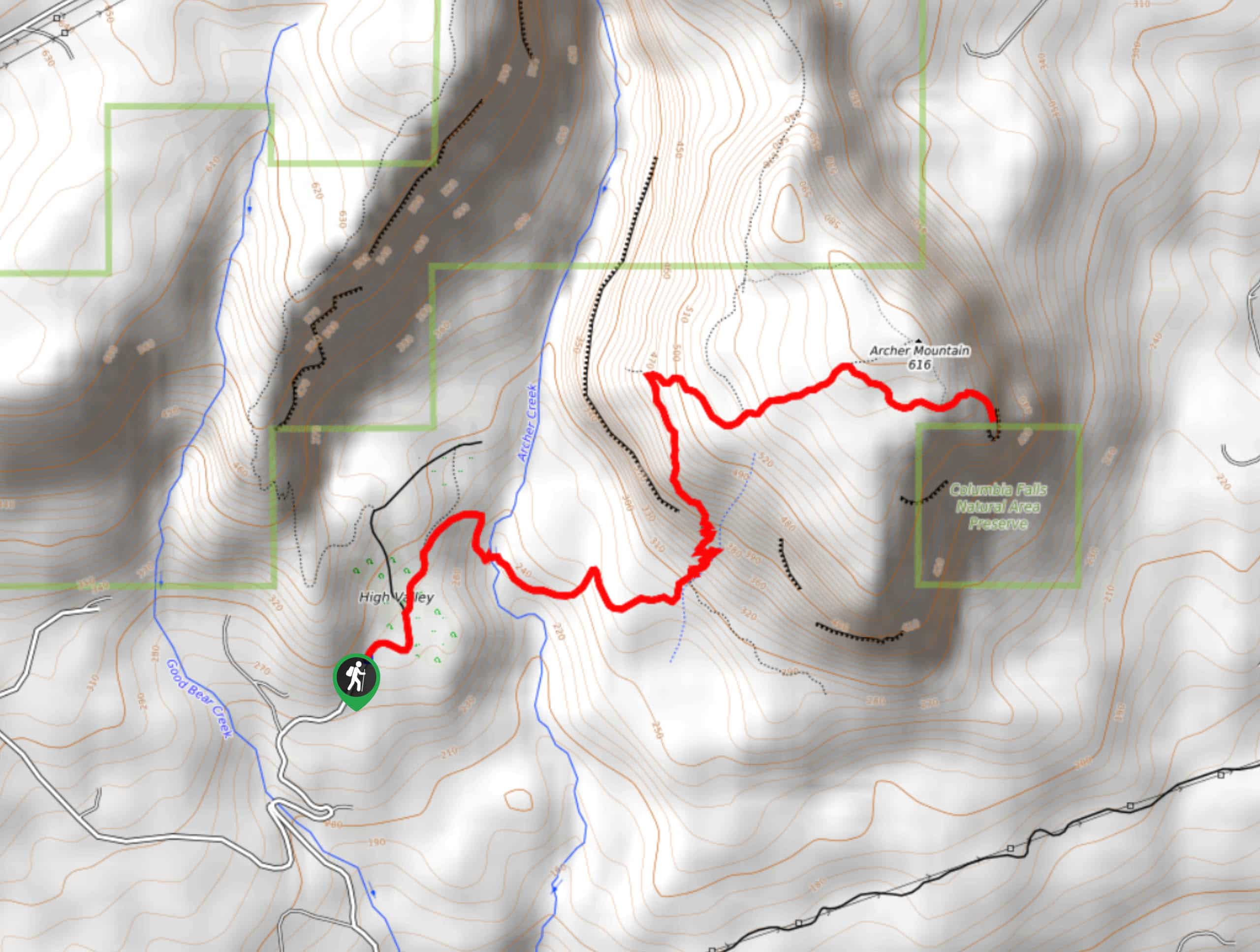
The trailhead for the Archer Mountain Trail is on Smith-Cripe Road.

About
| Backcountry Campground | No |
| When to do | May-November |
| Pets allowed | Yes - On Leash |
| Family friendly | No |
| Route Signage | Average |
| Crowd Levels | Moderate |
| Route Type | Out and back |
Archer Mountain Trail
Elevation Graph
Weather
Archer Mountain Trail Description
Archer Mountain isn’t the easiest or smoothest trail to climb, but you’ll be glad you did in the end. Prepare for a rocky, overgrown trail with plenty of steep sections. Persevere to the top and you’ll enjoy a wide-open view of the Columbia River Gorge.
This trail isn’t very well-suited to children or dogs. Bring poles and wear sturdy boots if you have them.
From the end of Smith-Cripe Road, hike past the gate and go left through the meadow. Stay right at the fork and then follow the clear trail on your right. There is signage here. The route crosses a stream on a log bridge and then takes you through a series of steep switchbacks. At the next junction, you’ll stay right (unless you want to pop out to Scott Point, which has a nice view. It’s a short side trip).
Hike straight up through the next junction. At the fork where the trail evens out a touch, go left. The final portion of this trail is exposed and you should take care navigating it. You wouldn’t want to fall here. From the summit, you’ll follow the same route back down to the trailhead. There are also opportunities for loop hikes using the connecting trails.
Similar hikes to the Archer Mountain Trail hike

Ptarmigan Trail
Ptarmigan Trail is a 4.2mi moderate trail near the base of Mount Saint Helens. This trail is suitable…

Lakes Trail #211 Loop
The Lakes Trail #211 Loop is used as both a full-day hike and for backpacking trips. This trail isn’t for…

Boundary West Trail
Boundary West Trail is a hike near Mount Saint Helens that doesn’t see much traffic, making it a nice pick…
Comments