Snowgrass Flats and Goat Lake Loop
View Photos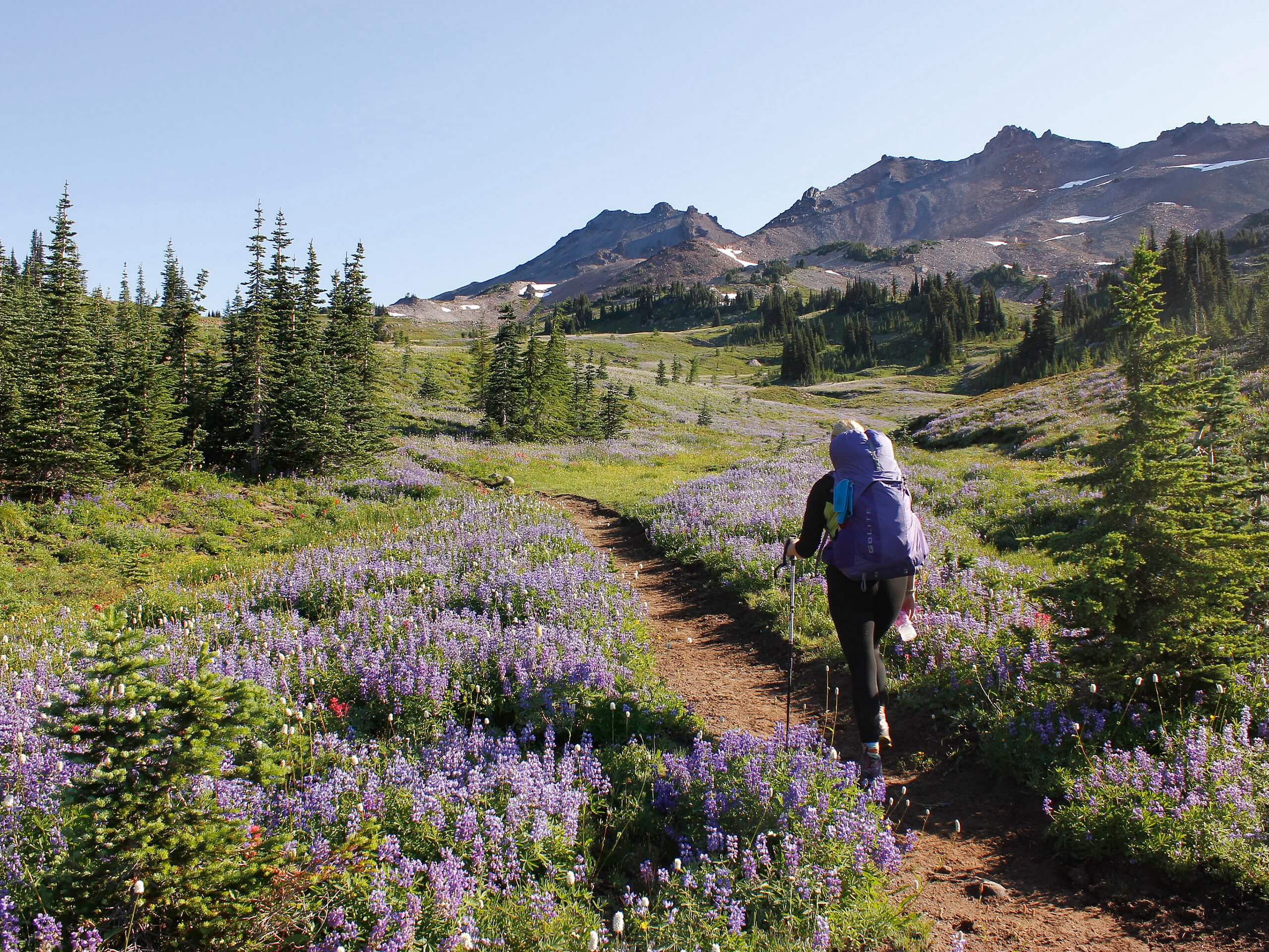
Snowgrass Flats and Goat Lake Loop
Difficulty Rating:
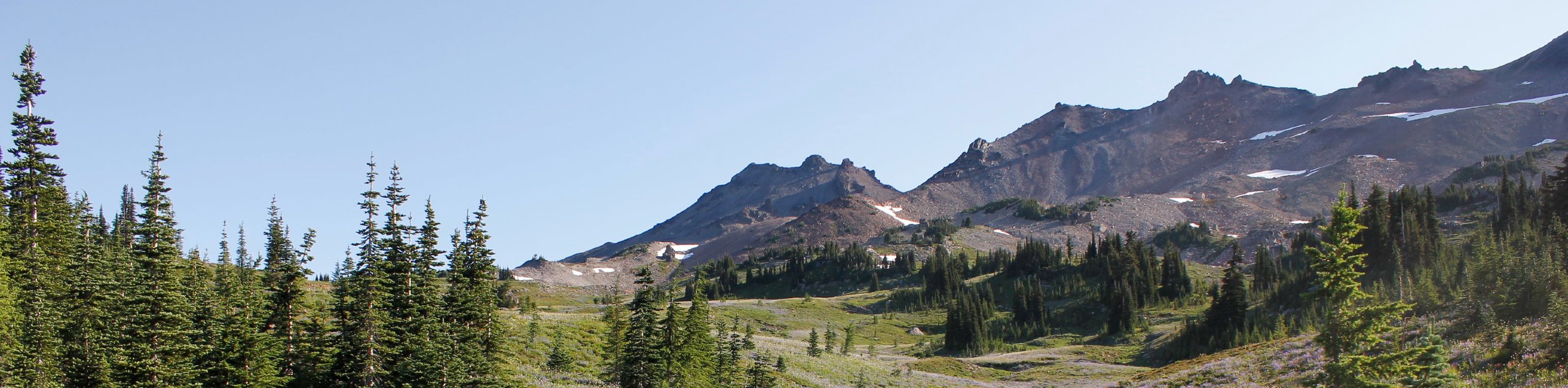
The Snowgrass Flats and Goat Lake Loop is a 121.0mi hard hike in Gifford Pinchot National Forest that can be used either for day trips or for backpacking trips. The scenery on this trail is truly excellent, with major mountains visible above wide meadows and through the conifers. This hike is rated as hard. We recommend downloading a GPS track before your hike as it can be easy to end up off-trail at some junctions along the way.
Getting there
The trailhead for the Snowgrass Flats and Goat Lake Loop is at the end of Berry Patch Road.

About
| Backcountry Campground | Various backcountry |
| When to do | July-October |
| Pets allowed | Yes - On Leash |
| Family friendly | No |
| Route Signage | Average |
| Crowd Levels | High |
| Route Type | Loop |
Snowgrass Flats and Goat Lake Loop
Elevation Graph
Weather
Snowgrass Flats and Goat Lake Loop Description
The Snowgrass Flats and Goat Lake Loop is a gorgeous choice for both day trips and multi-day adventures. There is plenty to admire, including tall mountain peaks and grassy meadows, as you hike between campsites and lakes.
We recommend downloading your GPS route ahead of time to assist with navigation where necessary. The snow can cling to parts of this trail into July, so save this one for the midsummer and late summer for the best conditions. This trail can be hiked in either direction, but we’ll describe it going clockwise.
Begin from the trailhead. Take the trail on your left (Goat Ridge Trail) as it climbs between unnamed peaks. Stay right at all junctions as you hike underneath Goat Ridge and Hawkeye Point. Pass Goat Lake and take Lilly Basin Trail, which has beautiful alpine valley views. Take the trail to your right once you reach Snowgrass Flats, then lose elevation as you climb back down into the valley. Cross the Goat Creek Bridge and pass a small unnamed lake before reaching the trailhead.
Similar hikes to the Snowgrass Flats and Goat Lake Loop hike

Ptarmigan Trail
Ptarmigan Trail is a 4.2mi moderate trail near the base of Mount Saint Helens. This trail is suitable…

Lakes Trail #211 Loop
The Lakes Trail #211 Loop is used as both a full-day hike and for backpacking trips. This trail isn’t for…

Boundary West Trail
Boundary West Trail is a hike near Mount Saint Helens that doesn’t see much traffic, making it a nice pick…
Comments