Glacier Lake Trail
View Photos
Glacier Lake Trail
Difficulty Rating:
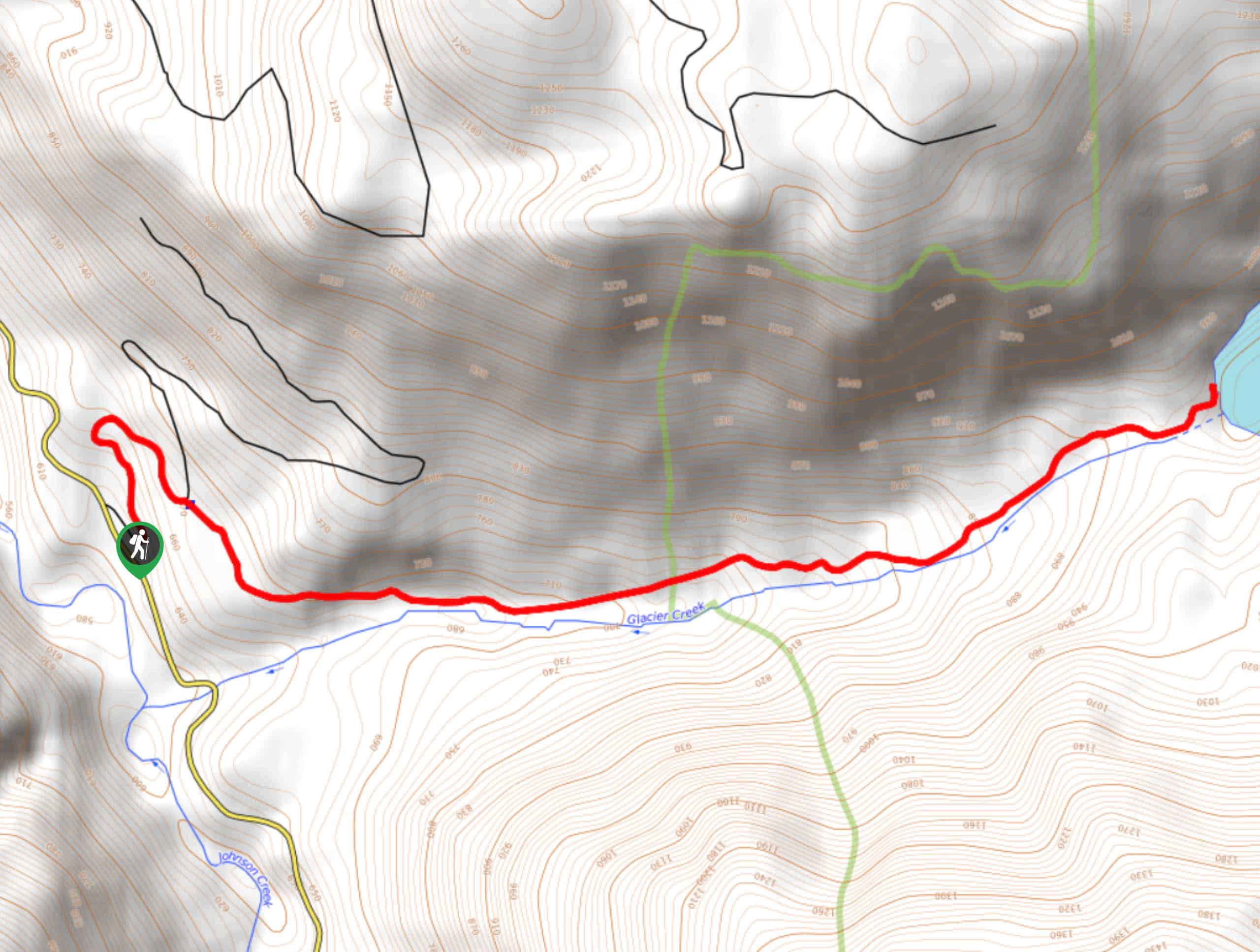
Glacier Lake Trail is a 46.0mi out and back hike in Gifford Pinchot National Forest that takes you to a pretty lake surrounded by trees. This hike is especially enjoyable in the fall when the leaves begin to change color. Although it’s a short hike, you’ll want to be prepared for a steep climb. Expect moderate traffic on this hike.
Getting there
The trailhead for the Glacier Lake Trail is off Johnson Creek Road.

About
| Backcountry Campground | No |
| When to do | May-November |
| Pets allowed | Yes - On Leash |
| Family friendly | Older Children only |
| Route Signage | Average |
| Crowd Levels | Moderate |
| Route Type | Out and back |
Glacier Lake Trail
Elevation Graph
Weather
Glacier Lake Trail Description
The hike to Glacier Lake is steep, but it’s fairly short and boasts great scenery. The hike takes you through a scenic forest that’s especially charming in the autumn. This hike might not seem like much of a challenge on paper, but sections are quite steep. Poles may be helpful.
Begin from the trailhead, taking the old Forest Road 2110 through two switchbacks. Watch for the Glacier Peak Trail where it splits off to your right on the curve of the second switchback. The trail undulates to start, taking you along Glacier Creek. Then, the climbing begins up to the lake.
At the lakeshore, enjoy the views and catch your breath. To get back to the trailhead, you’ll descend the same way you came up.
Similar hikes to the Glacier Lake Trail hike

Ptarmigan Trail
Ptarmigan Trail is a 4.2mi moderate trail near the base of Mount Saint Helens. This trail is suitable…

Lakes Trail #211 Loop
The Lakes Trail #211 Loop is used as both a full-day hike and for backpacking trips. This trail isn’t for…

Boundary West Trail
Boundary West Trail is a hike near Mount Saint Helens that doesn’t see much traffic, making it a nice pick…
Comments