Ape Canyon Trail
Difficulty Rating:
Ape Canyon Trail is well worth the effort from anyone in the area. This hike takes you through a wonderful section of old-growth forest (one of the few remaining stands near Mount Saint Helens) atop a butte with excellent views of Mount Rainier and Mount Adams.
The hike is rated as hard with 2083ft of elevation gain to complete, but it’s fairly gradual in its gain. Small children may find it too long or difficult, but older, active families often enjoy this hike. We recommend completing this hike in the late spring and early summer when the wildflowers are in bloom for the best experience.
This trail does get quite busy so we recommend visiting on a weekday or early in the morning to avoid some of the crowds.
Getting there
The trailhead for the Ape Canyon Trail is on FR 83.

About
| Backcountry Campground | No |
| When to do | May-November |
| Pets allowed | Yes - On Leash |
| Family friendly | Older Children only |
| Route Signage | Average |
| Crowd Levels | High |
| Route Type | Out and back |
Ape Canyon Trail
Elevation Graph
Weather
Ape Canyon Trail Description
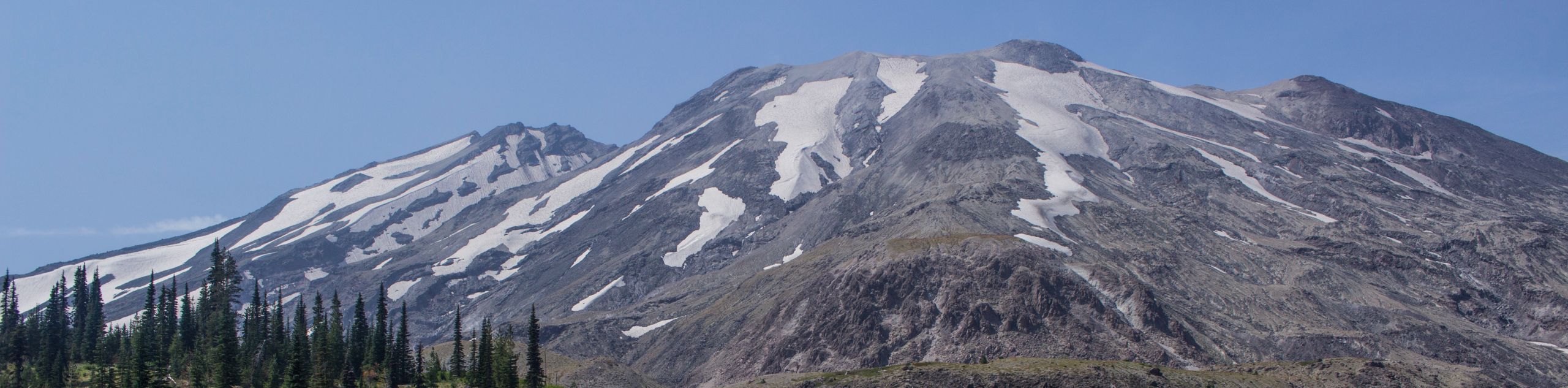
Ape Canyon Trail is a delightful hike, first taking you through one of the last stands of old-growth forest in the Mount Saint Helens area to a butte with a blanketing of wildflowers and great views of Mount Adams and Mount Rainier. As far day hikes go, it’s about as packed with scenery as it gets!
The hike is hard but fairly gradual. Expect it to get busy, especially on weekends, making an early start or a midweek visit a good choice.
This trail is popular with mountain bikers, so we recommend keeping an eye out, especially in areas with poorer visibility down the trail.
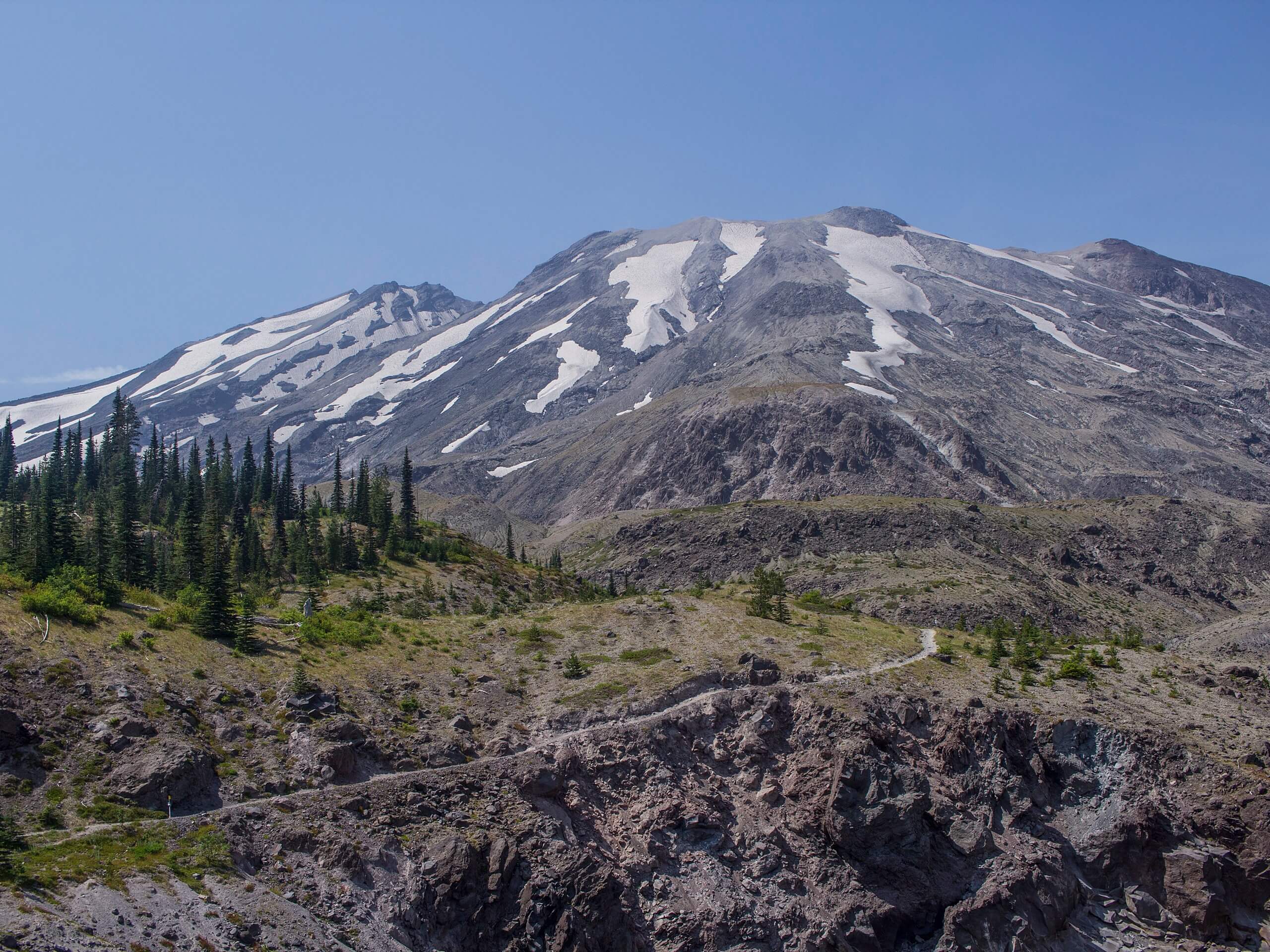
Begin near the end of Road 83 close to Lava Canyon. You’ll begin climbing gradually and consistently through the forest parallel to an old lahar flow. Admire the stately old-growth trees as you climb, most of which are Douglas, noble, and silver firs.
The further up you go, the more the view opens up. You’ll be able to see Mount Adams and Mount Rainier soon.
A couple of miles into the hike, you’ll come out of the forest and start hiking along a volcanic plain. The views here are epic, with Mount Saint Helens right before you and Adams and Rainier still visible further out. Snap some photos!
Continuing through the plan, you’ll reach the canyon edge. Look down at the creek flowing through below, then continue around the canyon’s far edge around Pumice Butte. Admire the dramatic geological features here before turning around and retracing your steps to the trailhead.
Hiking Route Highlights
Mount Saint Helens
Mount Saint Helens is an active volcano, last erupting in May of 1980, taking 57 lives and destroying 200 homes. The volcano is 8363ft high. Previously the summit was at 9677ft, but it was shortened in a lateral eruption triggered by an earthquake. Mount Saint Helens was originally named Lawetlat’la by the Cowlitz people.
Mount Adams
12281ft Mount Adams is the second-highest mountain in Washington State. Originally named Pahto or Klickitat, it rises above the Cascade Range in the southern portion of the state. Although Mount Adams has not erupted in over 1,000 years, it’s still considered to be potentially active. The mountain was named for President John Adams.
Mount Rainier
The tallest mountain in the state is a dominant part of your view from the lava flows near Takh Takh Meadows. This 14409ft stratovolcano is an iconic sight and is clearly visible from your perch on this trail. Mount Rainier is the tallest mountain in Washington State.
Frequently Asked Questions
Is Ape Cave near Ape Canyon?
The two sites are close to one another but aren’t connected or accessible easily by foot. You can use our Ape Caves route guide if you’d like to explore both.
Is Ape Canyon Trail kid-friendly?
We’d consider this trail friendly to older, active children. Small children may find it too long or difficult.
Insider Hints
Don’t forget your Northwest Forest Pass for this hike.
Similar hikes to the Ape Canyon Trail hike

Ptarmigan Trail
Ptarmigan Trail is a 4.2mi moderate trail near the base of Mount Saint Helens. This trail is suitable…

Lakes Trail #211 Loop
The Lakes Trail #211 Loop is used as both a full-day hike and for backpacking trips. This trail isn’t for…

Boundary West Trail
Boundary West Trail is a hike near Mount Saint Helens that doesn’t see much traffic, making it a nice pick…
Comments