
Lava Canyon Trail
View Photos
Lava Canyon Trail
Difficulty Rating:
The Lava Canyon is just across from the Ape Canyon Trailhead, offering similar unique scenery to its more popular neighbor. This canyon is thrilling, with a tall suspension bridge, waterfalls, ladders, and exposed cliffsides. While the beginning of this trail is a bit more kid-friendly, it gets more daunting as you go, so feel free to turn back if it becomes too much for your group.
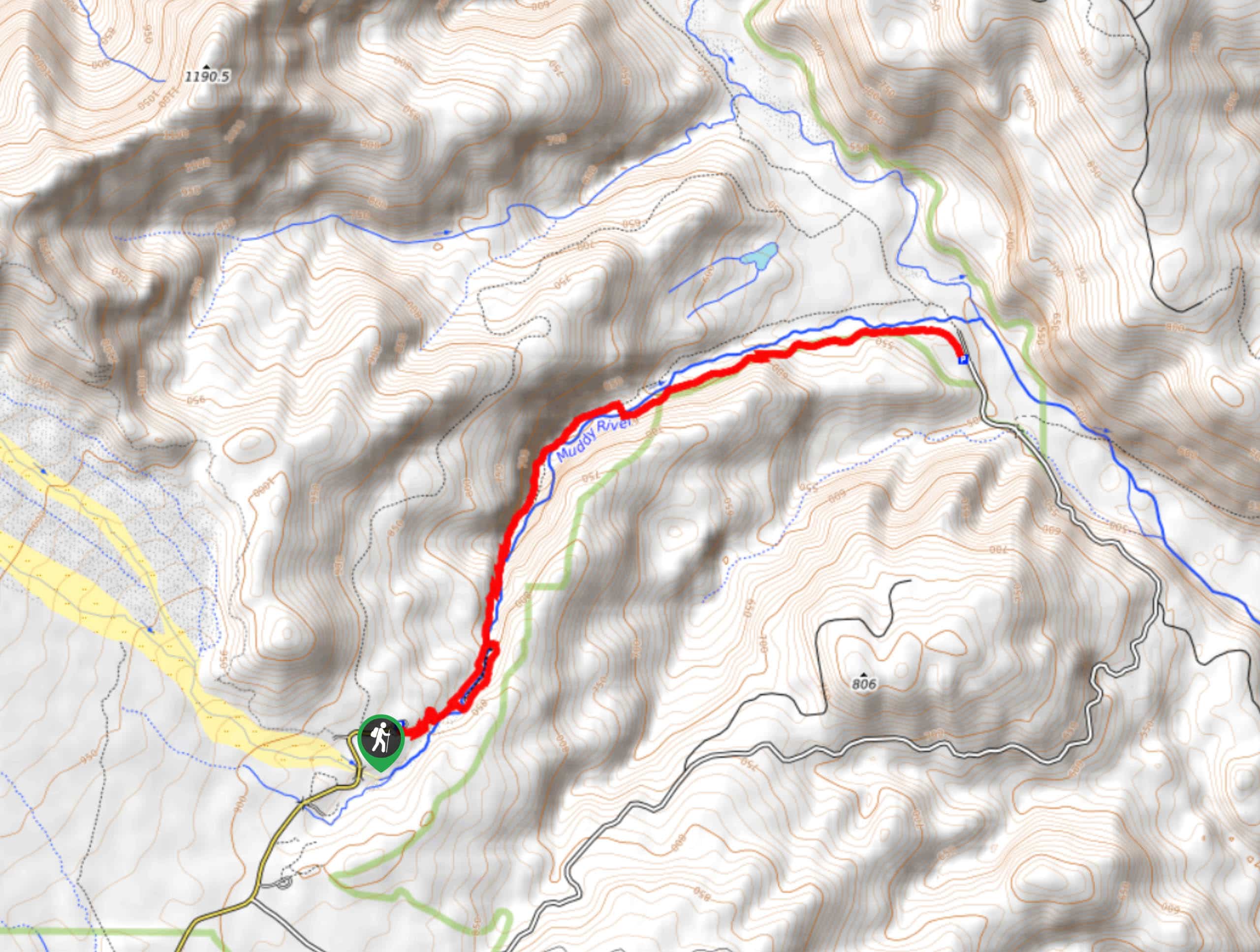
This hike is 5.4mi miles long and rated as moderate, but be prepared for steep sections, narrow sections, and a ladder climb of about 30ft.
Getting there
The trailhead for the Lava Canyon Trail is at the end of Lava Canyon Road.

About
| Backcountry Campground | No |
| When to do | May-November |
| Pets allowed | Yes - On Leash |
| Family friendly | Older Children only |
| Route Signage | Average |
| Crowd Levels | High |
| Route Type | Out and back |
Lava Canyon Trail
Elevation Graph
Weather
Lava Canyon Trail Description
Lava Canyon Trail is a fun hike with varied terrain and impressive scenery. There’s some narrow cliffside hiking, a ladder to climb, and a few stellar viewpoints. While this hike isn’t too long, it’s not the best fit for small kids or those who are scared of heights.
Stay on the trail to avoid getting stranded on narrow, rocky sections. The footing can be very loose in places, so poles are definitely recommended.
Begin from the trailhead. You’ll pass the interpretive site (stop in to learn more about the region’s volcanic history) and switchback along the river. Check out the falls, taking the trail on either side of the water to where they meet. There are lots of waterfalls along the trail, and the ladder climb comes near the end. Turn back from the end and follow the same route back.
Similar hikes to the Lava Canyon Trail hike

Ptarmigan Trail
Ptarmigan Trail is a 4.2mi moderate trail near the base of Mount Saint Helens. This trail is suitable…

Lakes Trail #211 Loop
The Lakes Trail #211 Loop is used as both a full-day hike and for backpacking trips. This trail isn’t for…

Boundary West Trail
Boundary West Trail is a hike near Mount Saint Helens that doesn’t see much traffic, making it a nice pick…
Comments