
Blue Lake Trail
View Photos
Blue Lake Trail
Difficulty Rating:
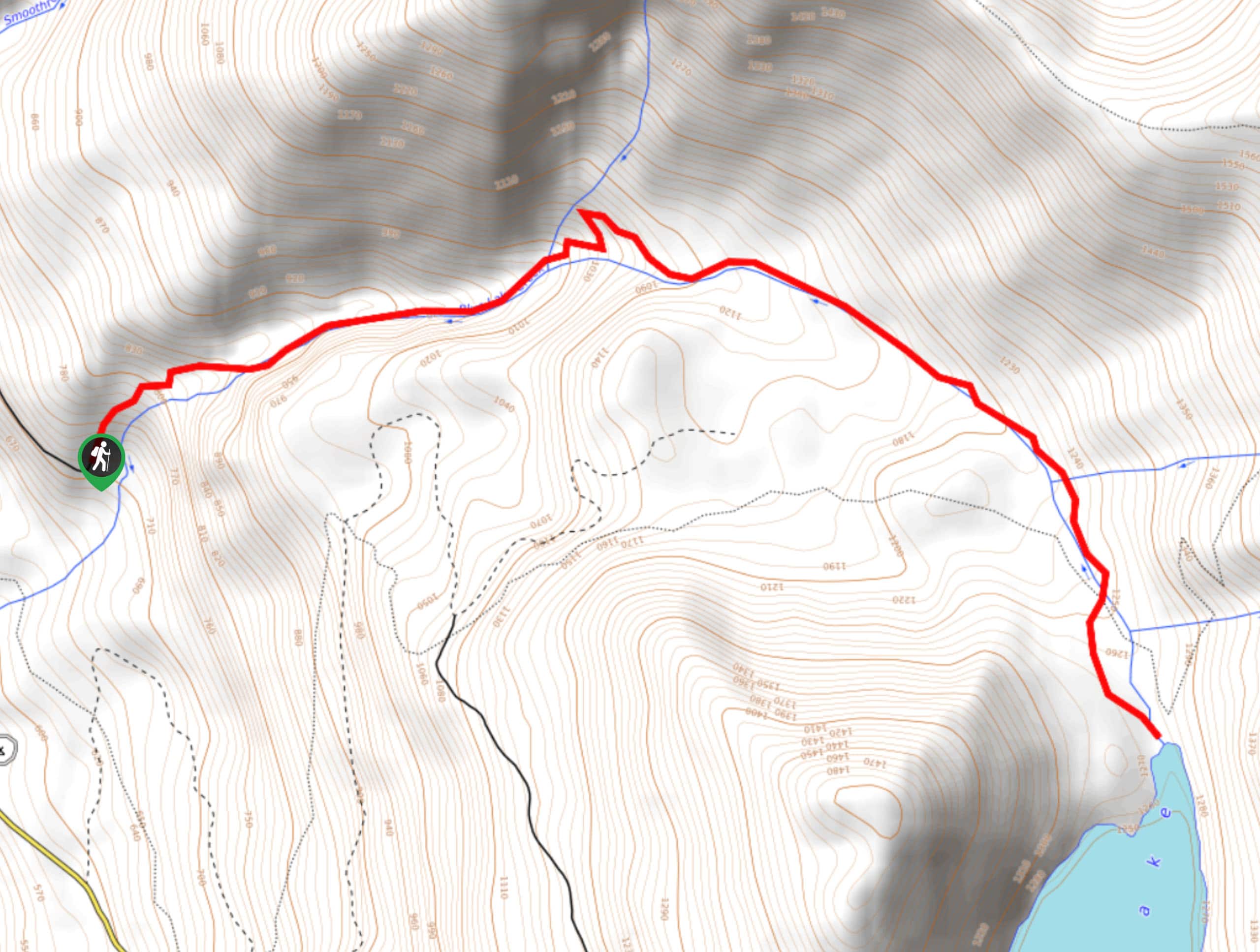
Blue Lake Trail leads you 4.8mi through a deep canyon to Blue Lake. This hike displays interesting hints of the area’s glacial past, with a 250ft wall of basalt left by a volcanic eruption within a glacier defining the route. This hike is rated as moderate, with a few steep sections and some exposure. Expect light traffic.
Getting there
The trailhead for the Blue Lake Trail is at the end of Forest Road 2300-171.

About
| Backcountry Campground | No |
| When to do | April-October |
| Pets allowed | Yes - On Leash |
| Family friendly | Older Children only |
| Route Signage | Average |
| Crowd Levels | Low |
| Route Type | Out and back |
Blue Lake Trail
Elevation Graph
Weather
Blue Lake Trail Description
Blue Lake Trail is a fascinating hike, with rock stairs, exposed slopes, and cliffs to navigate. It takes you through a deep gorge formed by the movement of glaciers many, many years ago. The most interesting remnant of this past is a 250ft wall of columnar basalt formed by a volcanic eruption within a glacier. This hike is foot traffic only, so you won’t need to share it with bikers.
The hike begins from the trailhead, climbing along the canyon above the river before dropping down to cross it twice. Hiking along the water, enjoy a bit of a break before the climbing begins, heading up the canyon wall with rock steps to help you out.
The second half of the canyon is a bit easier, and before you know it, you’ll be at Blue Lake. Catch your breath here before retracing your steps back to the trailhead.
Similar hikes to the Blue Lake Trail hike

Ptarmigan Trail
Ptarmigan Trail is a 4.2mi moderate trail near the base of Mount Saint Helens. This trail is suitable…

Boundary West Trail
Boundary West Trail is a hike near Mount Saint Helens that doesn’t see much traffic, making it a nice pick…

Silver Creek Trail
Silver Creek Trail is a moderate hike in the Gifford Pinchot National Forest that is suitable for most skill levels.…
Comments