
Moulton Falls Hike
View Photos
Moulton Falls Hike
Difficulty Rating:
The hike to Moulton Falls on Lewis River Trail is an easy hike suitable for all skill levels and ages. This 5.3mi out and back trail is a good choice year-round, and it’s shared by walkers, runners, and bikers. You’ll walk along a mossy cliff with the river beside you, having the chance to relax at viewpoints and benches on the way. It’s peaceful but also offers the chance to adventure a little if you take side trails to Big Tree Falls or up the Bells Mountain Trail to a nice viewpoint.
This trail is multi-use, so remember to share it and keep dogs leashed at all times.
Getting there
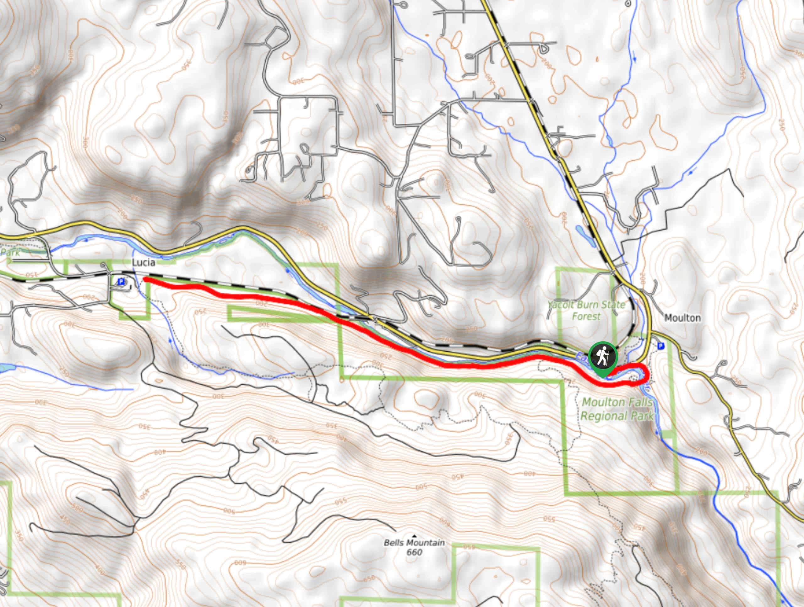
The trailhead for the Moulton Falls hike is on NE Lucia Falls Road.

About
| Backcountry Campground | No |
| When to do | Year-round |
| Pets allowed | Yes - On Leash |
| Family friendly | Older Children only |
| Route Signage | Average |
| Route Type | Out and back |
| Crowd Levels | High |
Moulton Falls Hike
Elevation Graph
Weather
Moulton Falls Hike Description
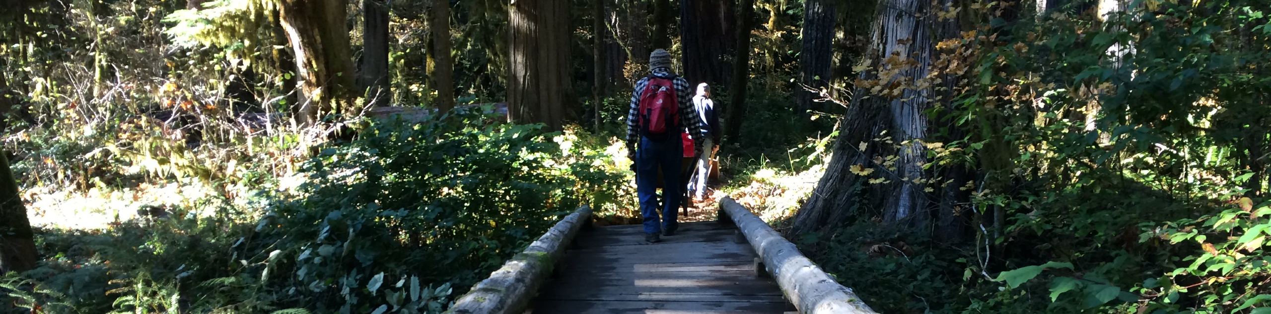
Moulton Falls is a scenic, wide waterfall on the East Fork Lewis River, and this trail allows you to appreciate both the falls and the picturesque landscape that surrounds it. There are mossy rocks, a lush forest, birds chirping- everything you need for a relaxing moment in nature.
The trail is easy, mostly flat, and suitable for all ages. It’s shared by walkers, runners, and bikers, so you’ll want to share the pathway. If you want a bit more of an adventure, you can take side trips to the Bells Mountain Trail viewpoint or to nearby Big Tree Falls. Yacolt Falls is also just up NE Lucia Falls Road, easily accessible on foot by crossing the road and following Big Tree Creek.
Begin from the parking lot on NE Lucia Road. There is also an overflow parking lot if the first one is full. Moulton Falls is right by where you’ll park, so take a moment to enjoy it before setting off. You’ll turn to your left and hike along NE Lucia Falls Road.
Near the restrooms, there’s a spur trail to your right that takes you down to a river viewpoint. Continue around the right curve and then cross the river on the beautiful two-storey arch bridge.
Go straight through a junction and then hike along the cliffside with the river on your right. Continue this way alongside the river. The trail eventually pulls away from the river and takes you through Moulton Falls Park.
Our route guide ends just before Lucia, where you’ll turn around and retrace your steps along the river, across the bridge, and back to the falls.
Hiking Route Highlights
Moulton Falls
The feature of the 387-acre Moulton Falls Park is Moulton Falls, a wide and low waterfall cascading over mossy rocks. There’s also a beautiful arch bridge two stories tall, which is a perfect viewpoint over the river. The park has several nice walking trails in addition to river and waterfall viewpoints.
Frequently Asked Questions
Can you swim at Moulton Falls Park?
Yes, you can swim in the park. There are no lifeguards on duty and water depth and rate of flow can vary, so we recommend caution when swimming.
How high is the Moulton Falls Bridge?
The bridge deck is 54ft high.
Insider Hints
Don’t jump off the arch bridge. There have been serious injuries resulting from bridge jumps at this site.
Head into the park throughout the seasons to see the foliage and water flow change.
Similar hikes to the Moulton Falls Hike hike
Harmony Trail
Harmony Trail is a wonderful easy hike in the Gifford Pinchot National Forest that takes you to the shore of…
Big Creek Falls Trail
Big Creek Falls Trail takes you through a beautiful forest to three waterfalls, one of which is clearly visible. This…
Curly Creek Falls via Lewis River Trail
Curly Creek Falls can be reached on an easy 0.8mi section of the Lewis River Trail suitable for…
Comments