
Goat Creek Trail
View Photos
Goat Creek Trail
Difficulty Rating:
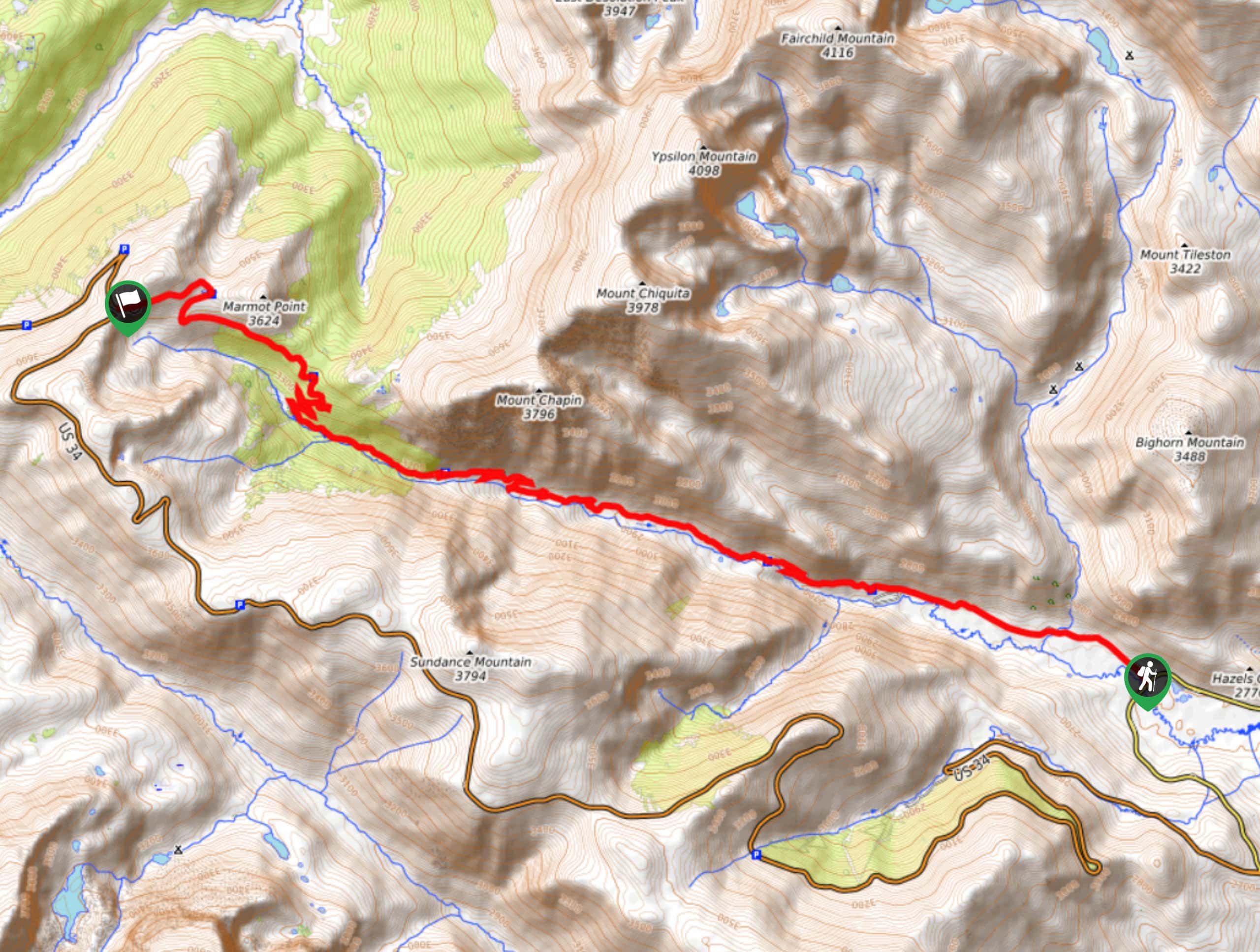
Goat Creek Trail is an interesting, varied hike in Gifford Pinchot National Forest. This 9.9mi trail is rated as hard and sees moderate traffic. The trail takes you across multiple stream crossings, underneath a waterfall, through the rainforest, and to the top of Vanson Peak if you’re willing to push a little further. We recommend waiting until the summertime to hike this trail as it tends to hold onto the snow.
Getting there
The trailhead for the Goat Creek Trail is at the end of Forest Road 2750.

About
| Backcountry Campground | No |
| When to do | May-November |
| Pets allowed | Yes - On Leash |
| Family friendly | No |
| Route Signage | Average |
| Crowd Levels | Moderate |
| Route Type | Out and back |
Goat Creek Trail
Elevation Graph
Weather
Goat Creek Trail Description
Goat Creek Trail is a varied, interesting hike. This hard trail features waterfalls, streams, rainforest, and mountain views. It’s a fun adventure without too much traffic. We do recommend bringing wading shoes for some of the crossings, which can be a bit tricky depending on the water levels.
This hike can be extended a short way to gain Vanson Peak. This will give you an even better vantage point over the beautiful scenery surrounding you.
Beginning from the end of the road, take the trail across the creek. Traverse to the first and second stream crossings, then head up the river valley at the junction with Tumwater Mountain Trail by keeping right. More crossings await as you climb, following the creek. Enjoy the small waterfalls along the way. At the tarn, go right and climb to the endpoint of the trail at the intersection with Goat Mountain Trail. Here you can either turn around and retrace your steps or take a right to head up to Vanson Peak before returning.
Similar hikes to the Goat Creek Trail hike

Ptarmigan Trail
Ptarmigan Trail is a 4.2mi moderate trail near the base of Mount Saint Helens. This trail is suitable…

Lakes Trail #211 Loop
The Lakes Trail #211 Loop is used as both a full-day hike and for backpacking trips. This trail isn’t for…

Boundary West Trail
Boundary West Trail is a hike near Mount Saint Helens that doesn’t see much traffic, making it a nice pick…
Comments