
Covel Creek Falls and Angel Falls Trail
View Photos
Covel Creek Falls and Angel Falls Trail
Difficulty Rating:
Covel Creek Falls and Angel Falls Trail is a moderate 36.0mi hike in Gifford Pinchot National Forest that sees moderate traffic. This route makes two waterfalls the star of the show. While it’s moderate overall, there are a few steep sections to contend with. We recommend doing this hike in the late spring or after it’s been raining for the best experience at the falls.
Getting there
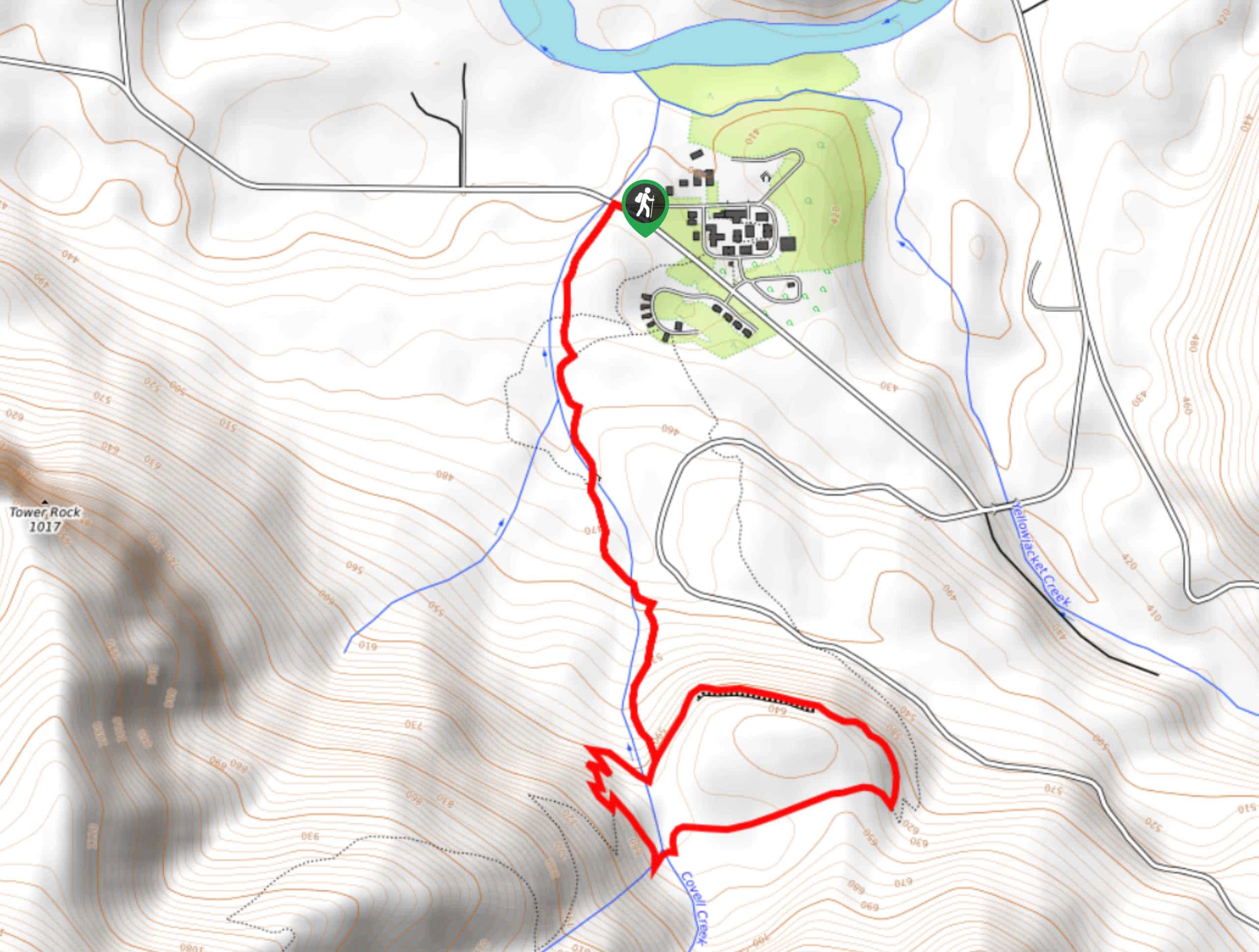
The trailhead for the Covel Creek Falls and Angels Falls Trail is off Forest Road 76.

About
| Backcountry Campground | No |
| When to do | June-October |
| Pets allowed | Yes - On Leash |
| Family friendly | Yes |
| Route Signage | Average |
| Crowd Levels | Moderate |
| Route Type | Lollipop |
Covel Creek Falls and Angel Falls Trail
Elevation Graph
Weather
Covel Creek Falls and Angel Falls Trail Description
The Covel Creek and Angel Falls hike is a fantastic quick adventure with two beautiful waterfalls to enjoy. This hike is moderately difficult, so while it has a few steep sections, it’s suitable for most skill levels. We like this hike best in the late spring when the waterfalls are the most impressive.
We recommend downloading a GPS track of this trail before setting out. There are some junctions that users report getting off-track at.
Beginning from the trailhead, head out along Covell Creek. Cross the creek twice before approaching Curtain Falls. Enjoy the falls here before deciding which way to do the loop. We prefer going counterclockwise to hit the 5 switchbacks on the other side of the falls downhill. From the falls, backtrack a few steps to the trail split and go right. Hike a level section and then take a right on Burley Mountain Trail. Cross the creek to check out Angel Falls, then head downhill back to Curtain Falls and retrace your steps from here to the trailhead.
Similar hikes to the Covel Creek Falls and Angel Falls Trail hike

Ptarmigan Trail
Ptarmigan Trail is a 4.2mi moderate trail near the base of Mount Saint Helens. This trail is suitable…

Boundary West Trail
Boundary West Trail is a hike near Mount Saint Helens that doesn’t see much traffic, making it a nice pick…

Silver Creek Trail
Silver Creek Trail is a moderate hike in the Gifford Pinchot National Forest that is suitable for most skill levels.…
Comments