
Moulton Falls and Mount Bell Loop
View Photos
Moulton Falls and Mount Bell Loop
Difficulty Rating:
The hike to Moulton Falls on Lewis River Trail is an easy hike suitable for all skill levels and ages. This guide makes it a loop with a return via Mount Bell. is a good choice year-round, and it’s shared by walkers, runners, and bikers. The footing is varied, with some gravel road, old logging road, and classic trail.
If you want the out and back trail, check out our Moulton Falls route guide.
Getting there
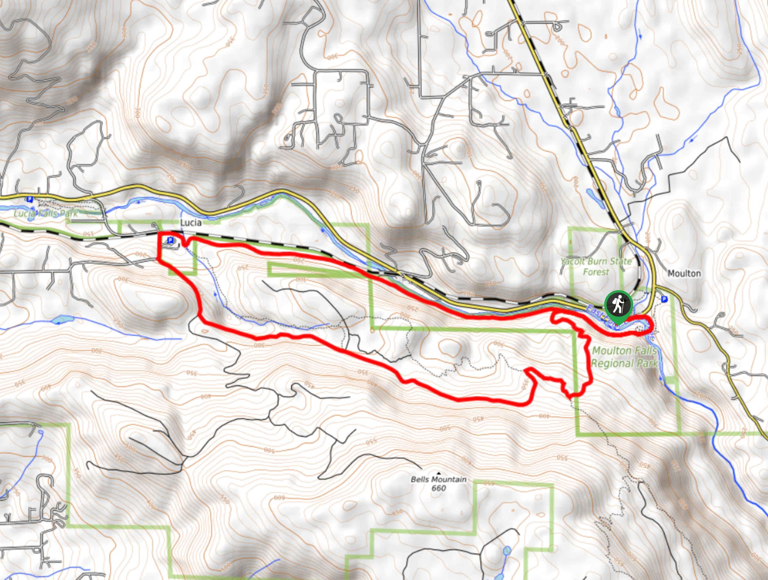
The trailhead for the Moulton Falls and Mount Bell Loop is on NE Lucia Falls Road.

About
| Backcountry Campground | No |
| When to do | Year-round |
| Pets allowed | Yes - On Leash |
| Family friendly | Yes |
| Route Signage | Poor |
| Crowd Levels | Moderate |
| Route Type | Loop |
Moulton Falls and Mount Bell Loop
Elevation Graph
Weather
Moulton Falls and Mount Bell Loop Description
Moulton Falls is a scenic, wide waterfall on the East Fork Lewis River, and this trail allows you to appreciate both the falls and the picturesque landscape that surrounds it. You’ll make your return a loop by swinging underneath Mount Bell.
The trail is easy, mostly flat, and suitable for all ages. It’s shared by walkers, runners, and bikers, for the first half, so you’ll want to share the pathway. Begin from the parking lot on NE Lucia Road. There is also an overflow parking lot if the first one is full. Moulton Falls is right by where you’ll park, so take a moment to enjoy it before setting off. You’ll turn to your left and hike along NE Lucia Falls Road.
Near the restrooms, there’s a spur trail to your right that takes you down to a river viewpoint. Continue around the right curve and then cross the river on the beautiful two-storey arch bridge.
Go straight through a junction and then hike along the cliffside with the river on your right. Continue this way alongside the river. Where the trail splits, hang a left onto Bell Mountain Trail. Traverse across the base of the mountain to Lucia, where you’ll get back onto the East Fork of the Lewis River Trail for your return trip.
Similar hikes to the Moulton Falls and Mount Bell Loop hike

Ptarmigan Trail
Ptarmigan Trail is a 4.2mi moderate trail near the base of Mount Saint Helens. This trail is suitable…

Boundary West Trail
Boundary West Trail is a hike near Mount Saint Helens that doesn’t see much traffic, making it a nice pick…

Silver Creek Trail
Silver Creek Trail is a moderate hike in the Gifford Pinchot National Forest that is suitable for most skill levels.…
Comments